Girard elevation
Girard (Illinois, Macoupin County), United States elevation is 205 meters and Girard elevation in feet is 673 ft above sea level [src 1]. Girard is a populated place (feature code) with elevation that is 74 meters (243 ft) smaller than average city elevation in United States.
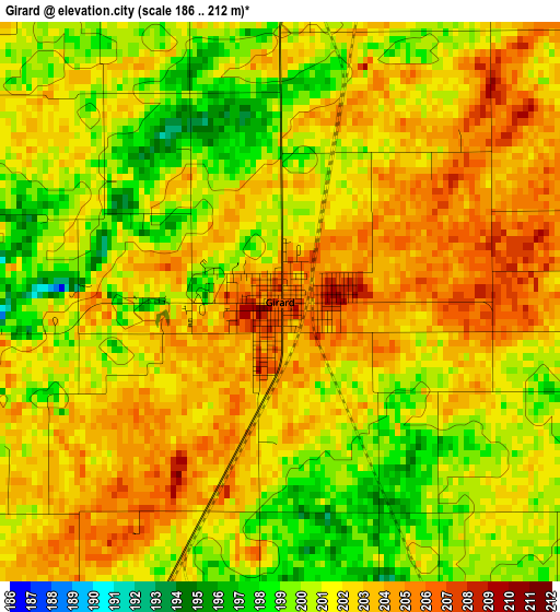
Below is the Elevation map of Girard, which displays elevation range with different colors. Scale of the first map is from 186 to 212 m (610 to 696 ft) with average elevation of 201.4 meters (=661 ft) [note 1]
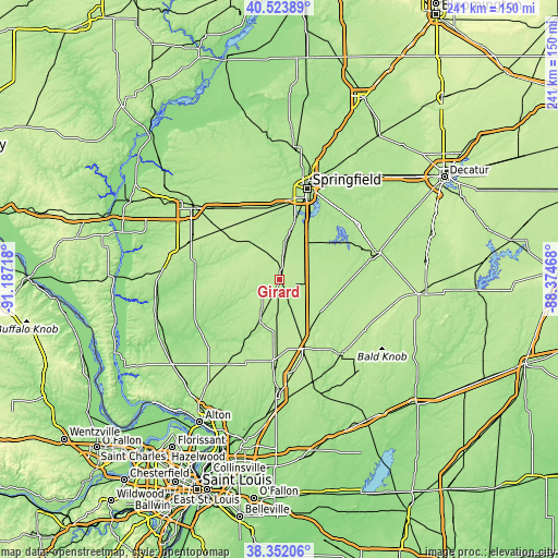
These maps also provides idea of topography and contour of this city, they are displayed at different zoom levels. More info about maps, scale and edge coordinates you can find below images.
| \ | Map #1 | Topo.Map |
| Scale [m] | 186..212 m | × |
| Scale [ft] | 610..696 ft | × |
| Average | 201.4 m = 661 ft | × |
| Width | 7.55 km = 4.7 mi | 241.5 km = 150.1 mi |
| Height | 7.55 km = 4.7 mi | 241.5 km = 150.1 mi |
| ↑Max Latitude | 39.480367° | 40.52389° |
| Latitude at center | 39.44644° | 39.44644° |
| ↓Min Latitude | 39.412496° | 38.35206° |
| ← Min Longitude | -89.824875° | -91.18718° |
| Longitude center | -89.78093° | -89.78093° |
| →Max Longitude | -89.736985° | -88.37468° |
Nearby cities:
Cities around Girard sort by population:
• Chatham elevation 185 m
26.4 km,  14°
14°
• Litchfield 209 m
32.1 km,  160°
160°
• Carlinville 190 m
20.5 km,  205°
205°
• Auburn 191 m
16.4 km, 10°
• Virden 210 m
6.2 km, 10°
• Gillespie 201 m
35.4 km,  185°
185°
• Pawnee 186 m
23.6 km,  46°
46°
• Kincaid 185 m
35.2 km,  63°
63°
• New Berlin 199 m
32.9 km,  340°
340°
• Waverly 210 m
21.9 km,  317°
317°
• Divernon 187 m
17 km,  38°
38°
• Morrisonville 193 m
28.1 km,  95°
95°
Multilingual:
 En español:
Girard elevación 205 m.
 En France:
Girard élévation 205 m.


Sources and notes:
- [note 1] Map square and city borders are not equal. Map elevation data is calculated only from area inside that square.
- [src 1] Elevation data from geonames database provided with same terms of usage.
- [src 2] The elevation map of Girard is generated using elevation data from NASA's 3 arcsec (90m) resolution SRTM data.
- [src 3] Base (background) map © OpenStreetMap contributors tiles are generated by Geofabrik and OpenTopoMap.
Copyright & License:
This Girard Elevation Map is licensed under CC BY-SA. You may reuse any part from this page, if you give a proper credit by linking to this URL:
 More info on terms of use page.