Carlinville elevation
Carlinville (Illinois, Macoupin County), United States elevation is 190 meters and Carlinville elevation in feet is 623 ft above sea level [src 1]. Carlinville is a seat of a second-order administrative division (feature code) with elevation that is 89 meters (292 ft) smaller than average city elevation in United States.
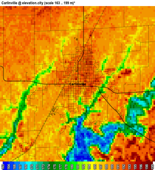
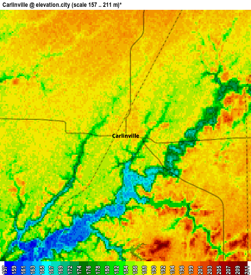
Below is the Elevation map of Carlinville, which displays elevation range with different colors. Scale of the first map is from 163 to 199 m (535 to 653 ft) with average elevation of 186.6 meters (=612 ft) [note 1]
These maps also provides idea of topography and contour of this city, they are displayed at different zoom levels. More info about maps, scale and edge coordinates you can find below images.
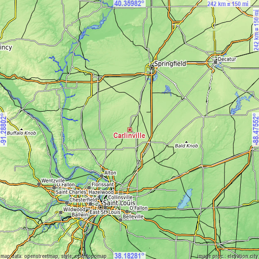
| \ | Map #1 | Map #2 | Topo.Map |
| Scale [m] | 163..199 m | 157..211 m | × |
| Scale [ft] | 535..653 ft | 515..692 ft | × |
| Average | 186.6 m = 612 ft | 188.2 m = 617 ft | × |
| Width | 7.56 km = 4.7 mi | 15.13 km = 9.4 mi | 242.1 km = 150.4 mi |
| Height | 7.56 km = 4.7 mi | 15.13 km = 9.4 mi | 242.1 km = 150.4 mi |
| ↑Max Latitude | 39.313778° | 39.34777° | 40.35982° |
| Latitude at center | 39.27977° | 39.27977° | 39.27977° |
| ↓Min Latitude | 39.245745° | 39.211704° | 38.18281° |
| ← Min Longitude | -89.925715° | -89.969661° | -91.28802° |
| Longitude center | -89.88177° | -89.88177° | -89.88177° |
| →Max Longitude | -89.837825° | -89.793879° | -88.47552° |
Nearby cities:
Cities around Carlinville sort by population:
• Litchfield elevation 209 m
22.8 km,  120°
120°
• Hillsboro 190 m
35.8 km,  111°
111°
• Staunton 189 m
30.8 km,  165°
165°
• Virden 210 m
26.5 km,  21°
21°
• Gillespie 201 m
17.5 km,  162°
162°
• Brighton 204 m
34.8 km,  219°
219°
• Girard 205 m
20.5 km,  25°
25°
• Mount Olive 208 m
26.6 km,  150°
150°
• Bunker Hill 202 m
27 km,  192°
192°
• Benld 192 m
21.8 km, 162°
• Waverly 210 m
35.2 km,  350°
350°
• Greenfield 179 m
29.3 km,  284°
284°
Multilingual:
 En español:
Carlinville elevación 190 m.
 En France:
Carlinville élévation 190 m.
 Auf Deutsch:
Carlinville höhe über dem Meeresspiegel ist 190 m.

Sources and notes:
- [note 1] Map square and city borders are not equal. Map elevation data is calculated only from area inside that square.
- [src 1] Elevation data from geonames database provided with same terms of usage.
- [src 2] The elevation map of Carlinville is generated using elevation data from NASA's 3 arcsec (90m) resolution SRTM data.
- [src 3] Base (background) map © OpenStreetMap contributors tiles are generated by Geofabrik and OpenTopoMap.
Copyright & License:
This Carlinville Elevation Map is licensed under CC BY-SA. You may reuse any part from this page, if you give a proper credit by linking to this URL:
 More info on terms of use page.