Bethany elevation
Bethany (Illinois, Moultrie County), United States elevation is 202 meters and Bethany elevation in feet is 663 ft above sea level [src 1]. Bethany is a populated place (feature code) with elevation that is 77 meters (253 ft) smaller than average city elevation in United States.
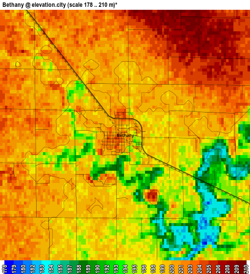
Below is the Elevation map of Bethany, which displays elevation range with different colors. Scale of the first map is from 178 to 210 m (584 to 689 ft) with average elevation of 199.1 meters (=653 ft) [note 1]
These maps also provides idea of topography and contour of this city, they are displayed at different zoom levels. More info about maps, scale and edge coordinates you can find below images.
| \ | Map #1 | Topo.Map |
| Scale [m] | 178..210 m | × |
| Scale [ft] | 584..689 ft | × |
| Average | 199.1 m = 653 ft | × |
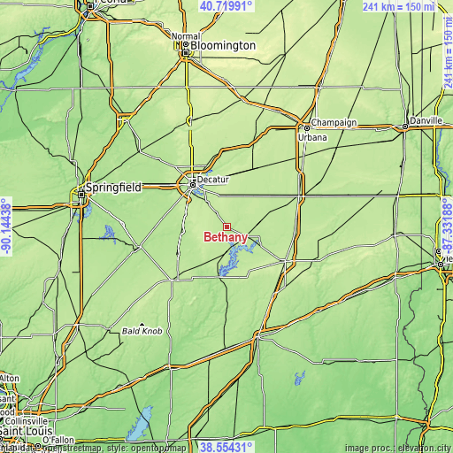
| Width | 7.52 km = 4.7 mi | 240.8 km = 149.6 mi |
| Height | 7.52 km = 4.7 mi | 240.8 km = 149.6 mi |
| ↑Max Latitude | 39.67942° | 40.71991° |
| Latitude at center | 39.64559° | 39.64559° |
| ↓Min Latitude | 39.611744° | 38.55431° |
| ← Min Longitude | -88.782075° | -90.14438° |
| Longitude center | -88.73813° | -88.73813° |
| →Max Longitude | -88.694185° | -87.33188° |
Nearby cities:
Cities around Bethany sort by population:
• Decatur elevation 206 m
28.5 km,  319°
319°
• Mount Zion 217 m
18.2 km, 320°
• Shelbyville 200 m
27 km,  189°
189°
• Sullivan 207 m
12.3 km,  114°
114°
• Arthur 202 m
24 km,  71°
71°
• Moweaqua 195 m
24.2 km,  264°
264°
• Cerro Gordo 230 m
27.3 km,  1°
1°
• Long Creek 209 m
20.7 km,  333°
333°
• Atwood 205 m
29.1 km,  54°
54°
• Windsor 216 m
25.9 km,  151°
151°
• Macon 215 m
23.4 km,  288°
288°
• Lovington 207 m
11.9 km, 49°
Multilingual:
 En español:
Bethany elevación 202 m.
 En France:
Bethany élévation 202 m.


Sources and notes:
- [note 1] Map square and city borders are not equal. Map elevation data is calculated only from area inside that square.
- [src 1] Elevation data from geonames database provided with same terms of usage.
- [src 2] The elevation map of Bethany is generated using elevation data from NASA's 3 arcsec (90m) resolution SRTM data.
- [src 3] Base (background) map © OpenStreetMap contributors tiles are generated by Geofabrik and OpenTopoMap.
Copyright & License:
This Bethany Elevation Map is licensed under CC BY-SA. You may reuse any part from this page, if you give a proper credit by linking to this URL:
 More info on terms of use page.