Wrens elevation
Wrens (Georgia, Jefferson County), United States elevation is 129 meters and Wrens elevation in feet is 423 ft above sea level [src 1]. Wrens is a populated place (feature code) with elevation that is 150 meters (492 ft) smaller than average city elevation in United States.
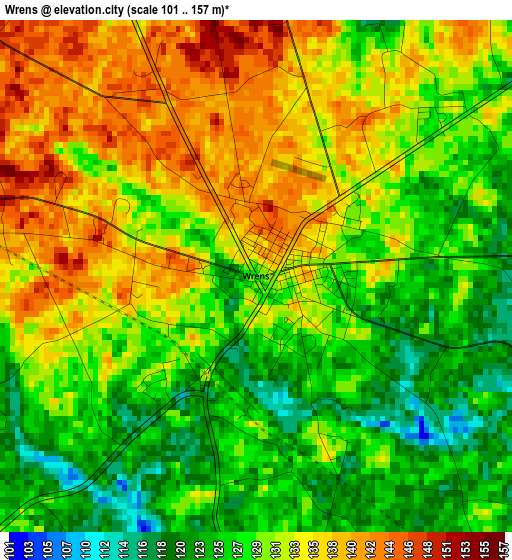
Below is the Elevation map of Wrens, which displays elevation range with different colors. Scale of the first map is from 101 to 157 m (331 to 515 ft) with average elevation of 130.6 meters (=428 ft) [note 1]
These maps also provides idea of topography and contour of this city, they are displayed at different zoom levels. More info about maps, scale and edge coordinates you can find below images.
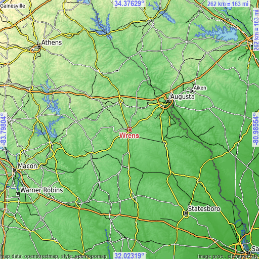
| \ | Map #1 | Topo.Map |
| Scale [m] | 101..157 m | × |
| Scale [ft] | 331..515 ft | × |
| Average | 130.6 m = 428 ft | × |
| Width | 8.18 km = 5.1 mi | 261.6 km = 162.6 mi |
| Height | 8.18 km = 5.1 mi | 261.6 km = 162.6 mi |
| ↑Max Latitude | 33.244411° | 34.37629° |
| Latitude at center | 33.20765° | 33.20765° |
| ↓Min Latitude | 33.170874° | 32.02319° |
| ← Min Longitude | -82.435735° | -83.79804° |
| Longitude center | -82.39179° | -82.39179° |
| →Max Longitude | -82.347845° | -80.98554° |
Nearby cities:
Cities around Wrens sort by population:
• Grovetown elevation 151 m
32.4 km,  33°
33°
• Thomson 163 m
31.1 km,  340°
340°
• Waynesboro 93 m
37.4 km,  110°
110°
• Hephzibah 129 m
29.9 km,  66°
66°
• Harlem 166 m
24.2 km,  17°
17°
• Louisville 101 m
23 km,  184°
184°
• West Warrenton 149 m
34.8 km,  310°
310°
• Firing Range 183 m
37.7 km, 312°
• Davisboro 95 m
32.4 km,  218°
218°
• Warrenton 158 m
33.5 km, 311°
• Sparks 134 m
34.8 km,  247°
247°
• Gibson 110 m
19.2 km,  278°
278°
Multilingual:
 En español:
Wrens elevación 129 m.
 En France:
Wrens élévation 129 m.


Sources and notes:
- [note 1] Map square and city borders are not equal. Map elevation data is calculated only from area inside that square.
- [src 1] Elevation data from geonames database provided with same terms of usage.
- [src 2] The elevation map of Wrens is generated using elevation data from NASA's 3 arcsec (90m) resolution SRTM data.
- [src 3] Base (background) map © OpenStreetMap contributors tiles are generated by Geofabrik and OpenTopoMap.
Copyright & License:
This Wrens Elevation Map is licensed under CC BY-SA. You may reuse any part from this page, if you give a proper credit by linking to this URL:
 More info on terms of use page.