Thomson elevation
Thomson (Georgia, McDuffie County), United States elevation is 163 meters and Thomson elevation in feet is 535 ft above sea level [src 1]. Thomson is a seat of a second-order administrative division (feature code) with elevation that is 116 meters (381 ft) smaller than average city elevation in United States.
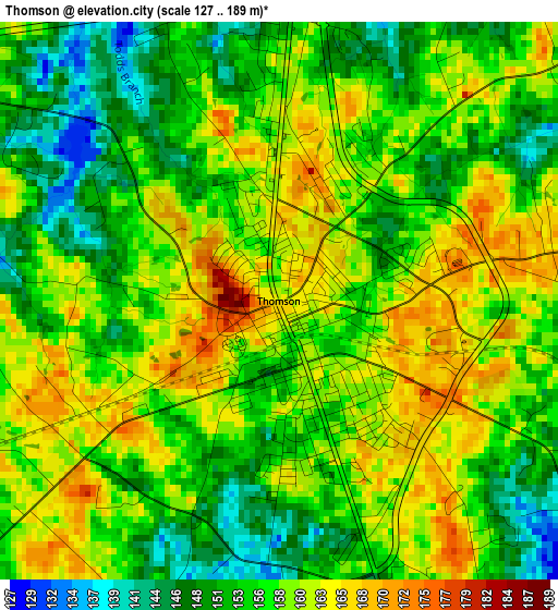
Below is the Elevation map of Thomson, which displays elevation range with different colors. Scale of the first map is from 127 to 189 m (417 to 620 ft) with average elevation of 156.9 meters (=515 ft) [note 1]
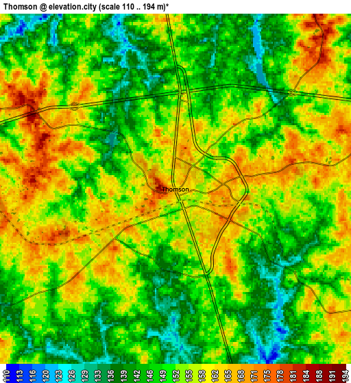
These maps also provides idea of topography and contour of this city, they are displayed at different zoom levels. More info about maps, scale and edge coordinates you can find below images.
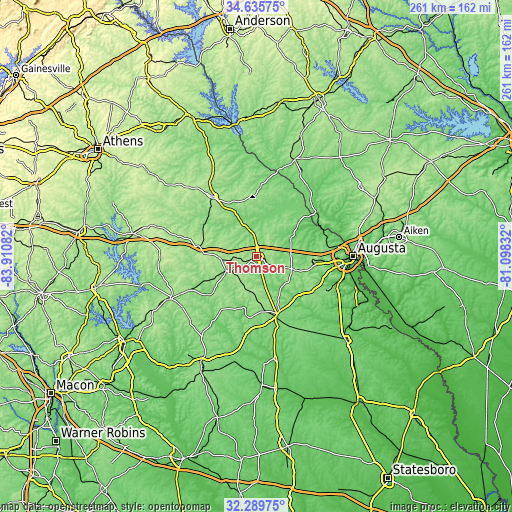
| \ | Map #1 | Map #2 | Topo.Map |
| Scale [m] | 127..189 m | 110..194 m | × |
| Scale [ft] | 417..620 ft | 361..636 ft | × |
| Average | 156.9 m = 515 ft | 152.3 m = 500 ft | × |
| Width | 8.15 km = 5.1 mi | 16.3 km = 10.1 mi | 260.9 km = 162.1 mi |
| Height | 8.15 km = 5.1 mi | 16.3 km = 10.1 mi | 260.9 km = 162.1 mi |
| ↑Max Latitude | 33.50734° | 33.543975° | 34.63575° |
| Latitude at center | 33.47069° | 33.47069° | 33.47069° |
| ↓Min Latitude | 33.434024° | 33.397343° | 32.28975° |
| ← Min Longitude | -82.548515° | -82.592461° | -83.91082° |
| Longitude center | -82.50457° | -82.50457° | -82.50457° |
| →Max Longitude | -82.460625° | -82.416679° | -81.09832° |
Nearby cities:
Cities around Thomson sort by population:
• Evans elevation 131 m
35.4 km,  78°
78°
• Grovetown 151 m
28.5 km,  94°
94°
• Washington 189 m
36.7 km,  323°
323°
• Harlem 166 m
18.9 km,  109°
109°
• West Warrenton 149 m
17.1 km,  247°
247°
• Firing Range 183 m
17.7 km,  257°
257°
• Wrens 129 m
31.1 km,  160°
160°
• Warrenton 158 m
16.2 km,  244°
244°
• Lincolnton 147 m
35.8 km,  3°
3°
• Gibson 110 m
27.7 km,  197°
197°
• Crawfordville 188 m
37.5 km,  284°
284°
• Appling 98 m
19.3 km,  64°
64°
Multilingual:
 En español:
Thomson elevación 163 m.
 En France:
Thomson élévation 163 m.


Sources and notes:
- [note 1] Map square and city borders are not equal. Map elevation data is calculated only from area inside that square.
- [src 1] Elevation data from geonames database provided with same terms of usage.
- [src 2] The elevation map of Thomson is generated using elevation data from NASA's 3 arcsec (90m) resolution SRTM data.
- [src 3] Base (background) map © OpenStreetMap contributors tiles are generated by Geofabrik and OpenTopoMap.
Copyright & License:
This Thomson Elevation Map is licensed under CC BY-SA. You may reuse any part from this page, if you give a proper credit by linking to this URL:
 More info on terms of use page.