Thomaston elevation
Thomaston (Georgia, Upson County), United States elevation is 233 meters and Thomaston elevation in feet is 764 ft above sea level [src 1]. Thomaston is a seat of a second-order administrative division (feature code) with elevation that is 46 meters (151 ft) smaller than average city elevation in United States.
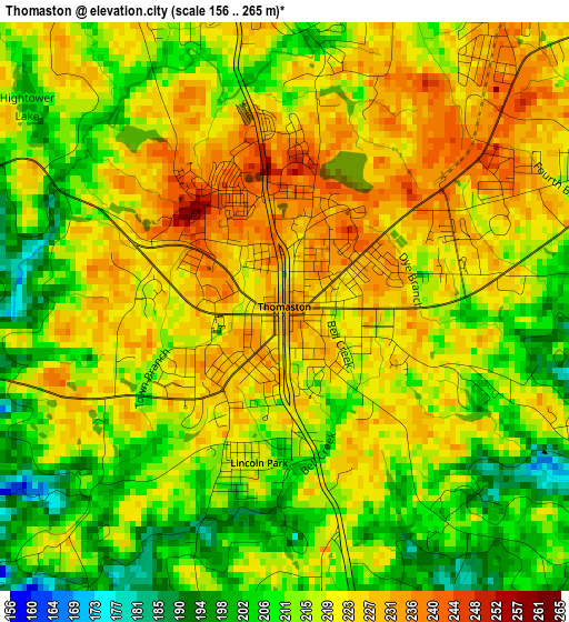
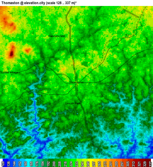
Below is the Elevation map of Thomaston, which displays elevation range with different colors. Scale of the first map is from 156 to 265 m (512 to 869 ft) with average elevation of 217.7 meters (=714 ft) [note 1]
These maps also provides idea of topography and contour of this city, they are displayed at different zoom levels. More info about maps, scale and edge coordinates you can find below images.
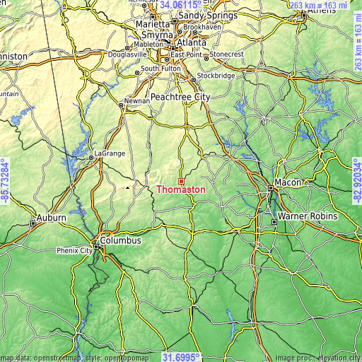
| \ | Map #1 | Map #2 | Topo.Map |
| Scale [m] | 156..265 m | 128..337 m | × |
| Scale [ft] | 512..869 ft | 420..1106 ft | × |
| Average | 217.7 m = 714 ft | 209.9 m = 689 ft | × |
| Width | 8.21 km = 5.1 mi | 16.41 km = 10.2 mi | 262.6 km = 163.2 mi |
| Height | 8.21 km = 5.1 mi | 16.41 km = 10.2 mi | 262.6 km = 163.2 mi |
| ↑Max Latitude | 32.925085° | 32.961964° | 34.06115° |
| Latitude at center | 32.88819° | 32.88819° | 32.88819° |
| ↓Min Latitude | 32.85128° | 32.814355° | 31.6995° |
| ← Min Longitude | -84.370535° | -84.414481° | -85.73284° |
| Longitude center | -84.32659° | -84.32659° | -84.32659° |
| →Max Longitude | -84.282645° | -84.238699° | -82.92034° |
Nearby cities:
Cities around Thomaston sort by population:
• Griffin elevation 303 m
40.3 km,  8°
8°
• Barnesville 264 m
24.4 km,  40°
40°
• Manchester 268 m
27.6 km,  263°
263°
• Forsyth 223 m
39.7 km,  65°
65°
• Hannahs Mill 229 m
5.4 km,  336°
336°
• Butler 196 m
37.7 km,  167°
167°
• East Griffin 272 m
40.6 km, 12°
• Sardis 251 m
30.9 km,  250°
250°
• Zebulon 267 m
23.9 km,  356°
356°
• Talbotton 216 m
30.7 km,  220°
220°
• Greenville 268 m
39.3 km,  293°
293°
• Knoxville 150 m
35.7 km,  120°
120°
Multilingual:
 En español:
Thomaston elevación 233 m.
 En France:
Thomaston élévation 233 m.
 Auf Deutsch:
Thomaston höhe über dem Meeresspiegel ist 233 m.

Sources and notes:
- [note 1] Map square and city borders are not equal. Map elevation data is calculated only from area inside that square.
- [src 1] Elevation data from geonames database provided with same terms of usage.
- [src 2] The elevation map of Thomaston is generated using elevation data from NASA's 3 arcsec (90m) resolution SRTM data.
- [src 3] Base (background) map © OpenStreetMap contributors tiles are generated by Geofabrik and OpenTopoMap.
Copyright & License:
This Thomaston Elevation Map is licensed under CC BY-SA. You may reuse any part from this page, if you give a proper credit by linking to this URL:
 More info on terms of use page.