Butler elevation
Butler (Georgia, Taylor County), United States elevation is 196 meters and Butler elevation in feet is 643 ft above sea level [src 1]. Butler is a seat of a second-order administrative division (feature code) with elevation that is 83 meters (272 ft) smaller than average city elevation in United States.
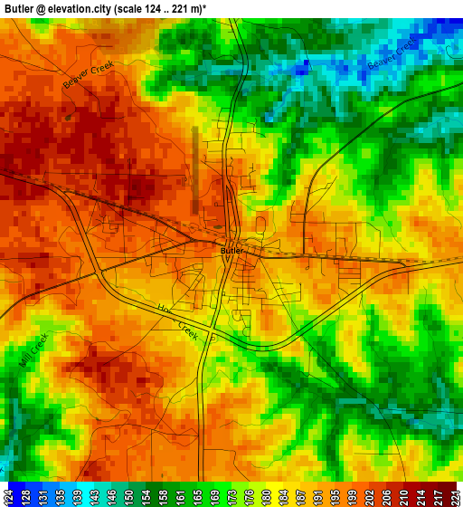
Below is the Elevation map of Butler, which displays elevation range with different colors. Scale of the first map is from 124 to 221 m (407 to 725 ft) with average elevation of 182.1 meters (=597 ft) [note 1]
These maps also provides idea of topography and contour of this city, they are displayed at different zoom levels. More info about maps, scale and edge coordinates you can find below images.
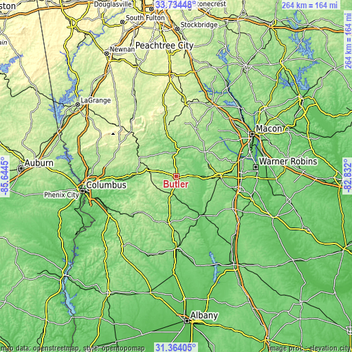
| \ | Map #1 | Topo.Map |
| Scale [m] | 124..221 m | × |
| Scale [ft] | 407..725 ft | × |
| Average | 182.1 m = 597 ft | × |
| Width | 8.24 km = 5.1 mi | 263.6 km = 163.8 mi |
| Height | 8.24 km = 5.1 mi | 263.6 km = 163.8 mi |
| ↑Max Latitude | 32.594122° | 33.73448° |
| Latitude at center | 32.55709° | 32.55709° |
| ↓Min Latitude | 32.520043° | 31.36405° |
| ← Min Longitude | -84.282195° | -85.6445° |
| Longitude center | -84.23825° | -84.23825° |
| →Max Longitude | -84.194305° | -82.832° |
Nearby cities:
Cities around Butler sort by population:
• Thomaston elevation 233 m
37.7 km,  347°
347°
• Fort Valley 162 m
32.9 km,  90°
90°
• Hannahs Mill 229 m
43.1 km, 346°
• Montezuma 107 m
34.3 km,  144°
144°
• Buena Vista 217 m
37.2 km,  224°
224°
• Ellaville 178 m
36.1 km,  190°
190°
• Marshallville 156 m
30.1 km,  111°
111°
• Sardis 251 m
46 km,  305°
305°
• Oglethorpe 93 m
33.7 km,  150°
150°
• Reynolds 135 m
13.3 km, 88°
• Talbotton 216 m
31.2 km,  295°
295°
• Knoxville 150 m
29.2 km,  50°
50°
Multilingual:
 En español:
Butler elevación 196 m.
 En France:
Butler élévation 196 m.


Sources and notes:
- [note 1] Map square and city borders are not equal. Map elevation data is calculated only from area inside that square.
- [src 1] Elevation data from geonames database provided with same terms of usage.
- [src 2] The elevation map of Butler is generated using elevation data from NASA's 3 arcsec (90m) resolution SRTM data.
- [src 3] Base (background) map © OpenStreetMap contributors tiles are generated by Geofabrik and OpenTopoMap.
Copyright & License:
This Butler Elevation Map is licensed under CC BY-SA. You may reuse any part from this page, if you give a proper credit by linking to this URL:
 More info on terms of use page.