Fort Valley elevation
Fort Valley (Georgia, Peach County), United States elevation is 162 meters and Fort Valley elevation in feet is 531 ft above sea level [src 1]. Fort Valley is a seat of a second-order administrative division (feature code) with elevation that is 117 meters (384 ft) smaller than average city elevation in United States.
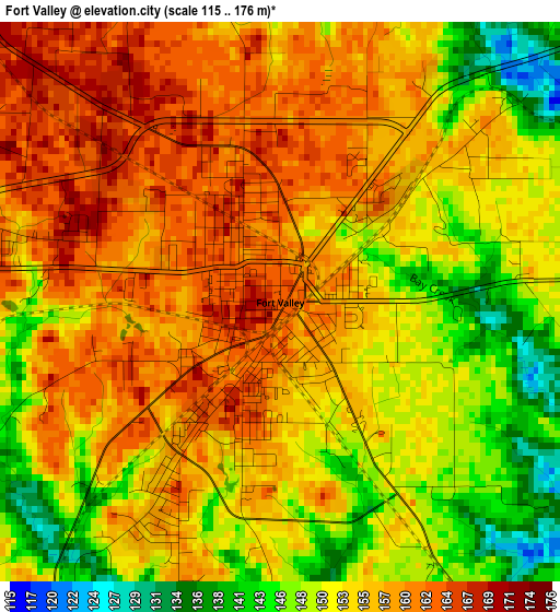
Below is the Elevation map of Fort Valley, which displays elevation range with different colors. Scale of the first map is from 115 to 176 m (377 to 577 ft) with average elevation of 154.2 meters (=506 ft) [note 1]
These maps also provides idea of topography and contour of this city, they are displayed at different zoom levels. More info about maps, scale and edge coordinates you can find below images.
| \ | Map #1 | Map #2 | Topo.Map |
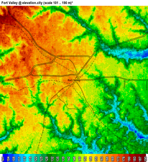
| Scale [m] | 115..176 m | 101..190 m | × |
| Scale [ft] | 377..577 ft | 331..623 ft | × |
| Average | 154.2 m = 506 ft | 149.7 m = 491 ft | × |
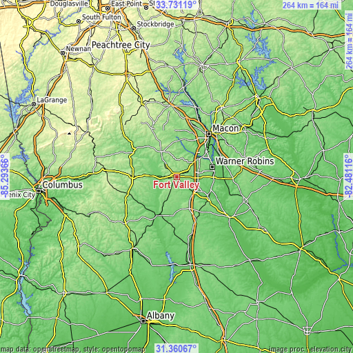
| Width | 8.24 km = 5.1 mi | 16.47 km = 10.2 mi | 263.6 km = 163.8 mi |
| Height | 8.24 km = 5.1 mi | 16.47 km = 10.2 mi | 263.6 km = 163.8 mi |
| ↑Max Latitude | 32.590793° | 32.627811° | 33.73119° |
| Latitude at center | 32.55376° | 32.55376° | 32.55376° |
| ↓Min Latitude | 32.516711° | 32.479648° | 31.36067° |
| ← Min Longitude | -83.931355° | -83.975301° | -85.29366° |
| Longitude center | -83.88741° | -83.88741° | -83.88741° |
| →Max Longitude | -83.843465° | -83.799519° | -82.48116° |
Nearby cities:
Cities around Fort Valley sort by population:
• Warner Robins elevation 132 m
25.4 km,  74°
74°
• Perry 113 m
18.1 km,  126°
126°
• Centerville 140 m
20.4 km, 65°
• Byron 157 m
16.3 km,  47°
47°
• West Point 150 m
27.7 km,  15°
15°
• Montezuma 107 m
30.6 km,  205°
205°
• Butler 196 m
32.9 km,  270°
270°
• Marshallville 156 m
11.9 km,  204°
204°
• Oglethorpe 93 m
33.2 km, 209°
• Robins Air Force Base 93 m
29 km,  77°
77°
• Reynolds 135 m
19.6 km, 271°
• Knoxville 150 m
21.6 km,  331°
331°
Multilingual:
 En español:
Fort Valley elevación 162 m.
 En France:
Fort Valley élévation 162 m.
 Auf Deutsch:
Fort Valley höhe über dem Meeresspiegel ist 162 m.

Sources and notes:
- [note 1] Map square and city borders are not equal. Map elevation data is calculated only from area inside that square.
- [src 1] Elevation data from geonames database provided with same terms of usage.
- [src 2] The elevation map of Fort Valley is generated using elevation data from NASA's 3 arcsec (90m) resolution SRTM data.
- [src 3] Base (background) map © OpenStreetMap contributors tiles are generated by Geofabrik and OpenTopoMap.
Copyright & License:
This Fort Valley Elevation Map is licensed under CC BY-SA. You may reuse any part from this page, if you give a proper credit by linking to this URL:
 More info on terms of use page.