Centerville elevation
Centerville (Georgia, Houston County), United States elevation is 140 meters and Centerville elevation in feet is 459 ft above sea level [src 1]. Centerville is a populated place (feature code) with elevation that is 139 meters (456 ft) smaller than average city elevation in United States.
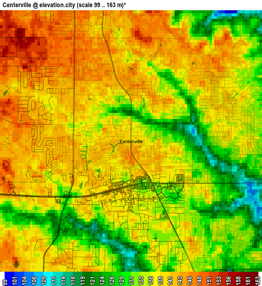
Below is the Elevation map of Centerville, which displays elevation range with different colors. Scale of the first map is from 99 to 163 m (325 to 535 ft) with average elevation of 136.7 meters (=448 ft) [note 1]
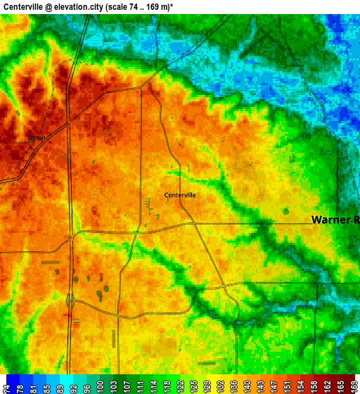
These maps also provides idea of topography and contour of this city, they are displayed at different zoom levels. More info about maps, scale and edge coordinates you can find below images.
| \ | Map #1 | Map #2 | Topo.Map |
| Scale [m] | 99..163 m | 74..169 m | × |
| Scale [ft] | 325..535 ft | 243..554 ft | × |
| Average | 136.7 m = 448 ft | 125.8 m = 413 ft | × |
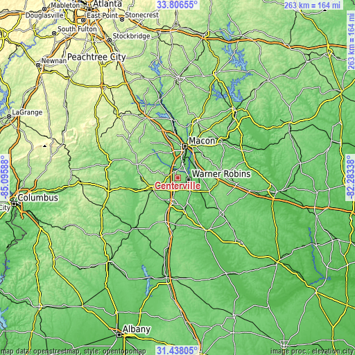
| Width | 8.23 km = 5.1 mi | 16.46 km = 10.2 mi | 263.4 km = 163.7 mi |
| Height | 8.23 km = 5.1 mi | 16.46 km = 10.2 mi | 263.4 km = 163.7 mi |
| ↑Max Latitude | 32.667142° | 32.704128° | 33.80655° |
| Latitude at center | 32.63014° | 32.63014° | 32.63014° |
| ↓Min Latitude | 32.593123° | 32.556091° | 31.43805° |
| ← Min Longitude | -83.733575° | -83.777521° | -85.09588° |
| Longitude center | -83.68963° | -83.68963° | -83.68963° |
| →Max Longitude | -83.645685° | -83.601739° | -82.28338° |
Nearby cities:
Cities around Centerville sort by population:
• Macon elevation 118 m
24 km,  12°
12°
• Warner Robins 132 m
6.1 km,  105°
105°
• Perry 113 m
19.5 km,  191°
191°
• Fort Valley 162 m
20.4 km,  245°
245°
• Byron 157 m
7.1 km,  291°
291°
• Unadilla 122 m
41.2 km, 186°
• West Point 150 m
21.2 km,  328°
328°
• Marshallville 156 m
30.4 km,  230°
230°
• Robins Air Force Base 93 m
10.1 km,  103°
103°
• Jeffersonville 163 m
32.7 km,  78°
78°
• Reynolds 135 m
38.9 km,  258°
258°
• Knoxville 150 m
30.7 km, 289°
Multilingual:
 En español:
Centerville elevación 140 m.
 En France:
Centerville élévation 140 m.
 Auf Deutsch:
Centerville höhe über dem Meeresspiegel ist 140 m.

Sources and notes:
- [note 1] Map square and city borders are not equal. Map elevation data is calculated only from area inside that square.
- [src 1] Elevation data from geonames database provided with same terms of usage.
- [src 2] The elevation map of Centerville is generated using elevation data from NASA's 3 arcsec (90m) resolution SRTM data.
- [src 3] Base (background) map © OpenStreetMap contributors tiles are generated by Geofabrik and OpenTopoMap.
Copyright & License:
This Centerville Elevation Map is licensed under CC BY-SA. You may reuse any part from this page, if you give a proper credit by linking to this URL:
 More info on terms of use page.