Porterdale elevation
Porterdale (Georgia, Newton County), United States elevation is 216 meters and Porterdale elevation in feet is 709 ft above sea level [src 1]. Porterdale is a populated place (feature code) with elevation that is 63 meters (207 ft) smaller than average city elevation in United States.
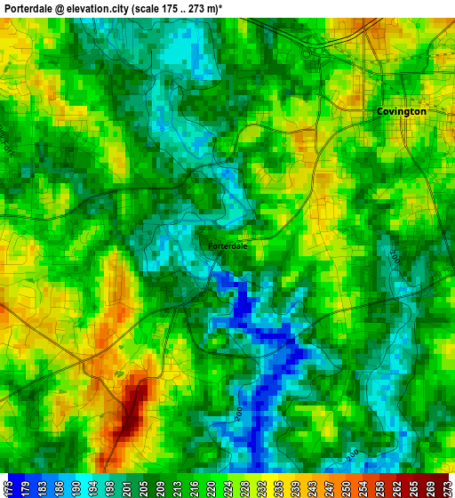
Below is the Elevation map of Porterdale, which displays elevation range with different colors. Scale of the first map is from 175 to 273 m (574 to 896 ft) with average elevation of 215.5 meters (=707 ft) [note 1]
These maps also provides idea of topography and contour of this city, they are displayed at different zoom levels. More info about maps, scale and edge coordinates you can find below images.
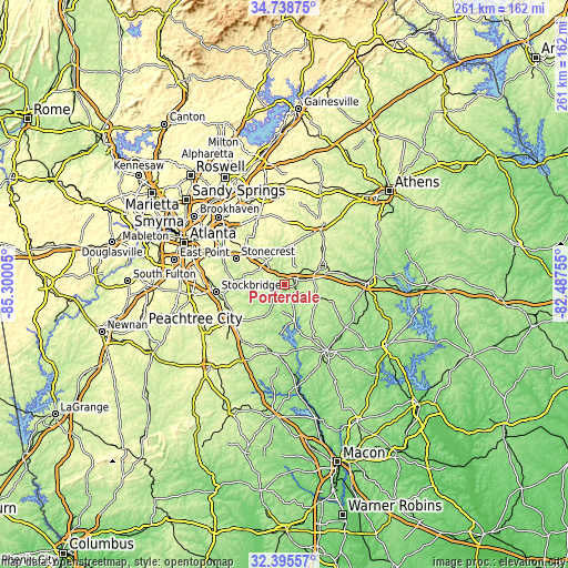
| \ | Map #1 | Topo.Map |
| Scale [m] | 175..273 m | × |
| Scale [ft] | 574..896 ft | × |
| Average | 215.5 m = 707 ft | × |
| Width | 8.14 km = 5.1 mi | 260.5 km = 161.9 mi |
| Height | 8.14 km = 5.1 mi | 260.5 km = 161.9 mi |
| ↑Max Latitude | 33.611716° | 34.73875° |
| Latitude at center | 33.57511° | 33.57511° |
| ↓Min Latitude | 33.538489° | 32.39557° |
| ← Min Longitude | -83.937745° | -85.30005° |
| Longitude center | -83.8938° | -83.8938° |
| →Max Longitude | -83.849855° | -82.48755° |
Nearby cities:
Cities around Porterdale sort by population:
• Stonecrest elevation 252 m
26.8 km,  303°
303°
• Redan 303 m
29 km,  310°
310°
• McDonough 267 m
27.4 km,  238°
238°
• Conyers 279 m
15.4 km, 311°
• Covington 232 m
3.9 km,  52°
52°
• Social Circle 272 m
18.6 km,  60°
60°
• Oakwood 235 m
8 km,  248°
248°
• Lakeview Estates 240 m
19.4 km,  318°
318°
• Oxford 238 m
5.5 km,  26°
26°
• Lithonia 286 m
24.8 km, 307°
• Walnut Grove 283 m
19 km,  11°
11°
• Pine Mountain 286 m
23.3 km, 298°
Multilingual:
 En español:
Porterdale elevación 216 m.
 En France:
Porterdale élévation 216 m.
 Auf Deutsch:
Porterdale höhe über dem Meeresspiegel ist 216 m.

Sources and notes:
- [note 1] Map square and city borders are not equal. Map elevation data is calculated only from area inside that square.
- [src 1] Elevation data from geonames database provided with same terms of usage.
- [src 2] The elevation map of Porterdale is generated using elevation data from NASA's 3 arcsec (90m) resolution SRTM data.
- [src 3] Base (background) map © OpenStreetMap contributors tiles are generated by Geofabrik and OpenTopoMap.
Copyright & License:
This Porterdale Elevation Map is licensed under CC BY-SA. You may reuse any part from this page, if you give a proper credit by linking to this URL:
 More info on terms of use page.