Redan elevation
Redan (Georgia, DeKalb County), United States elevation is 303 meters and Redan elevation in feet is 994 ft above sea level [src 1]. Redan is a populated place (feature code) with elevation that is 24 meters (79 ft) bigger than average city elevation in United States.
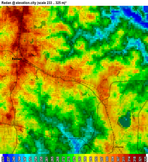
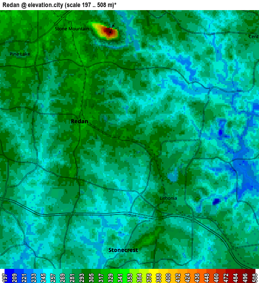
Below is the Elevation map of Redan, which displays elevation range with different colors. Scale of the first map is from 233 to 325 m (764 to 1066 ft) with average elevation of 281.8 meters (=925 ft) [note 1]
These maps also provides idea of topography and contour of this city, they are displayed at different zoom levels. More info about maps, scale and edge coordinates you can find below images.
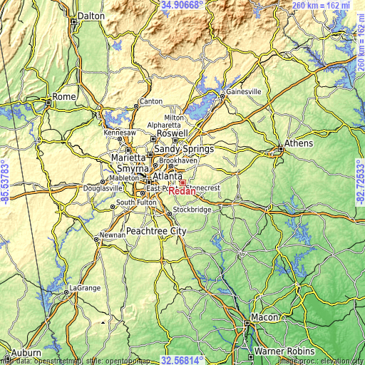
| \ | Map #1 | Map #2 | Topo.Map |
| Scale [m] | 233..325 m | 197..508 m | × |
| Scale [ft] | 764..1066 ft | 646..1667 ft | × |
| Average | 281.8 m = 925 ft | 276.1 m = 906 ft | × |
| Width | 8.13 km = 5.1 mi | 16.25 km = 10.1 mi | 260 km = 161.6 mi |
| Height | 8.13 km = 5.1 mi | 16.25 km = 10.1 mi | 260 km = 161.6 mi |
| ↑Max Latitude | 33.781913° | 33.818431° | 34.90668° |
| Latitude at center | 33.74538° | 33.74538° | 33.74538° |
| ↓Min Latitude | 33.708831° | 33.672267° | 32.56814° |
| ← Min Longitude | -84.175525° | -84.219471° | -85.53783° |
| Longitude center | -84.13158° | -84.13158° | -84.13158° |
| →Max Longitude | -84.087635° | -84.043689° | -82.72533° |
Nearby cities:
Cities around Redan sort by population:
• Stonecrest elevation 252 m
4.1 km,  184°
184°
• Candler-McAfee 291 m
13.2 km,  260°
260°
• Conyers 279 m
13.6 km,  129°
129°
• Belvedere Park 306 m
12.6 km,  274°
274°
• Clarkston 309 m
12.3 km,  305°
305°
• Mountain Park 315 m
11 km,  1°
1°
• Scottdale 313 m
13.2 km,  291°
291°
• Stone Mountain 321 m
7.8 km,  332°
332°
• Avondale Estates 322 m
12.9 km,  283°
283°
• Lakeview Estates 240 m
10.2 km,  114°
114°
• Lithonia 286 m
4.4 km,  146°
146°
• Pine Mountain 286 m
7.9 km,  168°
168°
Multilingual:
 En español:
Redan elevación 303 m.
 En France:
Redan élévation 303 m.


Sources and notes:
- [note 1] Map square and city borders are not equal. Map elevation data is calculated only from area inside that square.
- [src 1] Elevation data from geonames database provided with same terms of usage.
- [src 2] The elevation map of Redan is generated using elevation data from NASA's 3 arcsec (90m) resolution SRTM data.
- [src 3] Base (background) map © OpenStreetMap contributors tiles are generated by Geofabrik and OpenTopoMap.
Copyright & License:
This Redan Elevation Map is licensed under CC BY-SA. You may reuse any part from this page, if you give a proper credit by linking to this URL:
 More info on terms of use page.