Hiram elevation
Hiram (Georgia, Paulding County), United States elevation is 296 meters and Hiram elevation in feet is 971 ft above sea level [src 1]. Hiram is a populated place (feature code) with elevation that is 17 meters (56 ft) bigger than average city elevation in United States.
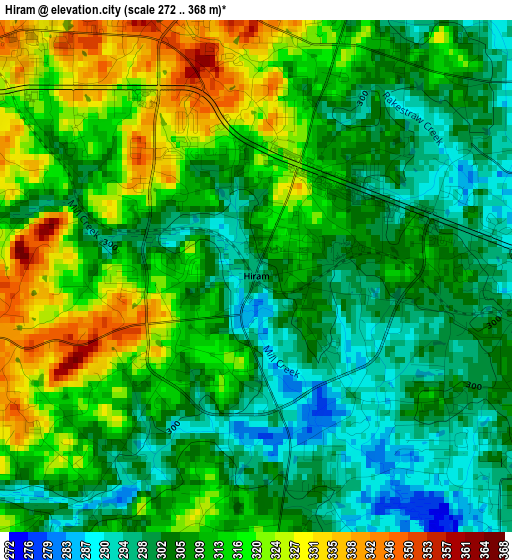
Below is the Elevation map of Hiram, which displays elevation range with different colors. Scale of the first map is from 272 to 368 m (892 to 1207 ft) with average elevation of 309.6 meters (=1016 ft) [note 1]
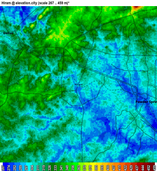
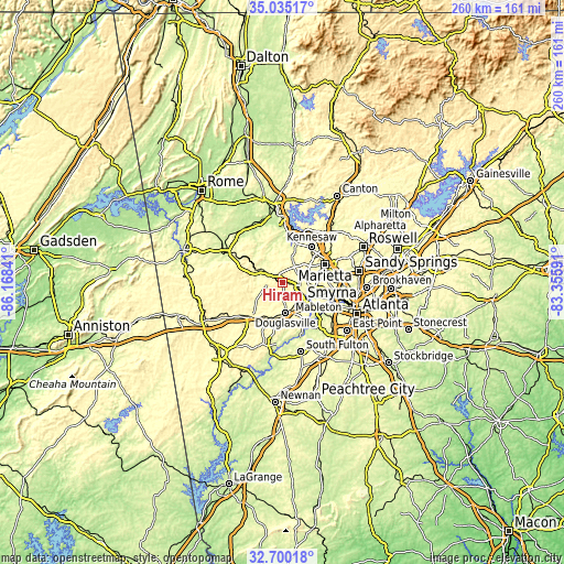
These maps also provides idea of topography and contour of this city, they are displayed at different zoom levels. More info about maps, scale and edge coordinates you can find below images.
| \ | Map #1 | Map #2 | Topo.Map |
| Scale [m] | 272..368 m | 267..459 m | × |
| Scale [ft] | 892..1207 ft | 876..1506 ft | × |
| Average | 309.6 m = 1016 ft | 314 m = 1030 ft | × |
| Width | 8.11 km = 5 mi | 16.23 km = 10.1 mi | 259.6 km = 161.3 mi |
| Height | 8.11 km = 5 mi | 16.23 km = 10.1 mi | 259.6 km = 161.3 mi |
| ↑Max Latitude | 33.912138° | 33.9486° | 35.03517° |
| Latitude at center | 33.87566° | 33.87566° | 33.87566° |
| ↓Min Latitude | 33.839167° | 33.802658° | 32.70018° |
| ← Min Longitude | -84.806105° | -84.850051° | -86.16841° |
| Longitude center | -84.76216° | -84.76216° | -84.76216° |
| →Max Longitude | -84.718215° | -84.674269° | -83.35591° |
Nearby cities:
Cities around Hiram sort by population:
• Marietta elevation 343 m
21.4 km,  66°
66°
• Smyrna 326 m
22.9 km,  87°
87°
• Mableton 300 m
17.8 km,  110°
110°
• Kennesaw 331 m
21.3 km,  39°
39°
• Douglasville 370 m
13.9 km,  174°
174°
• Acworth 277 m
22.6 km,  20°
20°
• Lithia Springs 318 m
13.1 km,  134°
134°
• Villa Rica 349 m
21.6 km,  222°
222°
• Powder Springs 287 m
7.5 km,  103°
103°
• Dallas 316 m
9 km,  306°
306°
• Fair Oaks 343 m
20.6 km,  77°
77°
• Austell 285 m
13.7 km,  120°
120°
Multilingual:
 En español:
Hiram elevación 296 m.
 En France:
Hiram élévation 296 m.


Sources and notes:
- [note 1] Map square and city borders are not equal. Map elevation data is calculated only from area inside that square.
- [src 1] Elevation data from geonames database provided with same terms of usage.
- [src 2] The elevation map of Hiram is generated using elevation data from NASA's 3 arcsec (90m) resolution SRTM data.
- [src 3] Base (background) map © OpenStreetMap contributors tiles are generated by Geofabrik and OpenTopoMap.
Copyright & License:
This Hiram Elevation Map is licensed under CC BY-SA. You may reuse any part from this page, if you give a proper credit by linking to this URL:
 More info on terms of use page.