Douglasville elevation
Douglasville (Georgia, Douglas County), United States elevation is 370 meters and Douglasville elevation in feet is 1214 ft above sea level [src 1]. Douglasville is a seat of a second-order administrative division (feature code) with elevation that is 91 meters (299 ft) bigger than average city elevation in United States.
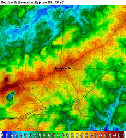
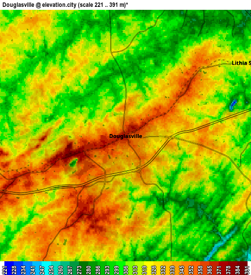
Below is the Elevation map of Douglasville, which displays elevation range with different colors. Scale of the first map is from 274 to 391 m (899 to 1283 ft) with average elevation of 330.4 meters (=1084 ft) [note 1]
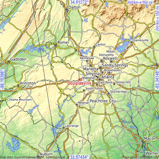
These maps also provides idea of topography and contour of this city, they are displayed at different zoom levels. More info about maps, scale and edge coordinates you can find below images.
| \ | Map #1 | Map #2 | Topo.Map |
| Scale [m] | 274..391 m | 221..391 m | × |
| Scale [ft] | 899..1283 ft | 725..1283 ft | × |
| Average | 330.4 m = 1084 ft | 319.4 m = 1048 ft | × |
| Width | 8.13 km = 5.1 mi | 16.25 km = 10.1 mi | 260 km = 161.6 mi |
| Height | 8.13 km = 5.1 mi | 16.25 km = 10.1 mi | 260 km = 161.6 mi |
| ↑Max Latitude | 33.788031° | 33.824546° | 34.91272° |
| Latitude at center | 33.7515° | 33.7515° | 33.7515° |
| ↓Min Latitude | 33.714954° | 33.678392° | 32.57434° |
| ← Min Longitude | -84.791655° | -84.835601° | -86.15396° |
| Longitude center | -84.74771° | -84.74771° | -84.74771° |
| →Max Longitude | -84.703765° | -84.659819° | -83.34146° |
Nearby cities:
Cities around Douglasville sort by population:
• Smyrna elevation 326 m
26.1 km,  55°
55°
• Mableton 300 m
17 km, 63°
• Union City 299 m
26.4 km,  133°
133°
• Lithia Springs 318 m
9.3 km, 59°
• Villa Rica 349 m
16 km,  262°
262°
• Powder Springs 287 m
13.4 km,  26°
26°
• Fairburn 316 m
25.7 km,  143°
143°
• Dallas 316 m
21 km,  335°
335°
• Fair Oaks 343 m
26.2 km,  45°
45°
• Austell 285 m
12.5 km, 57°
• Hiram 296 m
13.9 km,  354°
354°
• Chattahoochee Hills 248 m
22.4 km,  183°
183°
Multilingual:
 En español:
Douglasville elevación 370 m.
 En France:
Douglasville élévation 370 m.
 Auf Deutsch:
Douglasville höhe über dem Meeresspiegel ist 370 m.

Sources and notes:
- [note 1] Map square and city borders are not equal. Map elevation data is calculated only from area inside that square.
- [src 1] Elevation data from geonames database provided with same terms of usage.
- [src 2] The elevation map of Douglasville is generated using elevation data from NASA's 3 arcsec (90m) resolution SRTM data.
- [src 3] Base (background) map © OpenStreetMap contributors tiles are generated by Geofabrik and OpenTopoMap.
Copyright & License:
This Douglasville Elevation Map is licensed under CC BY-SA. You may reuse any part from this page, if you give a proper credit by linking to this URL:
 More info on terms of use page.