Cuthbert elevation
Cuthbert (Georgia, Randolph County), United States elevation is 147 meters and Cuthbert elevation in feet is 482 ft above sea level [src 1]. Cuthbert is a seat of a second-order administrative division (feature code) with elevation that is 132 meters (433 ft) smaller than average city elevation in United States.
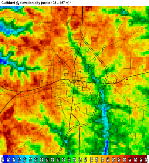
Below is the Elevation map of Cuthbert, which displays elevation range with different colors. Scale of the first map is from 103 to 167 m (338 to 548 ft) with average elevation of 141.8 meters (=465 ft) [note 1]
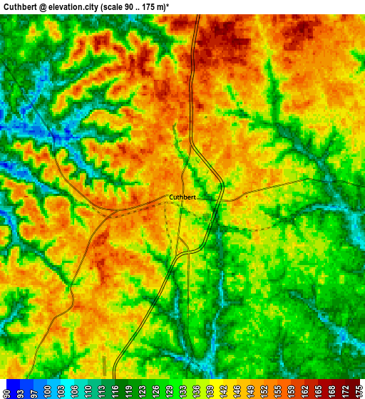
These maps also provides idea of topography and contour of this city, they are displayed at different zoom levels. More info about maps, scale and edge coordinates you can find below images.
| \ | Map #1 | Map #2 | Topo.Map |
| Scale [m] | 103..167 m | 90..175 m | × |
| Scale [ft] | 338..548 ft | 295..574 ft | × |
| Average | 141.8 m = 465 ft | 135.9 m = 446 ft | × |
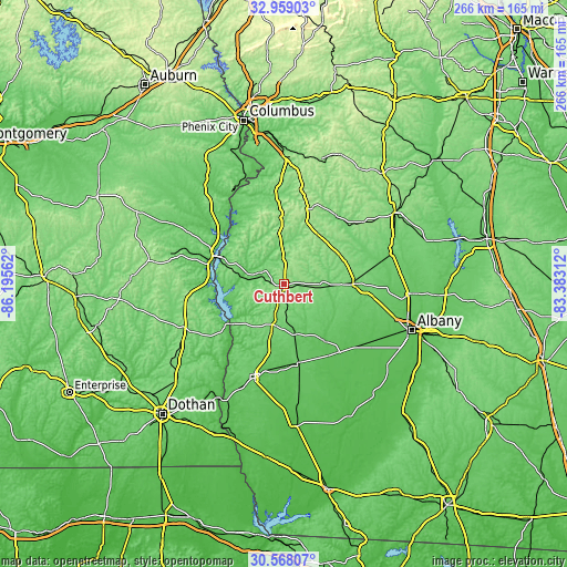
| Width | 8.31 km = 5.2 mi | 16.62 km = 10.3 mi | 265.8 km = 165.2 mi |
| Height | 8.31 km = 5.2 mi | 16.62 km = 10.3 mi | 265.9 km = 165.2 mi |
| ↑Max Latitude | 31.808623° | 31.845961° | 32.95903° |
| Latitude at center | 31.77127° | 31.77127° | 31.77127° |
| ↓Min Latitude | 31.733902° | 31.696519° | 30.56807° |
| ← Min Longitude | -84.833315° | -84.877261° | -86.19562° |
| Longitude center | -84.78937° | -84.78937° | -84.78937° |
| →Max Longitude | -84.745425° | -84.701479° | -83.38312° |
Nearby cities:
Cities around Cuthbert sort by population:
• Eufaula elevation 83 m
36.2 km,  291°
291°
• Blakely 86 m
45.9 km,  197°
197°
• Dawson 110 m
32.3 km,  89°
89°
• Abbeville 142 m
48.9 km,  243°
243°
• Morgan 81 m
31.6 km,  145°
145°
• Richland 184 m
37 km,  18°
18°
• Edison 94 m
24.2 km,  168°
168°
• Arlington 97 m
37.3 km, 170°
• Fort Gaines 79 m
30.5 km,  233°
233°
• Lumpkin 187 m
31.1 km,  358°
358°
• Georgetown 79 m
32.6 km, 292°
• Preston 141 m
40.5 km,  35°
35°
Multilingual:
 En español:
Cuthbert elevación 147 m.
 En France:
Cuthbert élévation 147 m.
 Auf Deutsch:
Cuthbert höhe über dem Meeresspiegel ist 147 m.

Sources and notes:
- [note 1] Map square and city borders are not equal. Map elevation data is calculated only from area inside that square.
- [src 1] Elevation data from geonames database provided with same terms of usage.
- [src 2] The elevation map of Cuthbert is generated using elevation data from NASA's 3 arcsec (90m) resolution SRTM data.
- [src 3] Base (background) map © OpenStreetMap contributors tiles are generated by Geofabrik and OpenTopoMap.
Copyright & License:
This Cuthbert Elevation Map is licensed under CC BY-SA. You may reuse any part from this page, if you give a proper credit by linking to this URL:
 More info on terms of use page.