Cartersville elevation
Cartersville (Georgia, Bartow County), United States elevation is 237 meters and Cartersville elevation in feet is 778 ft above sea level [src 1]. Cartersville is a seat of a second-order administrative division (feature code) with elevation that is 42 meters (138 ft) smaller than average city elevation in United States.
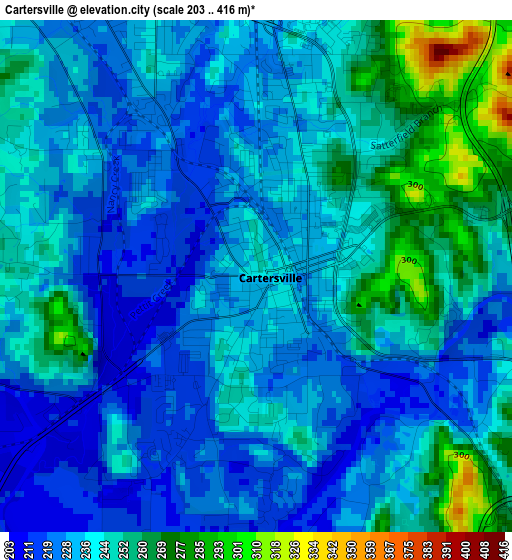
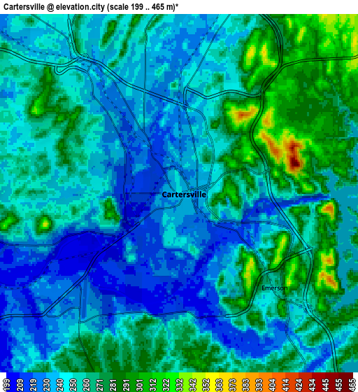
Below is the Elevation map of Cartersville, which displays elevation range with different colors. Scale of the first map is from 203 to 416 m (666 to 1365 ft) with average elevation of 239.1 meters (=784 ft) [note 1]
These maps also provides idea of topography and contour of this city, they are displayed at different zoom levels. More info about maps, scale and edge coordinates you can find below images.
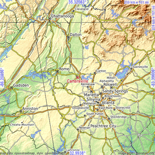
| \ | Map #1 | Map #2 | Topo.Map |
| Scale [m] | 203..416 m | 199..465 m | × |
| Scale [ft] | 666..1365 ft | 653..1526 ft | × |
| Average | 239.1 m = 784 ft | 254.1 m = 834 ft | × |
| Width | 8.09 km = 5 mi | 16.17 km = 10 mi | 258.7 km = 160.7 mi |
| Height | 8.09 km = 5 mi | 16.17 km = 10 mi | 258.7 km = 160.7 mi |
| ↑Max Latitude | 34.201683° | 34.238021° | 35.32083° |
| Latitude at center | 34.16533° | 34.16533° | 34.16533° |
| ↓Min Latitude | 34.128961° | 34.092576° | 32.9938° |
| ← Min Longitude | -84.846255° | -84.890201° | -86.20856° |
| Longitude center | -84.80231° | -84.80231° | -84.80231° |
| →Max Longitude | -84.758365° | -84.714419° | -83.39606° |
Nearby cities:
Cities around Cartersville sort by population:
• Kennesaw elevation 331 m
23.3 km,  132°
132°
• Woodstock 298 m
27 km,  105°
105°
• Canton 296 m
29.7 km,  74°
74°
• Acworth 277 m
15.9 km, 133°
• Dallas 316 m
27.1 km,  187°
187°
• Holly Springs 342 m
27.7 km,  88°
88°
• Adairsville 226 m
25.7 km,  331°
331°
• Rockmart 239 m
28.5 km,  230°
230°
• Euharlee 211 m
12.2 km,  259°
259°
• Rydal 265 m
20.5 km,  22°
22°
• Emerson 253 m
6.1 km, 134°
• Aragon 226 m
26.9 km,  240°
240°
Multilingual:
 En español:
Cartersville elevación 237 m.
 En France:
Cartersville élévation 237 m.
 Auf Deutsch:
Cartersville höhe über dem Meeresspiegel ist 237 m.

Sources and notes:
- [note 1] Map square and city borders are not equal. Map elevation data is calculated only from area inside that square.
- [src 1] Elevation data from geonames database provided with same terms of usage.
- [src 2] The elevation map of Cartersville is generated using elevation data from NASA's 3 arcsec (90m) resolution SRTM data.
- [src 3] Base (background) map © OpenStreetMap contributors tiles are generated by Geofabrik and OpenTopoMap.
Copyright & License:
This Cartersville Elevation Map is licensed under CC BY-SA. You may reuse any part from this page, if you give a proper credit by linking to this URL:
 More info on terms of use page.