Springville elevation
Springville (Alabama, Saint Clair County), United States elevation is 220 meters and Springville elevation in feet is 722 ft above sea level [src 1]. Springville is a populated place (feature code) with elevation that is 59 meters (194 ft) smaller than average city elevation in United States.
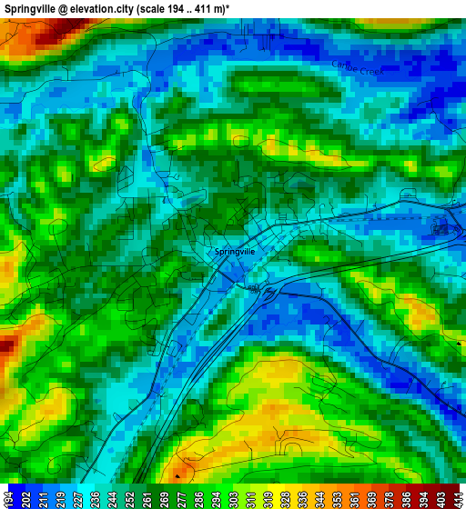
Below is the Elevation map of Springville, which displays elevation range with different colors. Scale of the first map is from 194 to 411 m (636 to 1348 ft) with average elevation of 261.4 meters (=858 ft) [note 1]
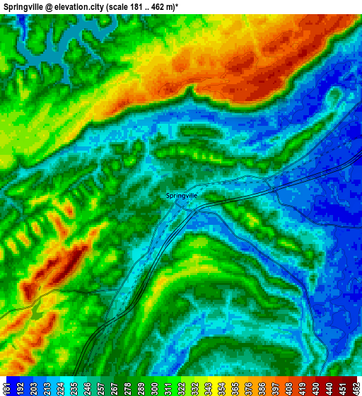
These maps also provides idea of topography and contour of this city, they are displayed at different zoom levels. More info about maps, scale and edge coordinates you can find below images.
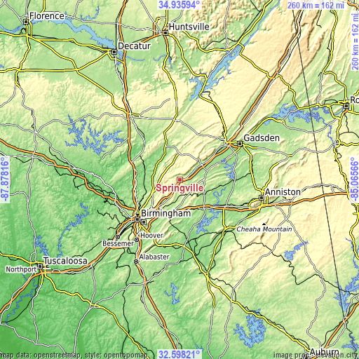
| \ | Map #1 | Map #2 | Topo.Map |
| Scale [m] | 194..411 m | 181..462 m | × |
| Scale [ft] | 636..1348 ft | 594..1516 ft | × |
| Average | 261.4 m = 858 ft | 280 m = 919 ft | × |
| Width | 8.12 km = 5 mi | 16.25 km = 10.1 mi | 259.9 km = 161.5 mi |
| Height | 8.12 km = 5 mi | 16.25 km = 10.1 mi | 259.9 km = 161.5 mi |
| ↑Max Latitude | 33.811571° | 33.848076° | 34.93594° |
| Latitude at center | 33.77505° | 33.77505° | 33.77505° |
| ↓Min Latitude | 33.738514° | 33.701962° | 32.59821° |
| ← Min Longitude | -86.515855° | -86.559801° | -87.87816° |
| Longitude center | -86.47191° | -86.47191° | -86.47191° |
| →Max Longitude | -86.427965° | -86.384019° | -85.06566° |
Nearby cities:
Cities around Springville sort by population:
• Dixiana elevation 227 m
16.9 km,  256°
256°
• Trussville 212 m
21.4 km,  216°
216°
• Moody 210 m
20.5 km,  184°
184°
• Clay 291 m
14.3 km,  235°
235°
• Oneonta 260 m
19.2 km,  359°
359°
• Grayson Valley 289 m
21 km,  227°
227°
• Margaret 210 m
9.9 km, 181°
• Argo 276 m
10.1 km,  195°
195°
• Chalkville 268 m
21.2 km, 230°
• Odenville 226 m
12.9 km,  147°
147°
• Ashville 173 m
21.2 km,  71°
71°
• Locust Fork 178 m
19.8 km,  318°
318°
Multilingual:
 En español:
Springville elevación 220 m.
 En France:
Springville élévation 220 m.
 Auf Deutsch:
Springville höhe über dem Meeresspiegel ist 220 m.

Sources and notes:
- [note 1] Map square and city borders are not equal. Map elevation data is calculated only from area inside that square.
- [src 1] Elevation data from geonames database provided with same terms of usage.
- [src 2] The elevation map of Springville is generated using elevation data from NASA's 3 arcsec (90m) resolution SRTM data.
- [src 3] Base (background) map © OpenStreetMap contributors tiles are generated by Geofabrik and OpenTopoMap.
Copyright & License:
This Springville Elevation Map is licensed under CC BY-SA. You may reuse any part from this page, if you give a proper credit by linking to this URL:
 More info on terms of use page.