Brent elevation
Brent (Alabama, Bibb County), United States elevation is 74 meters and Brent elevation in feet is 243 ft above sea level [src 1]. Brent is a populated place (feature code) with elevation that is 205 meters (673 ft) smaller than average city elevation in United States.
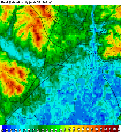
Below is the Elevation map of Brent, which displays elevation range with different colors. Scale of the first map is from 53 to 142 m (174 to 466 ft) with average elevation of 82.8 meters (=272 ft) [note 1]
These maps also provides idea of topography and contour of this city, they are displayed at different zoom levels. More info about maps, scale and edge coordinates you can find below images.
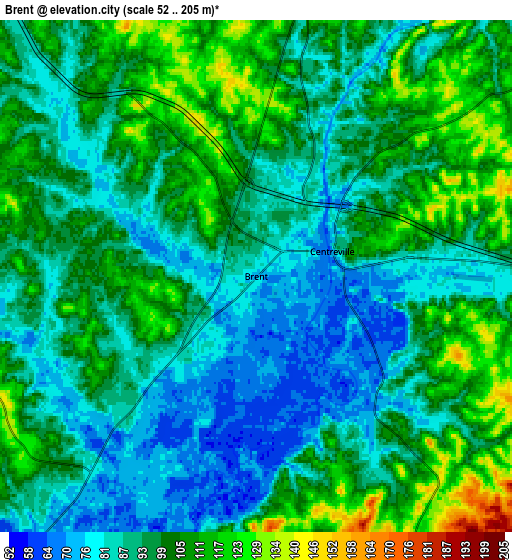
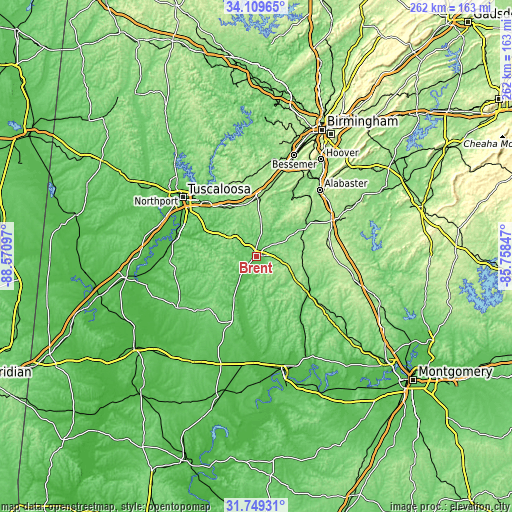
| \ | Map #1 | Map #2 | Topo.Map |
| Scale [m] | 53..142 m | 52..205 m | × |
| Scale [ft] | 174..466 ft | 171..673 ft | × |
| Average | 82.8 m = 272 ft | 95.8 m = 314 ft | × |
| Width | 8.2 km = 5.1 mi | 16.4 km = 10.2 mi | 262.4 km = 163 mi |
| Height | 8.2 km = 5.1 mi | 16.4 km = 10.2 mi | 262.4 km = 163 mi |
| ↑Max Latitude | 32.974224° | 33.011083° | 34.10965° |
| Latitude at center | 32.93735° | 32.93735° | 32.93735° |
| ↓Min Latitude | 32.900461° | 32.863556° | 31.74931° |
| ← Min Longitude | -87.208665° | -87.252611° | -88.57097° |
| Longitude center | -87.16472° | -87.16472° | -87.16472° |
| →Max Longitude | -87.120775° | -87.076829° | -85.75847° |
Nearby cities:
Cities around Brent sort by population:
• Montevallo elevation 125 m
33.4 km,  57°
57°
• Marion 116 m
36.9 km,  203°
203°
• Centreville 115 m
4.6 km,  77°
77°
• Jemison 219 m
39.1 km,  86°
86°
• Lake View 147 m
38.3 km,  3°
3°
• Thorsby 210 m
42 km, 93°
• Brookwood 184 m
38.3 km,  337°
337°
• Coaling 125 m
29.6 km,  326°
326°
• Woodstock 170 m
30 km, 2°
• Vance 156 m
27.1 km,  346°
346°
• West Blocton 156 m
20.4 km,  10°
10°
• North Bibb 176 m
29.7 km, 2°
Multilingual:
 En español:
Brent elevación 74 m.
 En France:
Brent élévation 74 m.


Sources and notes:
- [note 1] Map square and city borders are not equal. Map elevation data is calculated only from area inside that square.
- [src 1] Elevation data from geonames database provided with same terms of usage.
- [src 2] The elevation map of Brent is generated using elevation data from NASA's 3 arcsec (90m) resolution SRTM data.
- [src 3] Base (background) map © OpenStreetMap contributors tiles are generated by Geofabrik and OpenTopoMap.
Copyright & License:
This Brent Elevation Map is licensed under CC BY-SA. You may reuse any part from this page, if you give a proper credit by linking to this URL:
 More info on terms of use page.