Kiruhura elevation
Kiruhura (Western Region, Kiruhura District), Uganda elevation is 1344 meters and Kiruhura elevation in feet is 4409 ft above sea level [src 1]. Kiruhura is a seat of a second-order administrative division (feature code) with elevation that is 85 meters (279 ft) bigger than average city elevation in Uganda.
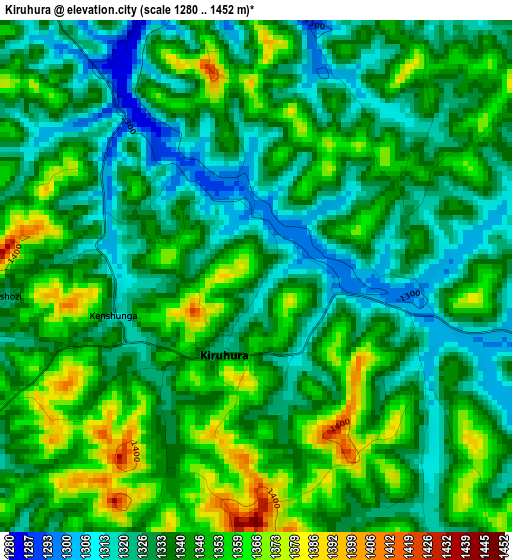
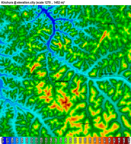
Below is the Elevation map of Kiruhura, which displays elevation range with different colors. Scale of the first map is from 1280 to 1452 m (4199 to 4764 ft) with average elevation of 1339.2 meters (=4394 ft) [note 1]
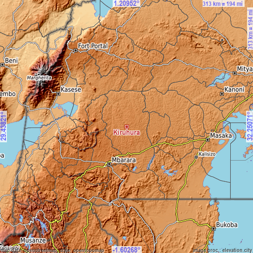
These maps also provides idea of topography and contour of this city, they are displayed at different zoom levels. More info about maps, scale and edge coordinates you can find below images.
| \ | Map #1 | Map #2 | Topo.Map |
| Scale [m] | 1280..1452 m | 1270..1452 m | × |
| Scale [ft] | 4199..4764 ft | 4167..4764 ft | × |
| Average | 1339.2 m = 4394 ft | 1333.3 m = 4374 ft | × |
| Width | 9.77 km = 6.1 mi | 19.55 km = 12.1 mi | 312.7 km = 194.3 mi |
| Height | 9.77 km = 6.1 mi | 19.54 km = 12.1 mi | 312.7 km = 194.3 mi |
| ↑Max Latitude | -0.152695° | -0.10875° | 1.20952° |
| Latitude at center | -0.19664° | -0.19664° | -0.19664° |
| ↓Min Latitude | -0.240585° | -0.28453° | -1.60268° |
| ← Min Longitude | 30.800515° | 30.756569° | 29.43821° |
| Longitude center | 30.84446° | 30.84446° | 30.84446° |
| →Max Longitude | 30.888405° | 30.932351° | 32.25071° |
Nearby cities:
Cities around Kiruhura sort by population:
• Mbarara elevation 1422 m
50.3 km,  205°
205°
• Bwizibwera 1415 m
50.1 km, 208°
• Ibanda 1439 m
39.3 km,  280°
280°
• Kamwenge 1253 m
60.8 km,  314°
314°
• Lyantonde 1261 m
41.7 km,  123°
123°
• Sembabule 1232 m
69.4 km,  78°
78°
• Rubirizi 1338 m
79.9 km,  261°
261°
• Isingiro 1389 m
74.7 km,  181°
181°
• Lwengo 1252 m
67.2 km,  111°
111°
• Kibingo 1425 m
65.9 km,  223°
223°
• Buhweju 1840 m
62.9 km,  254°
254°
• Nsika 1625 m
49.3 km, 248°
Multilingual:
 En español:
Kiruhura elevación 1344 m.
 En France:
Kiruhura élévation 1344 m.
 Auf Deutsch:
Kiruhura höhe über dem Meeresspiegel ist 1344 m.

Sources and notes:
- [note 1] Map square and city borders are not equal. Map elevation data is calculated only from area inside that square.
- [src 1] Elevation data from geonames database provided with same terms of usage.
- [src 2] The elevation map of Kiruhura is generated using elevation data from NASA's 3 arcsec (90m) resolution SRTM data.
- [src 3] Base (background) map © OpenStreetMap contributors tiles are generated by Geofabrik and OpenTopoMap.
Copyright & License:
This Kiruhura Elevation Map is licensed under CC BY-SA. You may reuse any part from this page, if you give a proper credit by linking to this URL:
 More info on terms of use page.