Masindi Port elevation
Masindi Port (Western Region, Kiryandongo District), Uganda elevation is 1039 meters and Masindi Port elevation in feet is 3409 ft above sea level [src 1]. Masindi Port is a populated place (feature code) with elevation that is 220 meters (722 ft) smaller than average city elevation in Uganda.
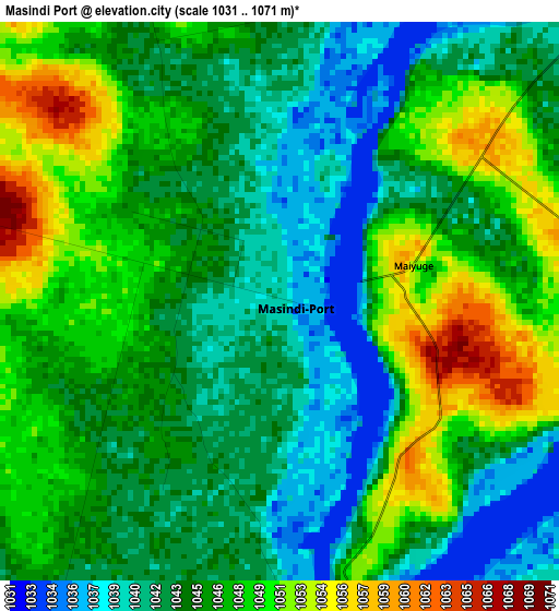
Below is the Elevation map of Masindi Port, which displays elevation range with different colors. Scale of the first map is from 1031 to 1071 m (3383 to 3514 ft) with average elevation of 1045.5 meters (=3430 ft) [note 1]
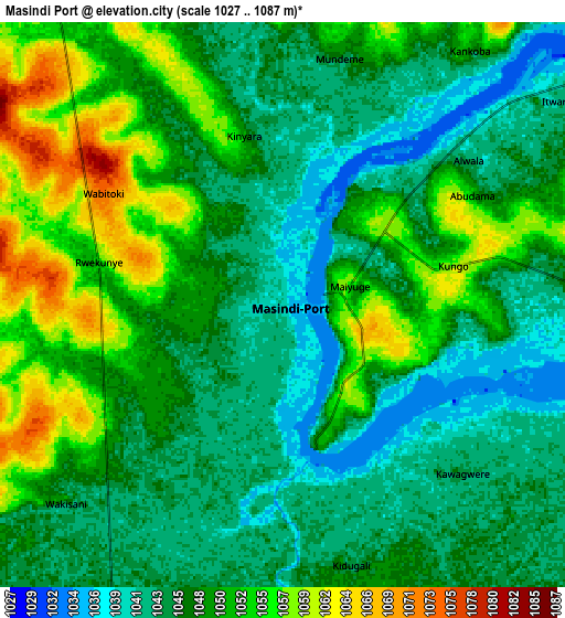
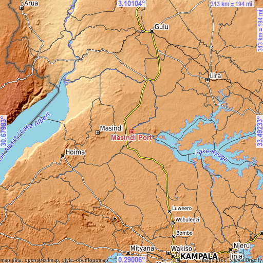
These maps also provides idea of topography and contour of this city, they are displayed at different zoom levels. More info about maps, scale and edge coordinates you can find below images.
| \ | Map #1 | Map #2 | Topo.Map |
| Scale [m] | 1031..1071 m | 1027..1087 m | × |
| Scale [ft] | 3383..3514 ft | 3369..3566 ft | × |
| Average | 1045.5 m = 3430 ft | 1048 m = 3438 ft | × |
| Width | 9.77 km = 6.1 mi | 19.54 km = 12.1 mi | 312.6 km = 194.2 mi |
| Height | 9.77 km = 6.1 mi | 19.54 km = 12.1 mi | 312.6 km = 194.2 mi |
| ↑Max Latitude | 1.739986° | 1.78391° | 3.10104° |
| Latitude at center | 1.69606° | 1.69606° | 1.69606° |
| ↓Min Latitude | 1.652133° | 1.608206° | 0.29006° |
| ← Min Longitude | 32.042135° | 31.998189° | 30.67983° |
| Longitude center | 32.08608° | 32.08608° | 32.08608° |
| →Max Longitude | 32.130025° | 32.173971° | 33.49233° |
Nearby cities:
Cities around Masindi Port sort by population:
• Hoima elevation 1131 m
86.6 km,  250°
250°
• Masindi 1140 m
41.3 km,  266°
266°
• Luwero 1108 m
103.5 km,  155°
155°
• Kiboga 1280 m
93.4 km,  201°
201°
• Apac 1043 m
59.1 km,  58°
58°
• Nakasongola 1091 m
59.6 km,  136°
136°
• Kigorobya 1094 m
86.8 km,  264°
264°
• Bulisa 632 m
88.4 km,  302°
302°
• Amolatar 1041 m
84.2 km,  96°
96°
• Oyam 1053 m
68.5 km,  28°
28°
• Kyankwanzi 1091 m
63.6 km,  209°
209°
• Kiryandongo 1086 m
20.2 km,  352°
352°
Multilingual:
 En español:
Masindi Port elevación 1039 m.
 En France:
Masindi Port élévation 1039 m.
 Auf Deutsch:
Masindi Port höhe über dem Meeresspiegel ist 1039 m.

Sources and notes:
- [note 1] Map square and city borders are not equal. Map elevation data is calculated only from area inside that square.
- [src 1] Elevation data from geonames database provided with same terms of usage.
- [src 2] The elevation map of Masindi Port is generated using elevation data from NASA's 3 arcsec (90m) resolution SRTM data.
- [src 3] Base (background) map © OpenStreetMap contributors tiles are generated by Geofabrik and OpenTopoMap.
Copyright & License:
This Masindi Port Elevation Map is licensed under CC BY-SA. You may reuse any part from this page, if you give a proper credit by linking to this URL:
 More info on terms of use page.