Bratslav elevation
Bratslav (Vinnyts'ka), Ukraine elevation is 215 meters and Bratslav elevation in feet is 705 ft above sea level [src 1]. Bratslav is a populated place (feature code) with elevation that is 58 meters (190 ft) bigger than average city elevation in Ukraine.
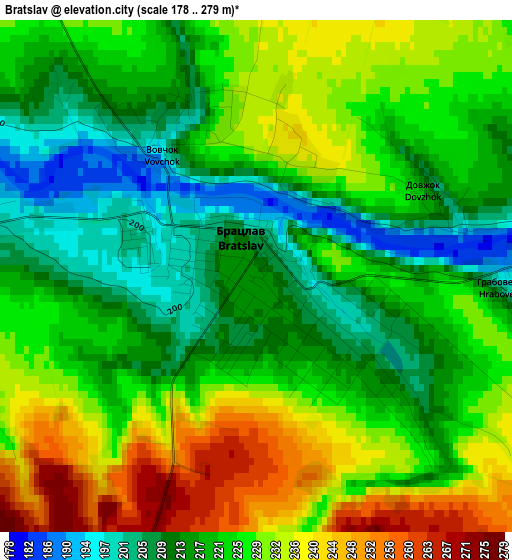
Below is the Elevation map of Bratslav, which displays elevation range with different colors. Scale of the first map is from 178 to 279 m (584 to 915 ft) with average elevation of 223 meters (=732 ft) [note 1]
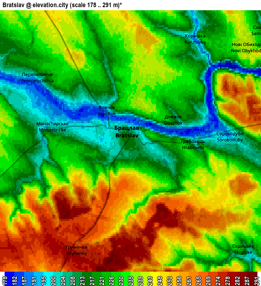
These maps also provides idea of topography and contour of this city, they are displayed at different zoom levels. More info about maps, scale and edge coordinates you can find below images.
| \ | Map #1 | Map #2 | Topo.Map |
| Scale [m] | 178..279 m | 178..291 m | × |
| Scale [ft] | 584..915 ft | 584..955 ft | × |
| Average | 223 m = 732 ft | 234.2 m = 768 ft | × |
| Width | 6.43 km = 4 mi | 12.87 km = 8 mi | 205.9 km = 127.9 mi |
| Height | 6.43 km = 4 mi | 12.87 km = 8 mi | 205.9 km = 127.9 mi |
| ↑Max Latitude | 48.851495° | 48.880403° | 49.7399° |
| Latitude at center | 48.82257° | 48.82257° | 48.82257° |
| ↓Min Latitude | 48.793628° | 48.76467° | 47.88814° |
| ← Min Longitude | 28.896755° | 28.852809° | 27.53445° |
| Longitude center | 28.9407° | 28.9407° | 28.9407° |
| →Max Longitude | 28.984645° | 29.028591° | 30.34695° |
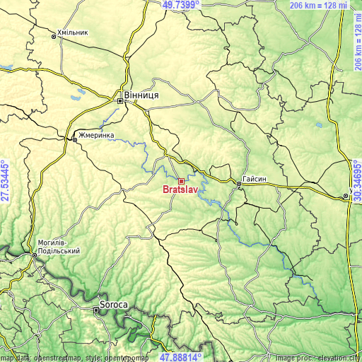
Nearby cities:
Cities around Bratslav sort by population:
• Haisyn elevation 210 m
32.9 km,  92°
92°
• Ladyzhyn 205 m
26.6 km,  125°
125°
• Tulchyn 231 m
17.9 km,  202°
202°
• Nemyriv 272 m
18.1 km,  335°
335°
• Illintsi 214 m
37.3 km,  32°
32°
• Vapnyarka 313 m
35.1 km, 204°
• Voronovytsya 287 m
37.1 km,  329°
329°
• Sutysky 250 m
45.4 km,  302°
302°
• Dashiv 194 m
40.8 km,  60°
60°
• Tomashpil’ 240 m
44 km,  224°
224°
• Trostyanets’ 196 m
41 km,  148°
148°
• Tyvriv 279 m
38.1 km, 303°
Multilingual:
 En español:
Bratslav elevación 215 m.
 En France:
Bratslav élévation 215 m.
 Auf Deutsch:
Bratslav höhe über dem Meeresspiegel ist 215 m.

Sources and notes:
- [note 1] Map square and city borders are not equal. Map elevation data is calculated only from area inside that square.
- [src 1] Elevation data from geonames database provided with same terms of usage.
- [src 2] The elevation map of Bratslav is generated using elevation data from NASA's 3 arcsec (90m) resolution SRTM data.
- [src 3] Base (background) map © OpenStreetMap contributors tiles are generated by Geofabrik and OpenTopoMap.
Copyright & License:
This Bratslav Elevation Map is licensed under CC BY-SA. You may reuse any part from this page, if you give a proper credit by linking to this URL:
 More info on terms of use page.