Illintsi elevation
Illintsi (Vinnyts'ka), Ukraine elevation is 214 meters and Illintsi elevation in feet is 702 ft above sea level [src 1]. Illintsi is a seat of a second-order administrative division (feature code) with elevation that is 57 meters (187 ft) bigger than average city elevation in Ukraine.
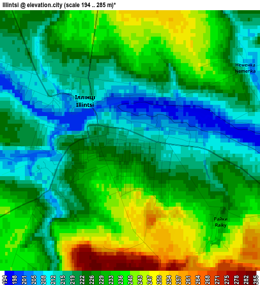
Below is the Elevation map of Illintsi, which displays elevation range with different colors. Scale of the first map is from 194 to 285 m (636 to 935 ft) with average elevation of 226.8 meters (=744 ft) [note 1]
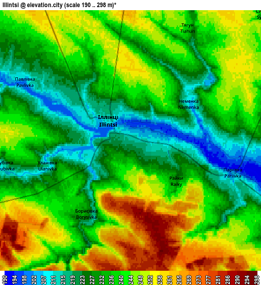
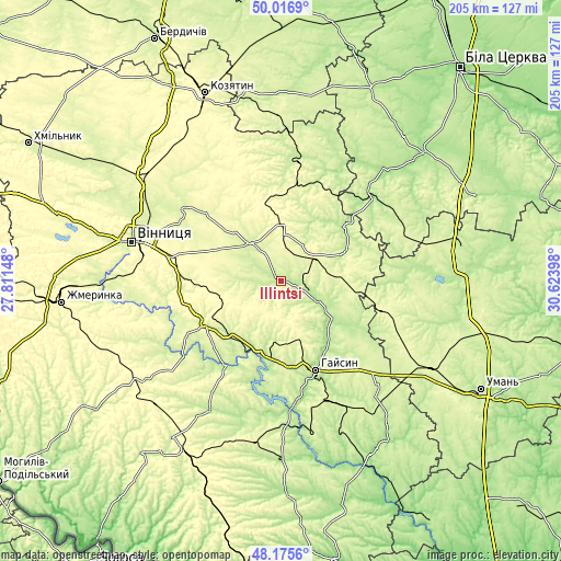
These maps also provides idea of topography and contour of this city, they are displayed at different zoom levels. More info about maps, scale and edge coordinates you can find below images.
| \ | Map #1 | Map #2 | Topo.Map |
| Scale [m] | 194..285 m | 190..298 m | × |
| Scale [ft] | 636..935 ft | 623..978 ft | × |
| Average | 226.8 m = 744 ft | 238.4 m = 782 ft | × |
| Width | 6.4 km = 4 mi | 12.8 km = 8 mi | 204.7 km = 127.2 mi |
| Height | 6.4 km = 4 mi | 12.8 km = 8 mi | 204.7 km = 127.2 mi |
| ↑Max Latitude | 49.133552° | 49.162297° | 50.0169° |
| Latitude at center | 49.10479° | 49.10479° | 49.10479° |
| ↓Min Latitude | 49.076012° | 49.047217° | 48.1756° |
| ← Min Longitude | 29.173785° | 29.129839° | 27.81148° |
| Longitude center | 29.21773° | 29.21773° | 29.21773° |
| →Max Longitude | 29.261675° | 29.305621° | 30.62398° |
Nearby cities:
Cities around Illintsi sort by population:
• Haisyn elevation 210 m
35 km,  158°
158°
• Tetiiv 195 m
44.4 km,  47°
47°
• Nemyriv 272 m
31.4 km,  241°
241°
• Pohrebyshche 228 m
42.6 km,  4°
4°
• Monastyryshche 246 m
44.6 km,  106°
106°
• Turbiv 252 m
45.1 km,  306°
306°
• Voronovytsya 287 m
39.1 km,  270°
270°
• Bratslav 215 m
37.3 km,  212°
212°
• Dashiv 194 m
18.8 km,  126°
126°
• Tsibulev 228 m
45.9 km,  93°
93°
• Orativ 232 m
24.4 km,  67°
67°
• Lypovets 243 m
18.2 km,  319°
319°
Multilingual:
 En español:
Illintsi elevación 214 m.
 En France:
Illintsi élévation 214 m.
 Auf Deutsch:
Illintsi höhe über dem Meeresspiegel ist 214 m.

Sources and notes:
- [note 1] Map square and city borders are not equal. Map elevation data is calculated only from area inside that square.
- [src 1] Elevation data from geonames database provided with same terms of usage.
- [src 2] The elevation map of Illintsi is generated using elevation data from NASA's 3 arcsec (90m) resolution SRTM data.
- [src 3] Base (background) map © OpenStreetMap contributors tiles are generated by Geofabrik and OpenTopoMap.
Copyright & License:
This Illintsi Elevation Map is licensed under CC BY-SA. You may reuse any part from this page, if you give a proper credit by linking to this URL:
 More info on terms of use page.