Hadyach elevation
Hadyach (Poltava), Ukraine elevation is 154 meters and Hadyach elevation in feet is 505 ft above sea level [src 1]. Hadyach is a seat of a second-order administrative division (feature code) with elevation that is 3 meters (10 ft) smaller than average city elevation in Ukraine.
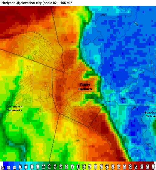
Below is the Elevation map of Hadyach, which displays elevation range with different colors. Scale of the first map is from 92 to 166 m (302 to 545 ft) with average elevation of 126.3 meters (=414 ft) [note 1]
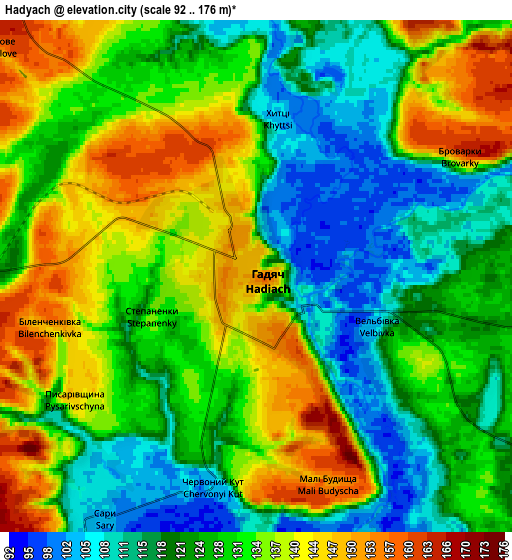
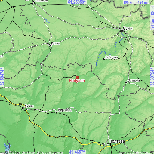
These maps also provides idea of topography and contour of this city, they are displayed at different zoom levels. More info about maps, scale and edge coordinates you can find below images.
| \ | Map #1 | Map #2 | Topo.Map |
| Scale [m] | 92..166 m | 92..176 m | × |
| Scale [ft] | 302..545 ft | 302..577 ft | × |
| Average | 126.3 m = 414 ft | 128.7 m = 422 ft | × |
| Width | 6.23 km = 3.9 mi | 12.47 km = 7.7 mi | 199.5 km = 124 mi |
| Height | 6.23 km = 3.9 mi | 12.47 km = 7.7 mi | 199.4 km = 123.9 mi |
| ↑Max Latitude | 50.399141° | 50.427145° | 51.25958° |
| Latitude at center | 50.37112° | 50.37112° | 50.37112° |
| ↓Min Latitude | 50.343083° | 50.315029° | 49.4657° |
| ← Min Longitude | 33.947045° | 33.903099° | 32.58474° |
| Longitude center | 33.99099° | 33.99099° | 33.99099° |
| →Max Longitude | 34.034935° | 34.078881° | 35.39724° |
Nearby cities:
Cities around Hadyach sort by population:
• Romny elevation 157 m
55.8 km,  319°
319°
• Myrhorod 100 m
52.4 km,  211°
211°
• Lebedyn 122 m
42.3 km,  55°
55°
• Lokhvytsya 104 m
51.8 km,  269°
269°
• Zin’kiv 115 m
32.1 km,  124°
124°
• Nedryhayliv 127 m
52.1 km,  351°
351°
• Shyshaky 150 m
54.4 km,  178°
178°
• Lypova Dolyna 120 m
25.5 km,  327°
327°
• Velyki Sorochyntsi 100 m
38.9 km,  185°
185°
• Romodan 151 m
63.6 km,  228°
228°
• Sencha 111 m
47.6 km,  254°
254°
• Komyshnya 141 m
30.2 km, 226°
Multilingual:
 En español:
Hadyach elevación 154 m.
 En France:
Hadyach élévation 154 m.


Sources and notes:
- [note 1] Map square and city borders are not equal. Map elevation data is calculated only from area inside that square.
- [src 1] Elevation data from geonames database provided with same terms of usage.
- [src 2] The elevation map of Hadyach is generated using elevation data from NASA's 3 arcsec (90m) resolution SRTM data.
- [src 3] Base (background) map © OpenStreetMap contributors tiles are generated by Geofabrik and OpenTopoMap.
Copyright & License:
This Hadyach Elevation Map is licensed under CC BY-SA. You may reuse any part from this page, if you give a proper credit by linking to this URL:
 More info on terms of use page.