Lebedyn elevation
Lebedyn (Sumy), Ukraine elevation is 122 meters and Lebedyn elevation in feet is 400 ft above sea level [src 1]. Lebedyn is a seat of a second-order administrative division (feature code) with elevation that is 35 meters (115 ft) smaller than average city elevation in Ukraine.
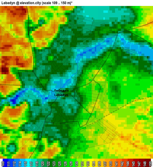
Below is the Elevation map of Lebedyn, which displays elevation range with different colors. Scale of the first map is from 109 to 150 m (358 to 492 ft) with average elevation of 127.2 meters (=417 ft) [note 1]
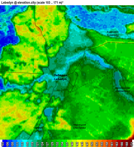
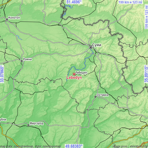
These maps also provides idea of topography and contour of this city, they are displayed at different zoom levels. More info about maps, scale and edge coordinates you can find below images.
| \ | Map #1 | Map #2 | Topo.Map |
| Scale [m] | 109..150 m | 103..171 m | × |
| Scale [ft] | 358..492 ft | 338..561 ft | × |
| Average | 127.2 m = 417 ft | 128.9 m = 423 ft | × |
| Width | 6.2 km = 3.9 mi | 12.41 km = 7.7 mi | 198.6 km = 123.4 mi |
| Height | 6.2 km = 3.9 mi | 12.41 km = 7.7 mi | 198.5 km = 123.3 mi |
| ↑Max Latitude | 50.613074° | 50.640951° | 51.4696° |
| Latitude at center | 50.58518° | 50.58518° | 50.58518° |
| ↓Min Latitude | 50.55727° | 50.529343° | 49.68383° |
| ← Min Longitude | 34.440955° | 34.397009° | 33.07865° |
| Longitude center | 34.4849° | 34.4849° | 34.4849° |
| →Max Longitude | 34.528845° | 34.572791° | 35.89115° |
Nearby cities:
Cities around Lebedyn sort by population:
• Sumy elevation 143 m
43.5 km,  30°
30°
• Okhtyrka 111 m
42.3 km,  136°
136°
• Hadyach 154 m
42.3 km,  235°
235°
• Zin’kiv 115 m
42.8 km,  191°
191°
• Trostyanets’ 120 m
35.8 km,  108°
108°
• Nedryhayliv 127 m
51 km,  302°
302°
• Lypova Dolyna 120 m
48.6 km,  267°
267°
• Boromlya 141 m
34.5 km,  83°
83°
• Verkhnya Syrovatka 142 m
43 km,  50°
50°
• Terny 138 m
57.7 km,  321°
321°
• Kyrykivka 114 m
50.9 km,  118°
118°
• Nyzy 126 m
30.5 km,  43°
43°
Multilingual:
 En español:
Lebedyn elevación 122 m.
 En France:
Lebedine élévation 122 m.


Sources and notes:
- [note 1] Map square and city borders are not equal. Map elevation data is calculated only from area inside that square.
- [src 1] Elevation data from geonames database provided with same terms of usage.
- [src 2] The elevation map of Lebedyn is generated using elevation data from NASA's 3 arcsec (90m) resolution SRTM data.
- [src 3] Base (background) map © OpenStreetMap contributors tiles are generated by Geofabrik and OpenTopoMap.
Copyright & License:
This Lebedyn Elevation Map is licensed under CC BY-SA. You may reuse any part from this page, if you give a proper credit by linking to this URL:
 More info on terms of use page.