Shyshaky elevation
Shyshaky (Poltava), Ukraine elevation is 150 meters and Shyshaky elevation in feet is 492 ft above sea level [src 1]. Shyshaky is a populated place (feature code) with elevation that is 7 meters (23 ft) smaller than average city elevation in Ukraine.
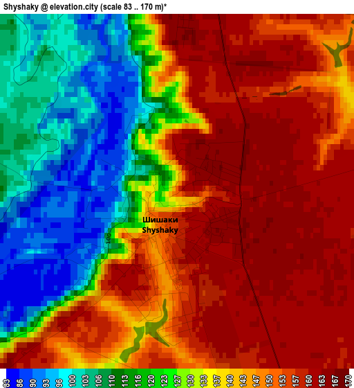
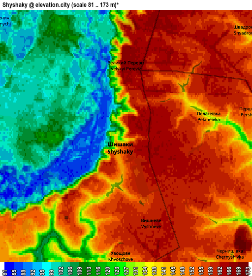
Below is the Elevation map of Shyshaky, which displays elevation range with different colors. Scale of the first map is from 83 to 170 m (272 to 558 ft) with average elevation of 137.1 meters (=450 ft) [note 1]
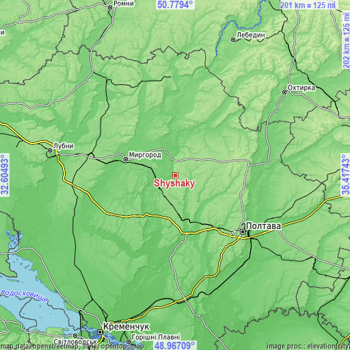
These maps also provides idea of topography and contour of this city, they are displayed at different zoom levels. More info about maps, scale and edge coordinates you can find below images.
| \ | Map #1 | Map #2 | Topo.Map |
| Scale [m] | 83..170 m | 81..173 m | × |
| Scale [ft] | 272..558 ft | 266..568 ft | × |
| Average | 137.1 m = 450 ft | 136.6 m = 448 ft | × |
| Width | 6.3 km = 3.9 mi | 12.59 km = 7.8 mi | 201.5 km = 125.2 mi |
| Height | 6.3 km = 3.9 mi | 12.59 km = 7.8 mi | 201.5 km = 125.2 mi |
| ↑Max Latitude | 49.910059° | 49.938351° | 50.7794° |
| Latitude at center | 49.88175° | 49.88175° | 49.88175° |
| ↓Min Latitude | 49.853425° | 49.825083° | 48.96709° |
| ← Min Longitude | 33.967235° | 33.923289° | 32.60493° |
| Longitude center | 34.01118° | 34.01118° | 34.01118° |
| →Max Longitude | 34.055125° | 34.099071° | 35.41743° |
Nearby cities:
Cities around Shyshaky sort by population:
• Poltava elevation 159 m
49.7 km,  130°
130°
• Myrhorod 100 m
30.4 km,  288°
288°
• Hadyach 154 m
54.4 km,  358°
358°
• Khorol 116 m
53.7 km,  258°
258°
• Zin’kiv 115 m
44.2 km,  34°
34°
• Reshetylivka 90 m
35.5 km,  172°
172°
• Dykan’ka 168 m
37.6 km,  99°
99°
• Oposhnya 173 m
43.8 km,  79°
79°
• Velyka Bahachka 92 m
23 km,  244°
244°
• Velyki Sorochyntsi 100 m
16.5 km,  342°
342°
• Romodan 151 m
50.6 km,  283°
283°
• Komyshnya 141 m
40.9 km,  325°
325°
Multilingual:
 En español:
Shyshaky elevación 150 m.
 En France:
Shyshaky élévation 150 m.
 Auf Deutsch:
Shyshaky höhe über dem Meeresspiegel ist 150 m.

Sources and notes:
- [note 1] Map square and city borders are not equal. Map elevation data is calculated only from area inside that square.
- [src 1] Elevation data from geonames database provided with same terms of usage.
- [src 2] The elevation map of Shyshaky is generated using elevation data from NASA's 3 arcsec (90m) resolution SRTM data.
- [src 3] Base (background) map © OpenStreetMap contributors tiles are generated by Geofabrik and OpenTopoMap.
Copyright & License:
This Shyshaky Elevation Map is licensed under CC BY-SA. You may reuse any part from this page, if you give a proper credit by linking to this URL:
 More info on terms of use page.