Chudey elevation
Chudey (Chernivtsi Oblast'), Ukraine elevation is 387 meters and Chudey elevation in feet is 1270 ft above sea level [src 1]. Chudey is a populated place (feature code) with elevation that is 230 meters (755 ft) bigger than average city elevation in Ukraine.
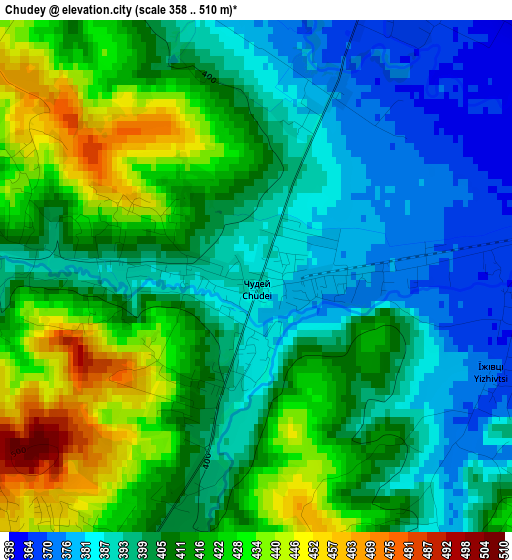
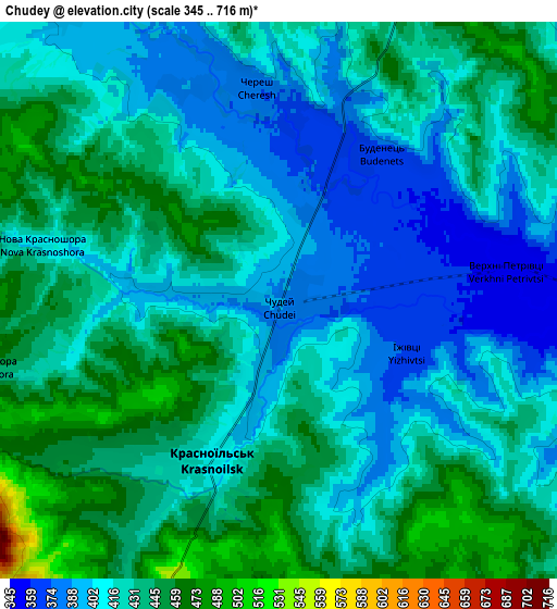
Below is the Elevation map of Chudey, which displays elevation range with different colors. Scale of the first map is from 358 to 510 m (1175 to 1673 ft) with average elevation of 407 meters (=1335 ft) [note 1]
These maps also provides idea of topography and contour of this city, they are displayed at different zoom levels. More info about maps, scale and edge coordinates you can find below images.
| \ | Map #1 | Map #2 | Topo.Map |
| Scale [m] | 358..510 m | 345..716 m | × |
| Scale [ft] | 1175..1673 ft | 1132..2349 ft | × |
| Average | 407 m = 1335 ft | 423.6 m = 1390 ft | × |
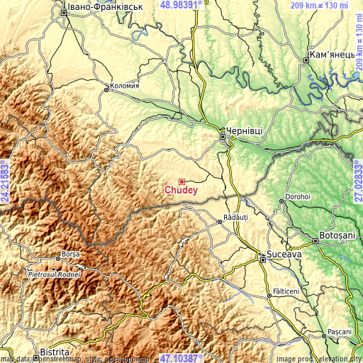
| Width | 6.53 km = 4.1 mi | 13.06 km = 8.1 mi | 209 km = 129.9 mi |
| Height | 6.53 km = 4.1 mi | 13.06 km = 8.1 mi | 209 km = 129.9 mi |
| ↑Max Latitude | 48.081837° | 48.111187° | 48.98391° |
| Latitude at center | 48.05247° | 48.05247° | 48.05247° |
| ↓Min Latitude | 48.023086° | 47.993686° | 47.10387° |
| ← Min Longitude | 25.578135° | 25.534189° | 24.21583° |
| Longitude center | 25.62208° | 25.62208° | 25.62208° |
| →Max Longitude | 25.666025° | 25.709971° | 27.02833° |
Nearby cities:
Cities around Chudey sort by population:
• Chernivtsi elevation 228 m
35.5 km,  41°
41°
• Hlyboka 348 m
23.2 km,  79°
79°
• Berehomet 450 m
24.7 km,  304°
304°
• Luzhany 180 m
36.5 km,  17°
17°
• Molodiya 240 m
35.2 km,  57°
57°
• Myhove 451 m
21.5 km, 302°
• Yizhivtsi 371 m
3.3 km,  115°
115°
• Ropcha 344 m
13.6 km, 56°
• Davydivka 404 m
8.7 km,  330°
330°
• Voloka 246 m
27.7 km, 55°
• Nyzhni Petrivtsi 390 m
8 km,  109°
109°
• Storozhynets’ 368 m
14.4 km,  30°
30°
Multilingual:
 En español:
Chudey elevación 387 m.
 En France:
Chudey élévation 387 m.


Sources and notes:
- [note 1] Map square and city borders are not equal. Map elevation data is calculated only from area inside that square.
- [src 1] Elevation data from geonames database provided with same terms of usage.
- [src 2] The elevation map of Chudey is generated using elevation data from NASA's 3 arcsec (90m) resolution SRTM data.
- [src 3] Base (background) map © OpenStreetMap contributors tiles are generated by Geofabrik and OpenTopoMap.
Copyright & License:
This Chudey Elevation Map is licensed under CC BY-SA. You may reuse any part from this page, if you give a proper credit by linking to this URL:
 More info on terms of use page.