Luzhany elevation
Luzhany (Chernivtsi Oblast'), Ukraine elevation is 180 meters and Luzhany elevation in feet is 591 ft above sea level [src 1]. Luzhany is a populated place (feature code) with elevation that is 23 meters (75 ft) bigger than average city elevation in Ukraine.
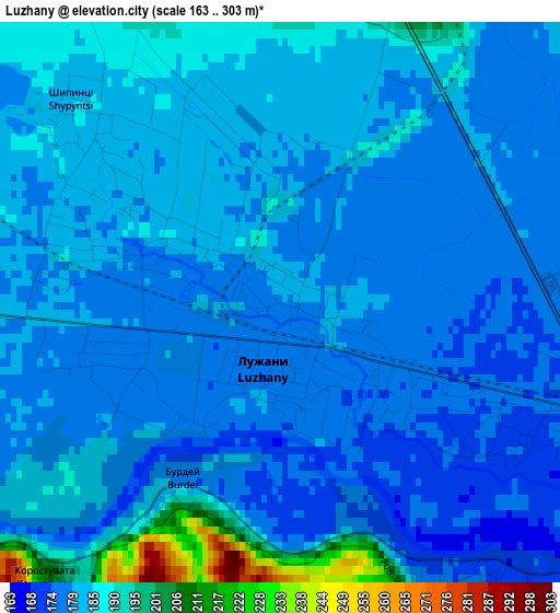
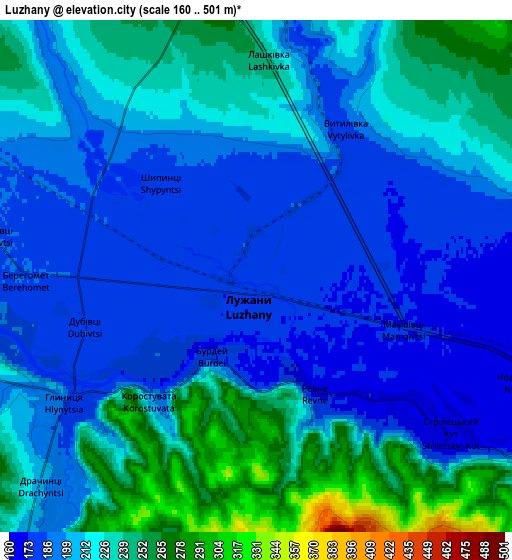
Below is the Elevation map of Luzhany, which displays elevation range with different colors. Scale of the first map is from 163 to 303 m (535 to 994 ft) with average elevation of 181.8 meters (=596 ft) [note 1]
These maps also provides idea of topography and contour of this city, they are displayed at different zoom levels. More info about maps, scale and edge coordinates you can find below images.
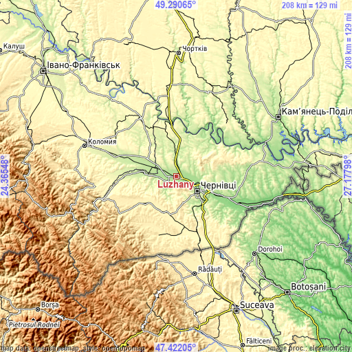
| \ | Map #1 | Map #2 | Topo.Map |
| Scale [m] | 163..303 m | 160..501 m | × |
| Scale [ft] | 535..994 ft | 525..1644 ft | × |
| Average | 181.8 m = 596 ft | 212.3 m = 697 ft | × |
| Width | 6.49 km = 4 mi | 12.99 km = 8.1 mi | 207.8 km = 129.1 mi |
| Height | 6.49 km = 4 mi | 12.99 km = 8.1 mi | 207.8 km = 129.1 mi |
| ↑Max Latitude | 48.394108° | 48.42328° | 49.29065° |
| Latitude at center | 48.36492° | 48.36492° | 48.36492° |
| ↓Min Latitude | 48.335715° | 48.306493° | 47.42205° |
| ← Min Longitude | 25.727785° | 25.683839° | 24.36548° |
| Longitude center | 25.77173° | 25.77173° | 25.77173° |
| →Max Longitude | 25.815675° | 25.859621° | 27.17798° |
Nearby cities:
Cities around Luzhany sort by population:
• Chernivtsi elevation 228 m
14.9 km,  123°
123°
• Sniatyn 227 m
17.5 km,  301°
301°
• Zastavna 239 m
18.4 km,  16°
16°
• Vashkivtsi 211 m
19.4 km,  276°
276°
• Molodiya 240 m
24.3 km,  130°
130°
• Verenchanka 218 m
20.3 km,  354°
354°
• Kadubivtsi 264 m
24.3 km,  359°
359°
• Stetseva 249 m
23.2 km,  321°
321°
• Shypyntsi 182 m
2.3 km,  305°
305°
• Voloka 246 m
22.5 km,  148°
148°
• Storozhynets’ 368 m
22.6 km,  189°
189°
• Kitsman’ 217 m
8.8 km, 357°
Multilingual:
 En español:
Luzhany elevación 180 m.
 En France:
Luzhany élévation 180 m.


Sources and notes:
- [note 1] Map square and city borders are not equal. Map elevation data is calculated only from area inside that square.
- [src 1] Elevation data from geonames database provided with same terms of usage.
- [src 2] The elevation map of Luzhany is generated using elevation data from NASA's 3 arcsec (90m) resolution SRTM data.
- [src 3] Base (background) map © OpenStreetMap contributors tiles are generated by Geofabrik and OpenTopoMap.
Copyright & License:
This Luzhany Elevation Map is licensed under CC BY-SA. You may reuse any part from this page, if you give a proper credit by linking to this URL:
 More info on terms of use page.