Zolochiv elevation
Zolochiv (Lviv), Ukraine elevation is 276 meters and Zolochiv elevation in feet is 906 ft above sea level [src 1]. Zolochiv is a seat of a second-order administrative division (feature code) with elevation that is 119 meters (390 ft) bigger than average city elevation in Ukraine.
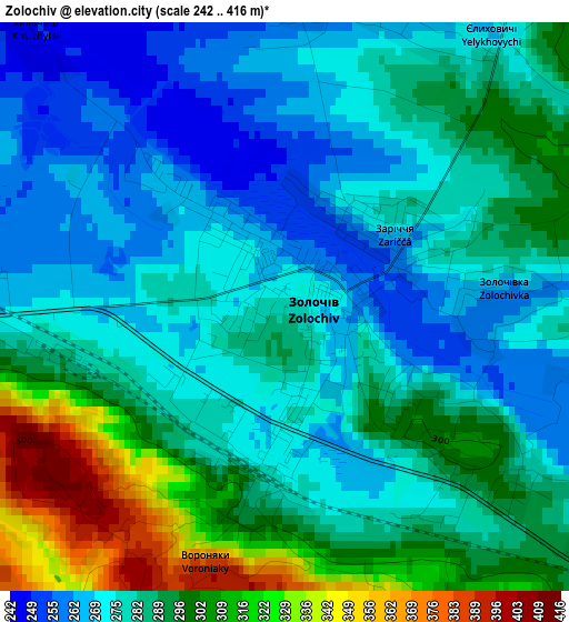
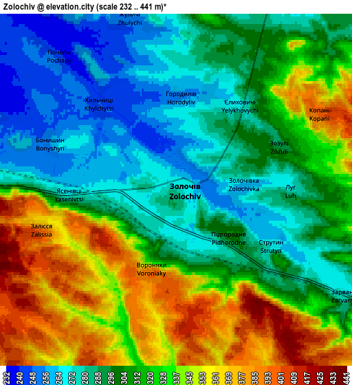
Below is the Elevation map of Zolochiv, which displays elevation range with different colors. Scale of the first map is from 242 to 416 m (794 to 1365 ft) with average elevation of 284.9 meters (=935 ft) [note 1]
These maps also provides idea of topography and contour of this city, they are displayed at different zoom levels. More info about maps, scale and edge coordinates you can find below images.
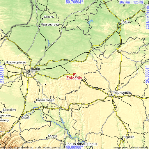
| \ | Map #1 | Map #2 | Topo.Map |
| Scale [m] | 242..416 m | 232..441 m | × |
| Scale [ft] | 794..1365 ft | 761..1447 ft | × |
| Average | 284.9 m = 935 ft | 312.5 m = 1025 ft | × |
| Width | 6.31 km = 3.9 mi | 12.61 km = 7.8 mi | 201.8 km = 125.4 mi |
| Height | 6.31 km = 3.9 mi | 12.61 km = 7.8 mi | 201.8 km = 125.4 mi |
| ↑Max Latitude | 49.834323° | 49.862659° | 50.70504° |
| Latitude at center | 49.80597° | 49.80597° | 49.80597° |
| ↓Min Latitude | 49.7776° | 49.749214° | 48.88988° |
| ← Min Longitude | 24.850415° | 24.806469° | 23.48811° |
| Longitude center | 24.89436° | 24.89436° | 24.89436° |
| →Max Longitude | 24.938305° | 24.982251° | 26.30061° |
Nearby cities:
Cities around Zolochiv sort by population:
• Brody elevation 223 m
36.3 km,  30°
30°
• Бережани 305 m
39.7 km,  175°
175°
• Peremyshlyany 301 m
28.8 km,  237°
237°
• Zboriv 354 m
23.7 km,  131°
131°
• Krasne 220 m
23.5 km,  300°
300°
• Ozerna 351 m
36.9 km,  122°
122°
• Zaliztsi 360 m
34.4 km,  92°
92°
• Pidkamin’ 368 m
34 km,  62°
62°
• Olesko 232 m
17.4 km,  359°
359°
• Pomoriany 323 m
18.5 km,  171°
171°
• Pidhirtsi 313 m
16.7 km,  21°
21°
• Bus’k 218 m
26.9 km,  311°
311°
Multilingual:
 En español:
Zolochiv elevación 276 m.
 En France:
Zolotchiv élévation 276 m.
 Auf Deutsch:
Solotschiw höhe über dem Meeresspiegel ist 276 m.

Sources and notes:
- [note 1] Map square and city borders are not equal. Map elevation data is calculated only from area inside that square.
- [src 1] Elevation data from geonames database provided with same terms of usage.
- [src 2] The elevation map of Zolochiv is generated using elevation data from NASA's 3 arcsec (90m) resolution SRTM data.
- [src 3] Base (background) map © OpenStreetMap contributors tiles are generated by Geofabrik and OpenTopoMap.
Copyright & License:
This Zolochiv Elevation Map is licensed under CC BY-SA. You may reuse any part from this page, if you give a proper credit by linking to this URL:
 More info on terms of use page.