Бережани elevation
Бережани (Ternopil), Ukraine elevation is 305 meters and Бережани elevation in feet is 1001 ft above sea level [src 1]. Бережани is a populated place (feature code) with elevation that is 148 meters (486 ft) bigger than average city elevation in Ukraine.
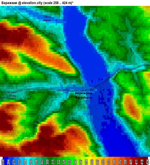
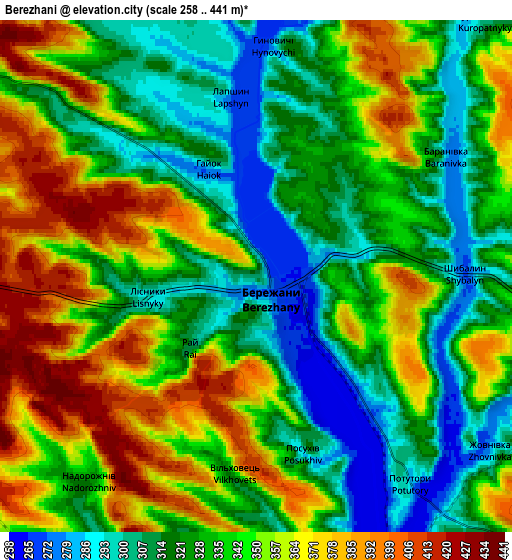
Below is the Elevation map of Бережани, which displays elevation range with different colors. Scale of the first map is from 258 to 424 m (846 to 1391 ft) with average elevation of 321.6 meters (=1055 ft) [note 1]
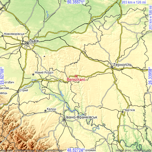
These maps also provides idea of topography and contour of this city, they are displayed at different zoom levels. More info about maps, scale and edge coordinates you can find below images.
| \ | Map #1 | Map #2 | Topo.Map |
| Scale [m] | 258..424 m | 258..441 m | × |
| Scale [ft] | 846..1391 ft | 846..1447 ft | × |
| Average | 321.6 m = 1055 ft | 338.5 m = 1111 ft | × |
| Width | 6.35 km = 3.9 mi | 12.71 km = 7.9 mi | 203.3 km = 126.3 mi |
| Height | 6.35 km = 3.9 mi | 12.71 km = 7.9 mi | 203.3 km = 126.3 mi |
| ↑Max Latitude | 49.478561° | 49.507105° | 50.35571° |
| Latitude at center | 49.45° | 49.45° | 49.45° |
| ↓Min Latitude | 49.421422° | 49.392828° | 48.52724° |
| ← Min Longitude | 24.889385° | 24.845439° | 23.52708° |
| Longitude center | 24.93333° | 24.93333° | 24.93333° |
| →Max Longitude | 24.977275° | 25.021221° | 26.33958° |
Nearby cities:
Cities around Бережани sort by population:
• Zolochiv elevation 276 m
39.7 km,  355°
355°
• Burshtyn 243 m
30.7 km,  226°
226°
• Kozova 361 m
15.8 km,  95°
95°
• Rohatyn 255 m
23.9 km,  258°
258°
• Peremyshlyany 301 m
36.1 km,  311°
311°
• Zboriv 354 m
28.2 km,  32°
32°
• Halych 218 m
39.5 km,  202°
202°
• Ozerna 351 m
34.8 km,  55°
55°
• Pidhaytsi 359 m
24.8 km,  144°
144°
• Bilshivtsi 219 m
32.5 km, 204°
• Pomoriany 323 m
21.2 km, 359°
• Monastyrys’ka 312 m
43.7 km,  156°
156°
Multilingual:
 En español:
Бережани elevación 305 m.
 En France:
Бережани élévation 305 m.
 Auf Deutsch:
Bereschany höhe über dem Meeresspiegel ist 305 m.

Sources and notes:
- [note 1] Map square and city borders are not equal. Map elevation data is calculated only from area inside that square.
- [src 1] Elevation data from geonames database provided with same terms of usage.
- [src 2] The elevation map of Бережани is generated using elevation data from NASA's 3 arcsec (90m) resolution SRTM data.
- [src 3] Base (background) map © OpenStreetMap contributors tiles are generated by Geofabrik and OpenTopoMap.
Copyright & License:
This Бережани Elevation Map is licensed under CC BY-SA. You may reuse any part from this page, if you give a proper credit by linking to this URL:
 More info on terms of use page.