Bor elevation
Bor (Niğde), Turkey elevation is 1116 meters and Bor elevation in feet is 3661 ft above sea level [src 1]. Bor is a seat of a second-order administrative division (feature code) with elevation that is 393 meters (1289 ft) bigger than average city elevation in Turkey.
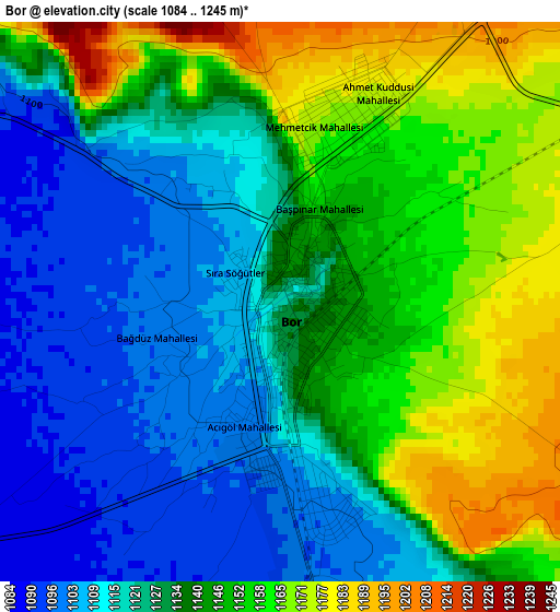
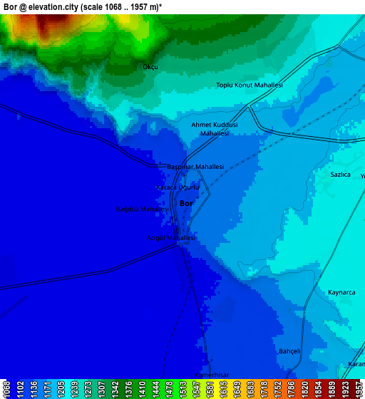
Below is the Elevation map of Bor, which displays elevation range with different colors. Scale of the first map is from 1084 to 1245 m (3556 to 4085 ft) with average elevation of 1135.8 meters (=3726 ft) [note 1]
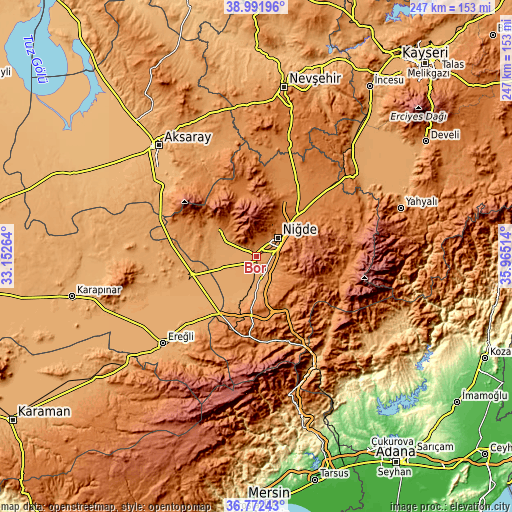
These maps also provides idea of topography and contour of this city, they are displayed at different zoom levels. More info about maps, scale and edge coordinates you can find below images.
| \ | Map #1 | Map #2 | Topo.Map |
| Scale [m] | 1084..1245 m | 1068..1957 m | × |
| Scale [ft] | 3556..4085 ft | 3504..6421 ft | × |
| Average | 1135.8 m = 3726 ft | 1177.1 m = 3862 ft | × |
| Width | 7.71 km = 4.8 mi | 15.42 km = 9.6 mi | 246.8 km = 153.4 mi |
| Height | 7.71 km = 4.8 mi | 15.42 km = 9.6 mi | 246.8 km = 153.4 mi |
| ↑Max Latitude | 37.925233° | 37.959889° | 38.99196° |
| Latitude at center | 37.89056° | 37.89056° | 37.89056° |
| ↓Min Latitude | 37.855871° | 37.821165° | 36.77243° |
| ← Min Longitude | 34.514945° | 34.470999° | 33.15264° |
| Longitude center | 34.55889° | 34.55889° | 34.55889° |
| →Max Longitude | 34.602835° | 34.646781° | 35.96514° |
Nearby cities:
Cities around Bor sort by population:
• Niğde elevation 1243 m
13.5 km,  51°
51°
• Derinkuyu 1354 m
56 km,  15°
15°
• Güzelyurt 1503 m
46 km,  339°
339°
• Altunhisar 1218 m
19.8 km,  304°
304°
• Taşpınar 1056 m
56.7 km, 304°
• Kamışlı 1141 m
50.6 km,  137°
137°
• Çiftehan 978 m
46 km,  156°
156°
• Misli 1315 m
42.4 km,  26°
26°
• Ulukışla 1435 m
38.7 km,  189°
189°
• Çamardı 1482 m
37.7 km,  99°
99°
• Çiftlik 1554 m
32.4 km,  348°
348°
• Kemerhisar 1110 m
7.5 km,  171°
171°
Multilingual:
 En español:
Bor elevación 1116 m.
 En France:
Bor élévation 1116 m.


Sources and notes:
- [note 1] Map square and city borders are not equal. Map elevation data is calculated only from area inside that square.
- [src 1] Elevation data from geonames database provided with same terms of usage.
- [src 2] The elevation map of Bor is generated using elevation data from NASA's 3 arcsec (90m) resolution SRTM data.
- [src 3] Base (background) map © OpenStreetMap contributors tiles are generated by Geofabrik and OpenTopoMap.
Copyright & License:
This Bor Elevation Map is licensed under CC BY-SA. You may reuse any part from this page, if you give a proper credit by linking to this URL:
 More info on terms of use page.