Menye elevation
Menye (Manisa), Turkey elevation is 705 meters and Menye elevation in feet is 2313 ft above sea level [src 1]. Menye is a seat of a third-order administrative division (feature code) with elevation that is 18 meters (59 ft) smaller than average city elevation in Turkey.
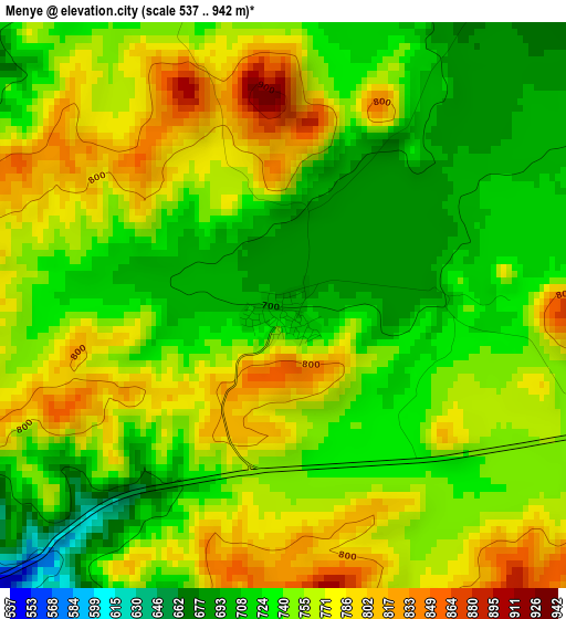
Below is the Elevation map of Menye, which displays elevation range with different colors. Scale of the first map is from 537 to 942 m (1762 to 3091 ft) with average elevation of 747.8 meters (=2453 ft) [note 1]
These maps also provides idea of topography and contour of this city, they are displayed at different zoom levels. More info about maps, scale and edge coordinates you can find below images.
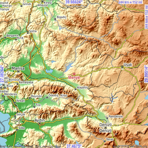
| \ | Map #1 | Topo.Map |
| Scale [m] | 537..942 m | × |
| Scale [ft] | 1762..3091 ft | × |
| Average | 747.8 m = 2453 ft | × |
| Width | 7.64 km = 4.7 mi | 244.5 km = 151.9 mi |
| Height | 7.64 km = 4.7 mi | 244.5 km = 151.9 mi |
| ↑Max Latitude | 38.609628° | 39.66624° |
| Latitude at center | 38.57528° | 38.57528° |
| ↓Min Latitude | 38.540916° | 37.4675° |
| ← Min Longitude | 28.444945° | 27.08264° |
| Longitude center | 28.48889° | 28.48889° |
| →Max Longitude | 28.532835° | 29.89514° |
Nearby cities:
Cities around Menye sort by population:
• Salihli elevation 109 m
31.4 km,  250°
250°
• Alaşehir 207 m
25.1 km,  174°
174°
• Kula 671 m
14.3 km,  102°
102°
• Sarıgöl 214 m
41.5 km,  154°
154°
• Kiraz 305 m
45.6 km,  212°
212°
• Gördes 671 m
43.4 km,  336°
336°
• Eşme 826 m
46.1 km,  115°
115°
• Selendi 443 m
37.9 km,  60°
60°
• Köprübaşı 262 m
20.7 km, 339°
• Yeşilyurt 181 m
30.3 km, 149°
• Borlu 256 m
19.8 km,  354°
354°
• Adala 117 m
19.2 km,  270°
270°
Multilingual:
 En español:
Menye elevación 705 m.
 En France:
Menye élévation 705 m.


Sources and notes:
- [note 1] Map square and city borders are not equal. Map elevation data is calculated only from area inside that square.
- [src 1] Elevation data from geonames database provided with same terms of usage.
- [src 2] The elevation map of Menye is generated using elevation data from NASA's 3 arcsec (90m) resolution SRTM data.
- [src 3] Base (background) map © OpenStreetMap contributors tiles are generated by Geofabrik and OpenTopoMap.
Copyright & License:
This Menye Elevation Map is licensed under CC BY-SA. You may reuse any part from this page, if you give a proper credit by linking to this URL:
 More info on terms of use page.