Kilis elevation
Kilis, Turkey elevation is 660 meters and Kilis elevation in feet is 2165 ft above sea level [src 1]. Kilis is a seat of a first-order administrative division (feature code) with elevation that is 63 meters (207 ft) smaller than average city elevation in Turkey.
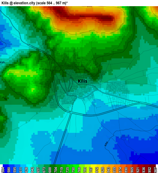
Below is the Elevation map of Kilis, which displays elevation range with different colors. Scale of the first map is from 564 to 967 m (1850 to 3173 ft) with average elevation of 677.1 meters (=2221 ft) [note 1]
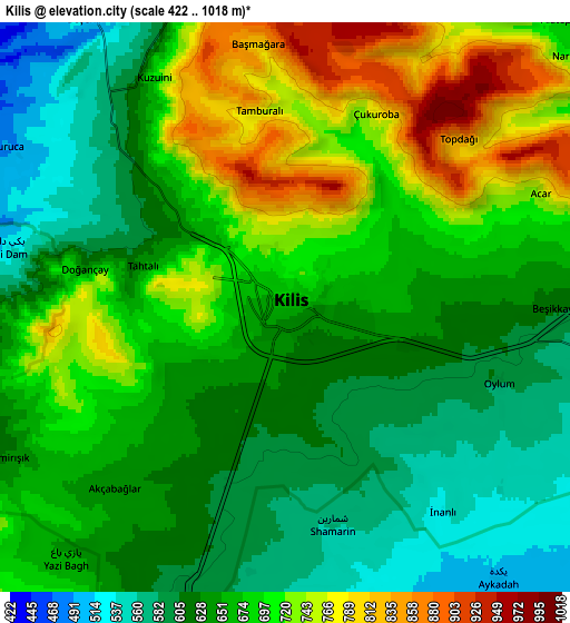
These maps also provides idea of topography and contour of this city, they are displayed at different zoom levels. More info about maps, scale and edge coordinates you can find below images.
| \ | Map #1 | Map #2 | Topo.Map |
| Scale [m] | 564..967 m | 422..1018 m | × |
| Scale [ft] | 1850..3173 ft | 1385..3340 ft | × |
| Average | 677.1 m = 2221 ft | 667.4 m = 2190 ft | × |
| Width | 7.83 km = 4.9 mi | 15.67 km = 9.7 mi | 250.7 km = 155.8 mi |
| Height | 7.83 km = 4.9 mi | 15.67 km = 9.7 mi | 250.7 km = 155.8 mi |
| ↑Max Latitude | 36.751329° | 36.786531° | 37.83507° |
| Latitude at center | 36.71611° | 36.71611° | 36.71611° |
| ↓Min Latitude | 36.680875° | 36.645624° | 35.58061° |
| ← Min Longitude | 37.071055° | 37.027109° | 35.70875° |
| Longitude center | 37.115° | 37.115° | 37.115° |
| →Max Longitude | 37.158945° | 37.202891° | 38.52125° |
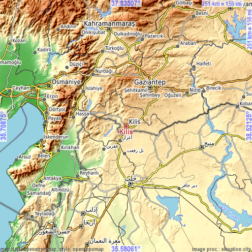
Nearby cities:
Cities around Kilis sort by population:
• Gaziantep elevation 842 m
45 km,  31°
31°
• Oğuzeli 688 m
45 km,  51°
51°
• Yeşildere 709 m
44.3 km, 49°
• Elbeyli 517 m
31.7 km,  98°
98°
• Musabeyli 756 m
25.8 km,  317°
317°
• Aşağı Karafakılı 348 m
50.1 km,  277°
277°
• Doğanpınar 578 m
46.9 km,  72°
72°
• Sakçagöz 694 m
53.6 km,  340°
340°
• Şehitkamil 860 m
46.8 km, 30°
• Şahinbey 883 m
42.2 km, 28°
• Burç 909 m
33.6 km,  9°
9°
• Polateli 844 m
14.2 km, 10°
Multilingual:
 En español:
Kilis elevación 660 m.
 En France:
Kilis élévation 660 m.


Sources and notes:
- [note 1] Map square and city borders are not equal. Map elevation data is calculated only from area inside that square.
- [src 1] Elevation data from geonames database provided with same terms of usage.
- [src 2] The elevation map of Kilis is generated using elevation data from NASA's 3 arcsec (90m) resolution SRTM data.
- [src 3] Base (background) map © OpenStreetMap contributors tiles are generated by Geofabrik and OpenTopoMap.
Copyright & License:
This Kilis Elevation Map is licensed under CC BY-SA. You may reuse any part from this page, if you give a proper credit by linking to this URL:
 More info on terms of use page.