Gaziantep elevation
Gaziantep, Turkey elevation is 842 meters and Gaziantep elevation in feet is 2762 ft above sea level [src 1]. Gaziantep is a seat of a first-order administrative division (feature code) with elevation that is 119 meters (390 ft) bigger than average city elevation in Turkey.
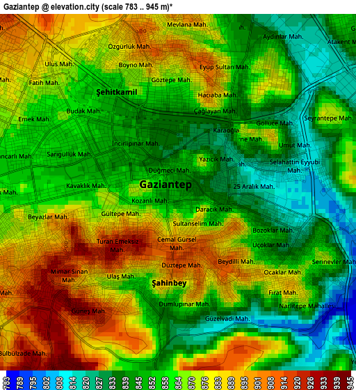
Below is the Elevation map of Gaziantep, which displays elevation range with different colors. Scale of the first map is from 783 to 945 m (2569 to 3100 ft) with average elevation of 862.7 meters (=2830 ft) [note 1]
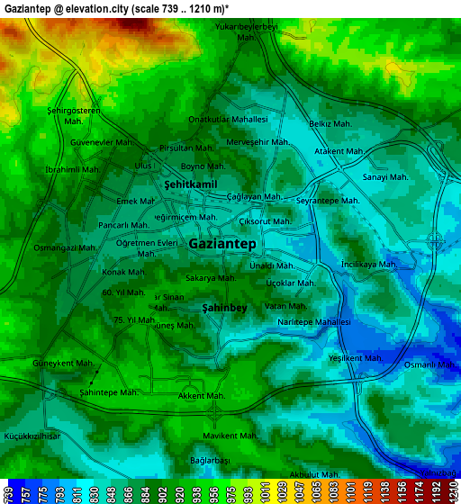
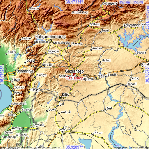
These maps also provides idea of topography and contour of this city, they are displayed at different zoom levels. More info about maps, scale and edge coordinates you can find below images.
| \ | Map #1 | Map #2 | Topo.Map |
| Scale [m] | 783..945 m | 739..1210 m | × |
| Scale [ft] | 2569..3100 ft | 2425..3970 ft | × |
| Average | 862.7 m = 2830 ft | 889.2 m = 2917 ft | × |
| Width | 7.8 km = 4.8 mi | 15.6 km = 9.7 mi | 249.5 km = 155 mi |
| Height | 7.8 km = 4.8 mi | 15.6 km = 9.7 mi | 249.5 km = 155 mi |
| ↑Max Latitude | 37.094501° | 37.129545° | 38.17331° |
| Latitude at center | 37.05944° | 37.05944° | 37.05944° |
| ↓Min Latitude | 37.024363° | 36.98927° | 35.92897° |
| ← Min Longitude | 37.338555° | 37.294609° | 35.97625° |
| Longitude center | 37.3825° | 37.3825° | 37.3825° |
| →Max Longitude | 37.426445° | 37.470391° | 38.78875° |
Nearby cities:
Cities around Gaziantep sort by population:
• Nizip elevation 524 m
37 km,  98°
98°
• Oğuzeli 688 m
15.6 km,  131°
131°
• Yavuzeli 565 m
33.1 km,  29°
29°
• Uluyatır 568 m
29.6 km,  111°
111°
• Yeşildere 709 m
13.9 km, 133°
• Sekili 602 m
27.2 km, 109°
• İkizce 531 m
41.1 km,  122°
122°
• Doğanpınar 578 m
31.8 km,  139°
139°
• Polateli 844 m
32.2 km,  221°
221°
• Burç 909 m
18.8 km,  254°
254°
• Şahinbey 883 m
3.7 km, 250°
• Şehitkamil 860 m
2.3 km,  354°
354°
Multilingual:
 En español:
Gaziantep elevación 842 m.
 En France:
Gaziantep élévation 842 m.
 Auf Deutsch:
Gaziantep höhe über dem Meeresspiegel ist 842 m.

Sources and notes:
- [note 1] Map square and city borders are not equal. Map elevation data is calculated only from area inside that square.
- [src 1] Elevation data from geonames database provided with same terms of usage.
- [src 2] The elevation map of Gaziantep is generated using elevation data from NASA's 3 arcsec (90m) resolution SRTM data.
- [src 3] Base (background) map © OpenStreetMap contributors tiles are generated by Geofabrik and OpenTopoMap.
Copyright & License:
This Gaziantep Elevation Map is licensed under CC BY-SA. You may reuse any part from this page, if you give a proper credit by linking to this URL:
 More info on terms of use page.