Göcek elevation
Göcek (Muğla), Turkey elevation is 7 meters and Göcek elevation in feet is 23 ft above sea level [src 1]. Göcek is a populated place (feature code) with elevation that is 716 meters (2349 ft) smaller than average city elevation in Turkey.
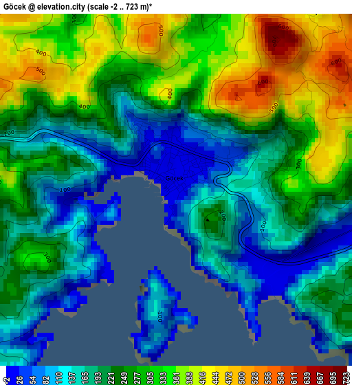
Below is the Elevation map of Göcek, which displays elevation range with different colors. Scale of the first map is from -2 to 723 m (-7 to 2372 ft) with average elevation of 239.8 meters (=787 ft) [note 1]
These maps also provides idea of topography and contour of this city, they are displayed at different zoom levels. More info about maps, scale and edge coordinates you can find below images.
| \ | Map #1 | Map #2 | Topo.Map |
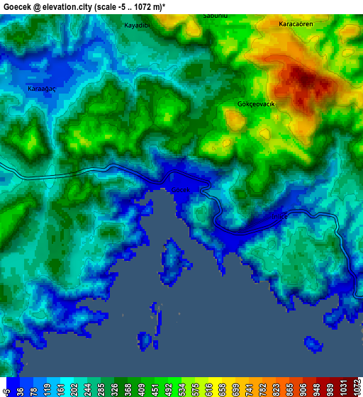
| Scale [m] | -2..723 m | -5..1072 m | × |
| Scale [ft] | -7..2372 ft | -16..3517 ft | × |
| Average | 239.8 m = 787 ft | 294.9 m = 968 ft | × |
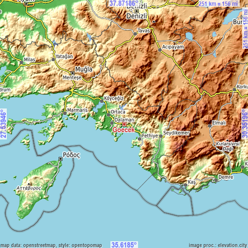
| Width | 7.83 km = 4.9 mi | 15.66 km = 9.7 mi | 250.6 km = 155.7 mi |
| Height | 7.83 km = 4.9 mi | 15.66 km = 9.7 mi | 250.5 km = 155.7 mi |
| ↑Max Latitude | 36.788652° | 36.823837° | 37.87186° |
| Latitude at center | 36.75345° | 36.75345° | 36.75345° |
| ↓Min Latitude | 36.718232° | 36.682998° | 35.6185° |
| ← Min Longitude | 28.901765° | 28.857819° | 27.53946° |
| Longitude center | 28.94571° | 28.94571° | 28.94571° |
| →Max Longitude | 28.989655° | 29.033601° | 30.35196° |
Nearby cities:
Cities around Göcek sort by population:
• Fethiye elevation 9 m
20.5 km,  127°
127°
• Ortaca 30 m
18.7 km,  300°
300°
• Dalaman 16 m
12.8 km,  276°
276°
• Sarigerme 26 m
21.9 km,  258°
258°
• Dalyan 3 m
28.3 km,  288°
288°
• Ölüdeniz 353 m
27.3 km,  139°
139°
• Yaniklar 21 m
10.6 km,  118°
118°
• Kargı 21 m
12.9 km, 116°
• Çameli 1311 m
50.5 km,  44°
44°
• Eşen 118 m
44.7 km, 137°
• Kemer 141 m
38.7 km,  107°
107°
• Yeşilüzümlü 505 m
25.7 km,  94°
94°
Multilingual:
 En español:
Göcek elevación 7 m.
 En France:
Göcek élévation 7 m.


Sources and notes:
- [note 1] Map square and city borders are not equal. Map elevation data is calculated only from area inside that square.
- [src 1] Elevation data from geonames database provided with same terms of usage.
- [src 2] The elevation map of Göcek is generated using elevation data from NASA's 3 arcsec (90m) resolution SRTM data.
- [src 3] Base (background) map © OpenStreetMap contributors tiles are generated by Geofabrik and OpenTopoMap.
Copyright & License:
This Göcek Elevation Map is licensed under CC BY-SA. You may reuse any part from this page, if you give a proper credit by linking to this URL:
 More info on terms of use page.