Ortaca elevation
Ortaca (Muğla), Turkey elevation is 30 meters and Ortaca elevation in feet is 98 ft above sea level [src 1]. Ortaca is a seat of a second-order administrative division (feature code) with elevation that is 693 meters (2274 ft) smaller than average city elevation in Turkey.
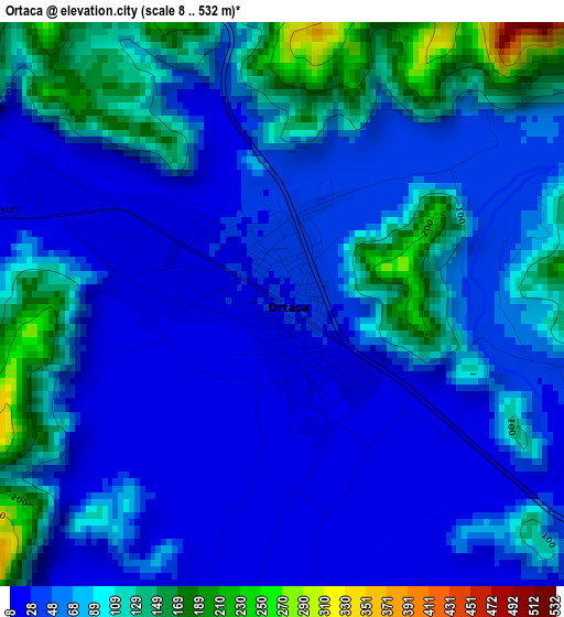
Below is the Elevation map of Ortaca, which displays elevation range with different colors. Scale of the first map is from 8 to 532 m (26 to 1745 ft) with average elevation of 70 meters (=230 ft) [note 1]
These maps also provides idea of topography and contour of this city, they are displayed at different zoom levels. More info about maps, scale and edge coordinates you can find below images.
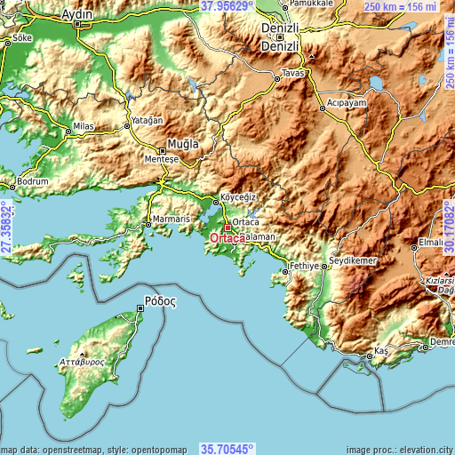
| \ | Map #1 | Map #2 | Topo.Map |
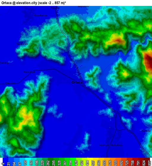
| Scale [m] | 8..532 m | -2..857 m | × |
| Scale [ft] | 26..1745 ft | -7..2812 ft | × |
| Average | 70 m = 230 ft | 124.1 m = 407 ft | × |
| Width | 7.82 km = 4.9 mi | 15.64 km = 9.7 mi | 250.3 km = 155.5 mi |
| Height | 7.82 km = 4.9 mi | 15.64 km = 9.7 mi | 250.3 km = 155.5 mi |
| ↑Max Latitude | 36.874312° | 36.909458° | 37.95629° |
| Latitude at center | 36.83915° | 36.83915° | 36.83915° |
| ↓Min Latitude | 36.803972° | 36.768777° | 35.70545° |
| ← Min Longitude | 28.720625° | 28.676679° | 27.35832° |
| Longitude center | 28.76457° | 28.76457° | 28.76457° |
| →Max Longitude | 28.808515° | 28.852461° | 30.17082° |
Nearby cities:
Cities around Ortaca sort by population:
• Fethiye elevation 9 m
39.2 km,  124°
124°
• Marmaris 8 m
43.7 km,  272°
272°
• Dalaman 16 m
8.8 km,  157°
157°
• Sarigerme 26 m
14.8 km,  201°
201°
• Ula 606 m
42.8 km,  313°
313°
• Dalyan 3 m
10.7 km, 267°
• Göcek 7 m
18.7 km, 120°
• Ölüdeniz 353 m
45.4 km,  131°
131°
• Yaniklar 21 m
29.4 km, 119°
• Kargı 21 m
31.7 km, 118°
• Beyağaç 697 m
45.6 km,  14°
14°
• Yeşilüzümlü 505 m
43.4 km,  105°
105°
Multilingual:
 En español:
Ortaca elevación 30 m.
 En France:
Ortaca élévation 30 m.


Sources and notes:
- [note 1] Map square and city borders are not equal. Map elevation data is calculated only from area inside that square.
- [src 1] Elevation data from geonames database provided with same terms of usage.
- [src 2] The elevation map of Ortaca is generated using elevation data from NASA's 3 arcsec (90m) resolution SRTM data.
- [src 3] Base (background) map © OpenStreetMap contributors tiles are generated by Geofabrik and OpenTopoMap.
Copyright & License:
This Ortaca Elevation Map is licensed under CC BY-SA. You may reuse any part from this page, if you give a proper credit by linking to this URL:
 More info on terms of use page.