Siverek elevation
Siverek (Şanlıurfa), Turkey elevation is 787 meters and Siverek elevation in feet is 2582 ft above sea level [src 1]. Siverek is a seat of a second-order administrative division (feature code) with elevation that is 64 meters (210 ft) bigger than average city elevation in Turkey.
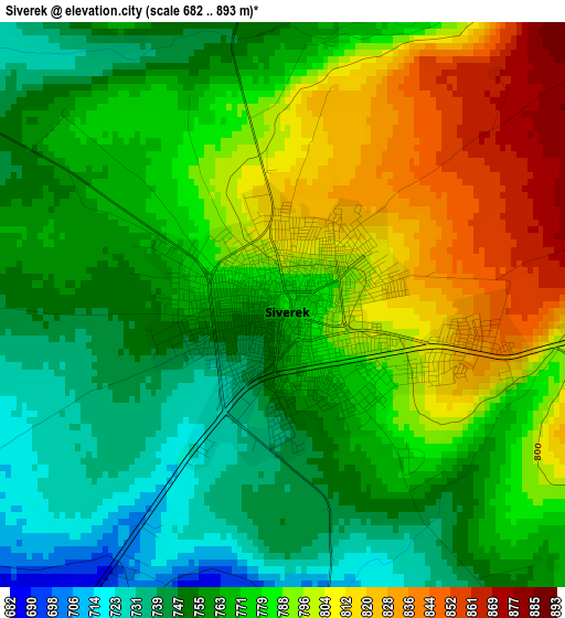
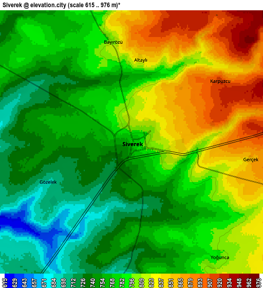
Below is the Elevation map of Siverek, which displays elevation range with different colors. Scale of the first map is from 682 to 893 m (2238 to 2930 ft) with average elevation of 775.9 meters (=2546 ft) [note 1]
These maps also provides idea of topography and contour of this city, they are displayed at different zoom levels. More info about maps, scale and edge coordinates you can find below images.
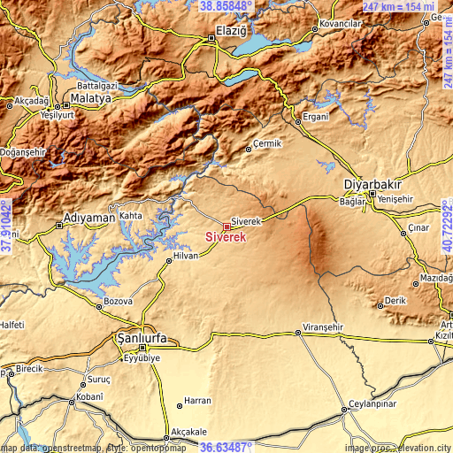
| \ | Map #1 | Map #2 | Topo.Map |
| Scale [m] | 682..893 m | 615..976 m | × |
| Scale [ft] | 2238..2930 ft | 2018..3202 ft | × |
| Average | 775.9 m = 2546 ft | 784.2 m = 2573 ft | × |
| Width | 7.73 km = 4.8 mi | 15.45 km = 9.6 mi | 247.2 km = 153.6 mi |
| Height | 7.73 km = 4.8 mi | 15.45 km = 9.6 mi | 247.2 km = 153.6 mi |
| ↑Max Latitude | 37.789767° | 37.824487° | 38.85848° |
| Latitude at center | 37.75503° | 37.75503° | 37.75503° |
| ↓Min Latitude | 37.720277° | 37.685508° | 36.63487° |
| ← Min Longitude | 39.272725° | 39.228779° | 37.91042° |
| Longitude center | 39.31667° | 39.31667° | 39.31667° |
| →Max Longitude | 39.360615° | 39.404561° | 40.72292° |
Nearby cities:
Cities around Siverek sort by population:
• Hilvan elevation 590 m
36.9 km,  239°
239°
• Gerger 1159 m
34.1 km,  309°
309°
• Yoğun 988 m
42 km,  24°
24°
• Gerger 778 m
39.2 km,  320°
320°
• Tilfetis 692 m
38.6 km,  217°
217°
• Taraksu 603 m
35.6 km, 324°
• Karakeçi 785 m
35.4 km,  161°
161°
• Karacadağ 1091 m
28.2 km,  95°
95°
• Çaylarbaşı 549 m
27.7 km,  257°
257°
• Bucak 690 m
25.7 km,  299°
299°
• Şekerli 774 m
21.4 km, 163°
• Karahan 851 m
16 km,  5°
5°
Multilingual:
 En español:
Siverek elevación 787 m.
 En France:
Siverek élévation 787 m.


Sources and notes:
- [note 1] Map square and city borders are not equal. Map elevation data is calculated only from area inside that square.
- [src 1] Elevation data from geonames database provided with same terms of usage.
- [src 2] The elevation map of Siverek is generated using elevation data from NASA's 3 arcsec (90m) resolution SRTM data.
- [src 3] Base (background) map © OpenStreetMap contributors tiles are generated by Geofabrik and OpenTopoMap.
Copyright & License:
This Siverek Elevation Map is licensed under CC BY-SA. You may reuse any part from this page, if you give a proper credit by linking to this URL:
 More info on terms of use page.