Turgutlu elevation
Turgutlu (Manisa), Turkey elevation is 98 meters and Turgutlu elevation in feet is 322 ft above sea level [src 1]. Turgutlu is a seat of a second-order administrative division (feature code) with elevation that is 625 meters (2051 ft) smaller than average city elevation in Turkey.
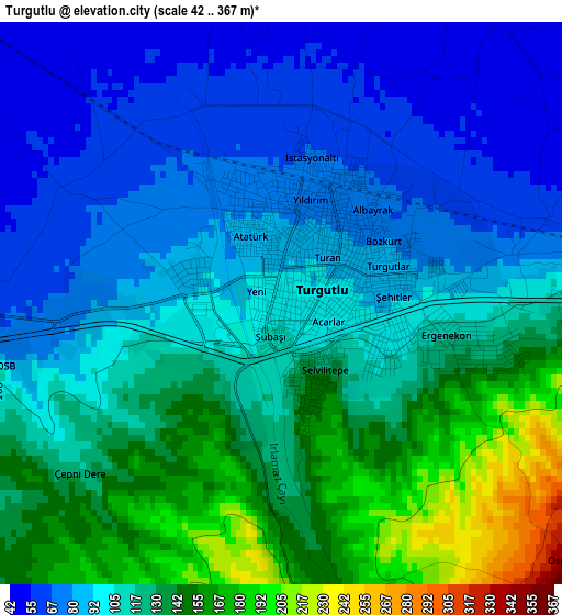
Below is the Elevation map of Turgutlu, which displays elevation range with different colors. Scale of the first map is from 42 to 367 m (138 to 1204 ft) with average elevation of 109.9 meters (=361 ft) [note 1]
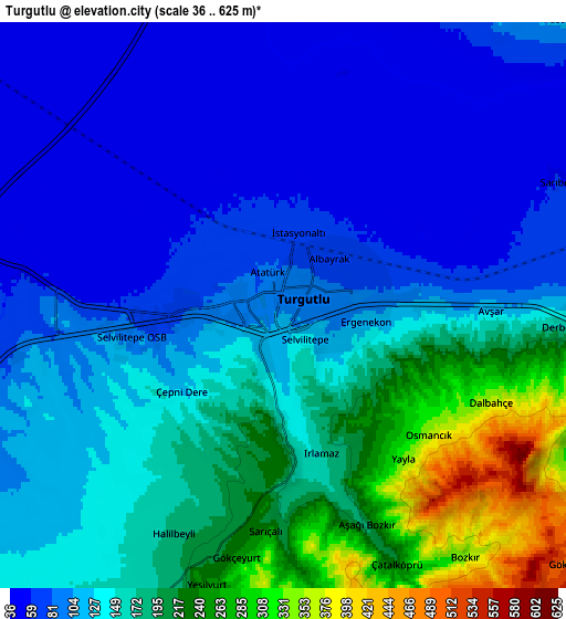
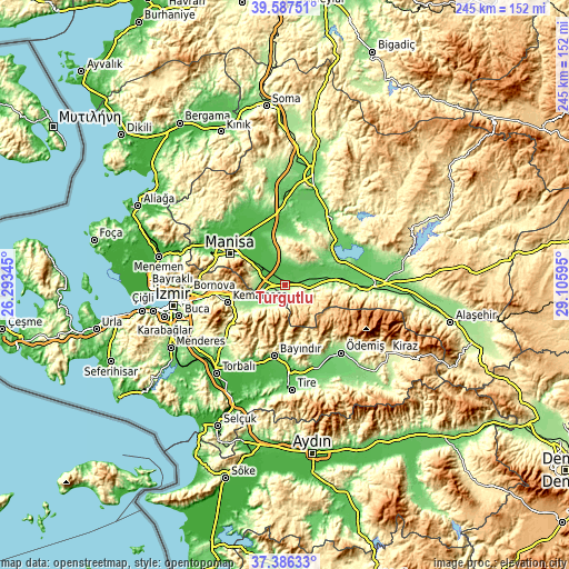
These maps also provides idea of topography and contour of this city, they are displayed at different zoom levels. More info about maps, scale and edge coordinates you can find below images.
| \ | Map #1 | Map #2 | Topo.Map |
| Scale [m] | 42..367 m | 36..625 m | × |
| Scale [ft] | 138..1204 ft | 118..2051 ft | × |
| Average | 109.9 m = 361 ft | 138.2 m = 453 ft | × |
| Width | 7.65 km = 4.8 mi | 15.3 km = 9.5 mi | 244.7 km = 152 mi |
| Height | 7.65 km = 4.8 mi | 15.3 km = 9.5 mi | 244.7 km = 152 mi |
| ↑Max Latitude | 38.529716° | 38.564086° | 39.58751° |
| Latitude at center | 38.49533° | 38.49533° | 38.49533° |
| ↓Min Latitude | 38.460928° | 38.426509° | 37.38633° |
| ← Min Longitude | 27.655755° | 27.611809° | 26.29345° |
| Longitude center | 27.6997° | 27.6997° | 27.6997° |
| →Max Longitude | 27.743645° | 27.787591° | 29.10595° |
Nearby cities:
Cities around Turgutlu sort by population:
• Manisa elevation 77 m
27.1 km,  298°
298°
• Salihli 109 m
39 km,  92°
92°
• Ödemiş 129 m
37.9 km,  141°
141°
• Kemalpaşa 211 m
25.8 km,  252°
252°
• Bayındır 72 m
31.2 km,  188°
188°
• Saruhanlı 43 m
29 km,  336°
336°
• Gölmarmara 105 m
30.6 km,  37°
37°
• Ahmetli 85 m
21 km,  82°
82°
• Muradiye 30 m
36.4 km, 300°
• Dağkızılca 264 m
33.8 km,  232°
232°
• Halitpaşa 188 m
21.2 km,  354°
354°
• Karaoğlanlı 167 m
12.2 km,  288°
288°
Multilingual:
 En español:
Turgutlu elevación 98 m.
 En France:
Turgutlu élévation 98 m.


Sources and notes:
- [note 1] Map square and city borders are not equal. Map elevation data is calculated only from area inside that square.
- [src 1] Elevation data from geonames database provided with same terms of usage.
- [src 2] The elevation map of Turgutlu is generated using elevation data from NASA's 3 arcsec (90m) resolution SRTM data.
- [src 3] Base (background) map © OpenStreetMap contributors tiles are generated by Geofabrik and OpenTopoMap.
Copyright & License:
This Turgutlu Elevation Map is licensed under CC BY-SA. You may reuse any part from this page, if you give a proper credit by linking to this URL:
 More info on terms of use page.