Nong Bua elevation
Nong Bua (Nakhon Sawan), Thailand elevation is 43 meters and Nong Bua elevation in feet is 141 ft above sea level [src 1]. Nong Bua is a seat of a second-order administrative division (feature code) with elevation that is 82 meters (269 ft) smaller than average city elevation in Thailand.
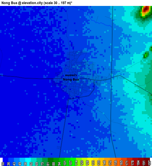
Below is the Elevation map of Nong Bua, which displays elevation range with different colors. Scale of the first map is from 30 to 197 m (98 to 646 ft) with average elevation of 43 meters (=141 ft) [note 1]
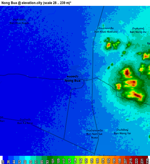
These maps also provides idea of topography and contour of this city, they are displayed at different zoom levels. More info about maps, scale and edge coordinates you can find below images.
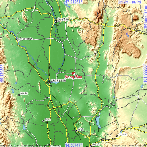
| \ | Map #1 | Map #2 | Topo.Map |
| Scale [m] | 30..197 m | 28..239 m | × |
| Scale [ft] | 98..646 ft | 92..784 ft | × |
| Average | 43 m = 141 ft | 48.9 m = 160 ft | × |
| Width | 9.4 km = 5.8 mi | 18.8 km = 11.7 mi | 300.8 km = 186.9 mi |
| Height | 9.4 km = 5.8 mi | 18.8 km = 11.7 mi | 300.8 km = 186.9 mi |
| ↑Max Latitude | 15.906847° | 15.949105° | 17.21261° |
| Latitude at center | 15.86458° | 15.86458° | 15.86458° |
| ↓Min Latitude | 15.822304° | 15.780019° | 14.50747° |
| ← Min Longitude | 100.541865° | 100.497919° | 99.17956° |
| Longitude center | 100.58581° | 100.58581° | 100.58581° |
| →Max Longitude | 100.629755° | 100.673701° | 101.99206° |
Nearby cities:
Cities around Nong Bua sort by population:
• Nakhon Sawan elevation 31 m
51.2 km,  249°
249°
• Nong Phai 111 m
52.8 km,  74°
74°
• Taphan Hin 36 m
43.4 km,  335°
335°
• Chon Daen 106 m
46.5 km,  38°
38°
• Bang Mun Nak 33 m
28.6 km,  309°
309°
• Thap Khlo 51 m
32.9 km,  2°
2°
• Phai Sali 55 m
30.2 km,  166°
166°
• Pho Thale 35 m
43 km, 306°
• Bueng Sam Phan 190 m
35.9 km,  96°
96°
• Chumsaeng 32 m
29.9 km,  275°
275°
• Tha Tako 36 m
27.3 km,  204°
204°
• Dong Charoen 60 m
19.2 km,  25°
25°
Multilingual:
 En español:
Nong Bua elevación 43 m.
 En France:
Nong Bua élévation 43 m.


Sources and notes:
- [note 1] Map square and city borders are not equal. Map elevation data is calculated only from area inside that square.
- [src 1] Elevation data from geonames database provided with same terms of usage.
- [src 2] The elevation map of Nong Bua is generated using elevation data from NASA's 3 arcsec (90m) resolution SRTM data.
- [src 3] Base (background) map © OpenStreetMap contributors tiles are generated by Geofabrik and OpenTopoMap.
Copyright & License:
This Nong Bua Elevation Map is licensed under CC BY-SA. You may reuse any part from this page, if you give a proper credit by linking to this URL:
 More info on terms of use page.