Thap Khlo elevation
Thap Khlo (Phichit), Thailand elevation is 51 meters and Thap Khlo elevation in feet is 167 ft above sea level [src 1]. Thap Khlo is a seat of a second-order administrative division (feature code) with elevation that is 74 meters (243 ft) smaller than average city elevation in Thailand.
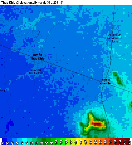
Below is the Elevation map of Thap Khlo, which displays elevation range with different colors. Scale of the first map is from 31 to 208 m (102 to 682 ft) with average elevation of 50.2 meters (=165 ft) [note 1]
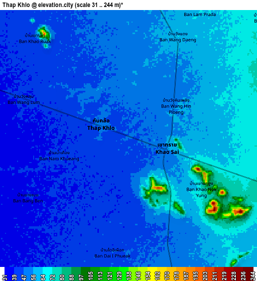
These maps also provides idea of topography and contour of this city, they are displayed at different zoom levels. More info about maps, scale and edge coordinates you can find below images.
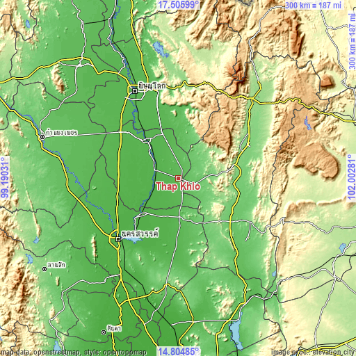
| \ | Map #1 | Map #2 | Topo.Map |
| Scale [m] | 31..208 m | 31..244 m | × |
| Scale [ft] | 102..682 ft | 102..801 ft | × |
| Average | 50.2 m = 165 ft | 52.3 m = 172 ft | × |
| Width | 9.39 km = 5.8 mi | 18.77 km = 11.7 mi | 300.3 km = 186.6 mi |
| Height | 9.39 km = 5.8 mi | 18.77 km = 11.7 mi | 300.4 km = 186.7 mi |
| ↑Max Latitude | 16.202234° | 16.24443° | 17.50599° |
| Latitude at center | 16.16003° | 16.16003° | 16.16003° |
| ↓Min Latitude | 16.117817° | 16.075594° | 14.80485° |
| ← Min Longitude | 100.552615° | 100.508669° | 99.19031° |
| Longitude center | 100.59656° | 100.59656° | 100.59656° |
| →Max Longitude | 100.640505° | 100.684451° | 102.00281° |
Nearby cities:
Cities around Thap Khlo sort by population:
• Phichit elevation 44 m
41 km,  319°
319°
• Taphan Hin 36 m
20.1 km,  289°
289°
• Chon Daen 106 m
28.3 km,  83°
83°
• Bang Mun Nak 33 m
27.5 km,  237°
237°
• Nong Bua 43 m
32.9 km,  182°
182°
• Wang Sai Phun 50 m
26.2 km,  346°
346°
• Noen Maprang 60 m
45.4 km,  4°
4°
• Chumsaeng 32 m
42.9 km,  225°
225°
• Sak Lek 40 m
40.7 km,  340°
340°
• Pho Thale 35 m
36.6 km,  258°
258°
• Wang Pong 128 m
29.1 km,  46°
46°
• Dong Charoen 60 m
17 km,  155°
155°
Multilingual:
 En español:
Thap Khlo elevación 51 m.
 En France:
Thap Khlo élévation 51 m.
 Auf Deutsch:
Thap Khlo höhe über dem Meeresspiegel ist 51 m.

Sources and notes:
- [note 1] Map square and city borders are not equal. Map elevation data is calculated only from area inside that square.
- [src 1] Elevation data from geonames database provided with same terms of usage.
- [src 2] The elevation map of Thap Khlo is generated using elevation data from NASA's 3 arcsec (90m) resolution SRTM data.
- [src 3] Base (background) map © OpenStreetMap contributors tiles are generated by Geofabrik and OpenTopoMap.
Copyright & License:
This Thap Khlo Elevation Map is licensed under CC BY-SA. You may reuse any part from this page, if you give a proper credit by linking to this URL:
 More info on terms of use page.