Aş Şanamayn elevation
Aş Şanamayn (Daraa), Syria elevation is 642 meters and Aş Şanamayn elevation in feet is 2106 ft above sea level [src 1]. Aş Şanamayn is a seat of a second-order administrative division (feature code) with elevation that is 113 meters (371 ft) bigger than average city elevation in Syria.
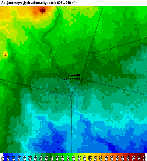
Below is the Elevation map of Aş Şanamayn, which displays elevation range with different colors. Scale of the first map is from 606 to 710 m (1988 to 2329 ft) with average elevation of 638.8 meters (=2096 ft) [note 1]
These maps also provides idea of topography and contour of this city, they are displayed at different zoom levels. More info about maps, scale and edge coordinates you can find below images.
| \ | Map #1 | Map #2 | Topo.Map |
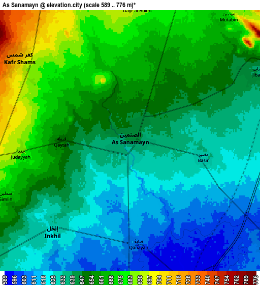
| Scale [m] | 606..710 m | 589..776 m | × |
| Scale [ft] | 1988..2329 ft | 1932..2546 ft | × |
| Average | 638.8 m = 2096 ft | 646 m = 2119 ft | × |
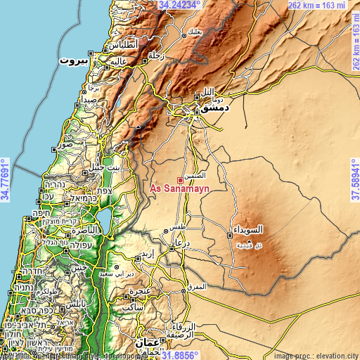
| Width | 8.19 km = 5.1 mi | 16.38 km = 10.2 mi | 262 km = 162.8 mi |
| Height | 8.19 km = 5.1 mi | 16.38 km = 10.2 mi | 262 km = 162.8 mi |
| ↑Max Latitude | 33.108678° | 33.14548° | 34.24234° |
| Latitude at center | 33.07186° | 33.07186° | 33.07186° |
| ↓Min Latitude | 33.035027° | 32.998178° | 31.8856° |
| ← Min Longitude | 36.139215° | 36.095269° | 34.77691° |
| Longitude center | 36.18316° | 36.18316° | 36.18316° |
| →Max Longitude | 36.227105° | 36.271051° | 37.58941° |
Nearby cities:
Cities around Aş Şanamayn sort by population:
• Al Qunayţirah elevation 942 m
33.9 km,  280°
280°
• Jāsim 657 m
14.5 km,  232°
232°
• Inkhil 623 m
7.9 km,  220°
220°
• Ash Shaykh Miskīn 534 m
27 km,  184°
184°
• Al Kiswah 724 m
32.3 km,  9°
9°
• Izra‘ 581 m
23.3 km,  163°
163°
• Tasīl 505 m
33.1 km, 216°
• Khān Arnabah 944 m
29.9 km,  294°
294°
• Sa‘sa‘ 888 m
27.9 km,  326°
326°
• Nawá 571 m
24.2 km,  213°
213°
• Mismīyah 618 m
20.6 km,  72°
72°
• Ghabāghib 698 m
12.9 km,  17°
17°
Multilingual:
 En español:
Aş Şanamayn elevación 642 m.
 En France:
Aş Şanamayn élévation 642 m.
 Auf Deutsch:
Aş Şanamayn höhe über dem Meeresspiegel ist 642 m.

Sources and notes:
- [note 1] Map square and city borders are not equal. Map elevation data is calculated only from area inside that square.
- [src 1] Elevation data from geonames database provided with same terms of usage.
- [src 2] The elevation map of Aş Şanamayn is generated using elevation data from NASA's 3 arcsec (90m) resolution SRTM data.
- [src 3] Base (background) map © OpenStreetMap contributors tiles are generated by Geofabrik and OpenTopoMap.
Copyright & License:
This Aş Şanamayn Elevation Map is licensed under CC BY-SA. You may reuse any part from this page, if you give a proper credit by linking to this URL:
 More info on terms of use page.