Baranchinskiy elevation
Baranchinskiy (Sverdlovsk), Russia elevation is 221 meters and Baranchinskiy elevation in feet is 725 ft above sea level [src 1]. Baranchinskiy is a populated place (feature code) with elevation that is 22 meters (72 ft) bigger than average city elevation in Russia.
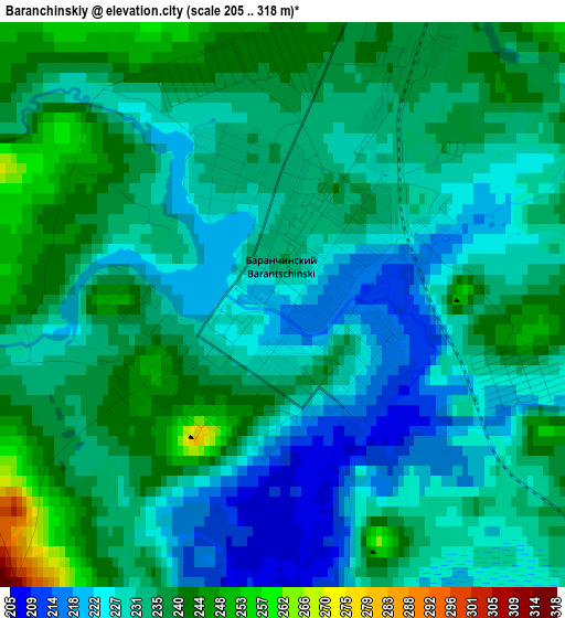
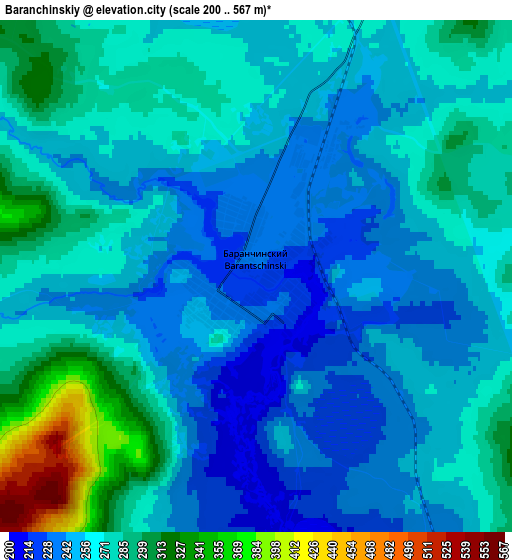
Below is the Elevation map of Baranchinskiy, which displays elevation range with different colors. Scale of the first map is from 205 to 318 m (673 to 1043 ft) with average elevation of 232.8 meters (=764 ft) [note 1]
These maps also provides idea of topography and contour of this city, they are displayed at different zoom levels. More info about maps, scale and edge coordinates you can find below images.
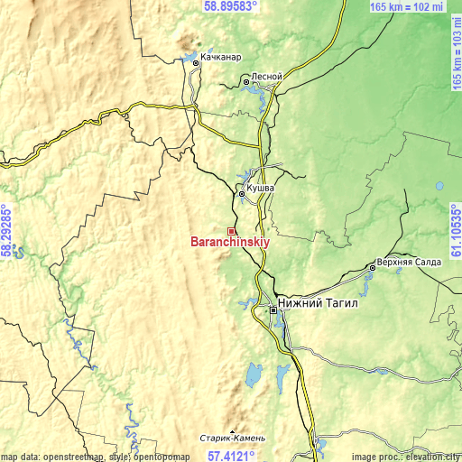
| \ | Map #1 | Map #2 | Topo.Map |
| Scale [m] | 205..318 m | 200..567 m | × |
| Scale [ft] | 673..1043 ft | 656..1860 ft | × |
| Average | 232.8 m = 764 ft | 264.8 m = 869 ft | × |
| Width | 5.16 km = 3.2 mi | 10.31 km = 6.4 mi | 165 km = 102.5 mi |
| Height | 5.16 km = 3.2 mi | 10.31 km = 6.4 mi | 165 km = 102.5 mi |
| ↑Max Latitude | 58.184875° | 58.208034° | 58.89583° |
| Latitude at center | 58.1617° | 58.1617° | 58.1617° |
| ↓Min Latitude | 58.13851° | 58.115305° | 57.4121° |
| ← Min Longitude | 59.655155° | 59.611209° | 58.29285° |
| Longitude center | 59.6991° | 59.6991° | 59.6991° |
| →Max Longitude | 59.743045° | 59.786991° | 61.10535° |
Nearby cities:
Cities around Baranchinskiy sort by population:
• Nizhny Tagil elevation 185 m
31.2 km,  149°
149°
• Verkhnyaya Salda 201 m
52.1 km,  103°
103°
• Kushva 301 m
14.8 km,  13°
13°
• Krasnoural’sk 221 m
30.1 km,  41°
41°
• Lesnoy 221 m
53.2 km, 6°
• Nizhnyaya Tura 202 m
52.4 km, 7°
• Verkhnyaya Tura 212 m
23 km,  15°
15°
• Svobodnyy 223 m
43.1 km,  108°
108°
• Nikolo-Pavlovskoye 209 m
47.1 km, 153°
• Tëplaya Gora 382 m
54.4 km,  317°
317°
• Chernoistochinsk 221 m
48.4 km,  167°
167°
• Uralets 395 m
55.7 km,  183°
183°
Multilingual:
 En español:
Baranchinskiy elevación 221 m.
 En France:
Baranchinskiy élévation 221 m.
 Auf Deutsch:
Baranchinskiy höhe über dem Meeresspiegel ist 221 m.

Sources and notes:
- [note 1] Map square and city borders are not equal. Map elevation data is calculated only from area inside that square.
- [src 1] Elevation data from geonames database provided with same terms of usage.
- [src 2] The elevation map of Baranchinskiy is generated using elevation data from NASA's 3 arcsec (90m) resolution SRTM data.
- [src 3] Base (background) map © OpenStreetMap contributors tiles are generated by Geofabrik and OpenTopoMap.
Copyright & License:
This Baranchinskiy Elevation Map is licensed under CC BY-SA. You may reuse any part from this page, if you give a proper credit by linking to this URL:
 More info on terms of use page.