Golubinci elevation
Golubinci (Vojvodina, Srem), Serbia elevation is 88 meters and Golubinci elevation in feet is 289 ft above sea level [src 1]. Golubinci is a populated place (feature code) with elevation that is 79 meters (259 ft) smaller than average city elevation in Serbia.
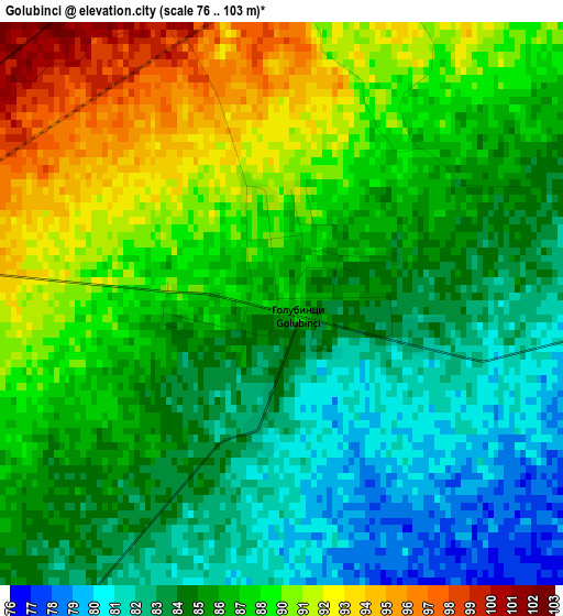
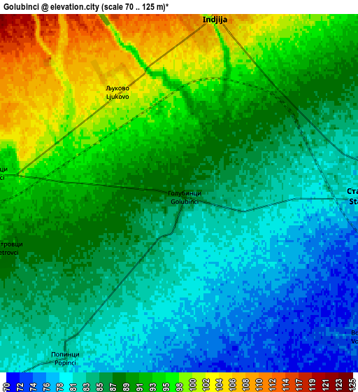
Below is the Elevation map of Golubinci, which displays elevation range with different colors. Scale of the first map is from 76 to 103 m (249 to 338 ft) with average elevation of 86.9 meters (=285 ft) [note 1]
These maps also provides idea of topography and contour of this city, they are displayed at different zoom levels. More info about maps, scale and edge coordinates you can find below images.
| \ | Map #1 | Map #2 | Topo.Map |
| Scale [m] | 76..103 m | 70..125 m | × |
| Scale [ft] | 249..338 ft | 230..410 ft | × |
| Average | 86.9 m = 285 ft | 88.4 m = 290 ft | × |
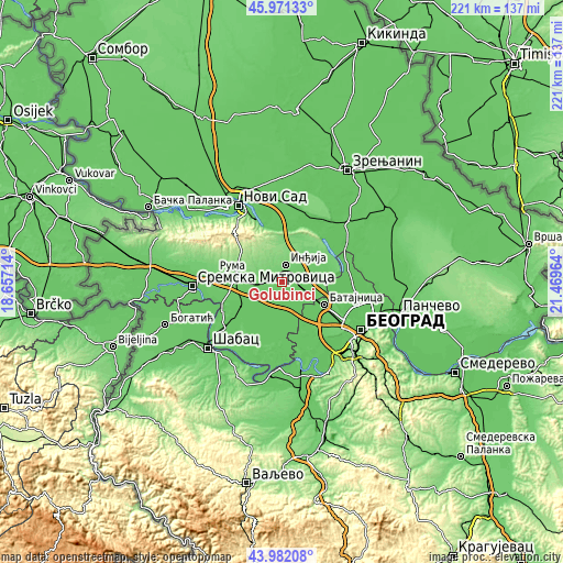
| Width | 6.91 km = 4.3 mi | 13.82 km = 8.6 mi | 221.2 km = 137.4 mi |
| Height | 6.91 km = 4.3 mi | 13.82 km = 8.6 mi | 221.2 km = 137.4 mi |
| ↑Max Latitude | 45.016404° | 45.04746° | 45.97133° |
| Latitude at center | 44.98533° | 44.98533° | 44.98533° |
| ↓Min Latitude | 44.95424° | 44.923132° | 43.98208° |
| ← Min Longitude | 20.019445° | 19.975499° | 18.65714° |
| Longitude center | 20.06339° | 20.06339° | 20.06339° |
| →Max Longitude | 20.107335° | 20.151281° | 21.46964° |
Nearby cities:
Cities around Golubinci sort by population:
• Inđija elevation 114 m
7.1 km,  11°
11°
• Stara Pazova 81 m
7.7 km,  90°
90°
• Nova Pazova 76 m
13.1 km,  110°
110°
• Beška 120 m
16.2 km,  0°
0°
• Vojka 76 m
8.8 km,  127°
127°
• Stari Banovci 77 m
17.3 km, 90°
• Ugrinovci 75 m
15.6 km,  141°
141°
• Putinci 110 m
7.3 km,  276°
276°
• Novi Karlovci 100 m
13.6 km,  42°
42°
• Šimanovci 76 m
12.6 km,  169°
169°
• Pećinci 83 m
11.4 km,  221°
221°
• Ljukovo 105 m
5.3 km,  327°
327°
Multilingual:
 En español:
Golubinci elevación 88 m.
 En France:
Golubinci élévation 88 m.
 Auf Deutsch:
Golubinci höhe über dem Meeresspiegel ist 88 m.

Sources and notes:
- [note 1] Map square and city borders are not equal. Map elevation data is calculated only from area inside that square.
- [src 1] Elevation data from geonames database provided with same terms of usage.
- [src 2] The elevation map of Golubinci is generated using elevation data from NASA's 3 arcsec (90m) resolution SRTM data.
- [src 3] Base (background) map © OpenStreetMap contributors tiles are generated by Geofabrik and OpenTopoMap.
Copyright & License:
This Golubinci Elevation Map is licensed under CC BY-SA. You may reuse any part from this page, if you give a proper credit by linking to this URL:
 More info on terms of use page.