Inđija elevation
Inđija (Vojvodina, Srem), Serbia elevation is 114 meters and Inđija elevation in feet is 374 ft above sea level [src 1]. Inđija is a populated place (feature code) with elevation that is 53 meters (174 ft) smaller than average city elevation in Serbia.
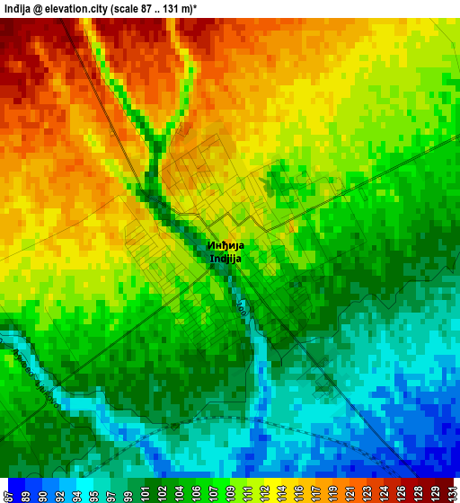
Below is the Elevation map of Inđija, which displays elevation range with different colors. Scale of the first map is from 87 to 131 m (285 to 430 ft) with average elevation of 107.5 meters (=353 ft) [note 1]
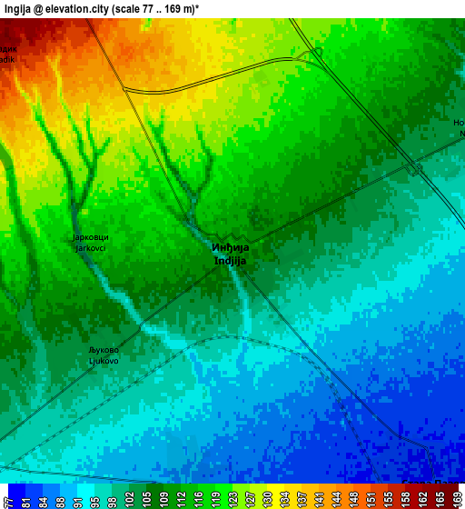
These maps also provides idea of topography and contour of this city, they are displayed at different zoom levels. More info about maps, scale and edge coordinates you can find below images.
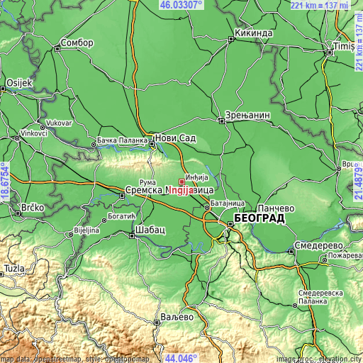
| \ | Map #1 | Map #2 | Topo.Map |
| Scale [m] | 87..131 m | 77..169 m | × |
| Scale [ft] | 285..430 ft | 253..554 ft | × |
| Average | 107.5 m = 353 ft | 107.5 m = 353 ft | × |
| Width | 6.9 km = 4.3 mi | 13.81 km = 8.6 mi | 220.9 km = 137.3 mi |
| Height | 6.9 km = 4.3 mi | 13.81 km = 8.6 mi | 220.9 km = 137.3 mi |
| ↑Max Latitude | 45.079199° | 45.110222° | 46.03307° |
| Latitude at center | 45.04816° | 45.04816° | 45.04816° |
| ↓Min Latitude | 45.017104° | 44.98603° | 44.046° |
| ← Min Longitude | 20.037705° | 19.993759° | 18.6754° |
| Longitude center | 20.08165° | 20.08165° | 20.08165° |
| →Max Longitude | 20.125595° | 20.169541° | 21.4879° |
Nearby cities:
Cities around Inđija sort by population:
• Stara Pazova elevation 81 m
9.4 km,  138°
138°
• Nova Pazova 76 m
15.9 km, 137°
• Beška 120 m
9.3 km,  352°
352°
• Golubinci 88 m
7.1 km,  191°
191°
• Vojka 76 m
13.5 km,  155°
155°
• Stari Banovci 77 m
17.4 km,  114°
114°
• Novi Slankamen 127 m
15.1 km,  55°
55°
• Putinci 110 m
10.7 km,  234°
234°
• Novi Karlovci 100 m
8.3 km,  67°
67°
• Krčedin 108 m
10.8 km,  21°
21°
• Čortanovci 156 m
12.8 km,  337°
337°
• Ljukovo 105 m
4.9 km,  240°
240°
Multilingual:
 En español:
Inđija elevación 114 m.
 En France:
Inđija élévation 114 m.


Sources and notes:
- [note 1] Map square and city borders are not equal. Map elevation data is calculated only from area inside that square.
- [src 1] Elevation data from geonames database provided with same terms of usage.
- [src 2] The elevation map of Inđija is generated using elevation data from NASA's 3 arcsec (90m) resolution SRTM data.
- [src 3] Base (background) map © OpenStreetMap contributors tiles are generated by Geofabrik and OpenTopoMap.
Copyright & License:
This Inđija Elevation Map is licensed under CC BY-SA. You may reuse any part from this page, if you give a proper credit by linking to this URL:
 More info on terms of use page.