Buhoci elevation
Buhoci (Bacău, Comuna Buhoci), Romania elevation is 160 meters and Buhoci elevation in feet is 525 ft above sea level [src 1]. Buhoci is a seat of a second-order administrative division (feature code) with elevation that is 92 meters (302 ft) smaller than average city elevation in Romania.
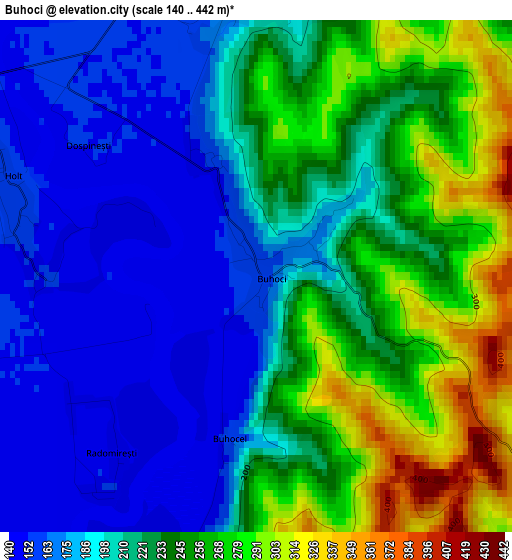
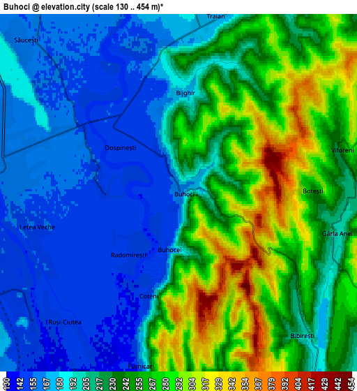
Below is the Elevation map of Buhoci, which displays elevation range with different colors. Scale of the first map is from 140 to 442 m (459 to 1450 ft) with average elevation of 219.6 meters (=720 ft) [note 1]
These maps also provides idea of topography and contour of this city, they are displayed at different zoom levels. More info about maps, scale and edge coordinates you can find below images.
| \ | Map #1 | Map #2 | Topo.Map |
| Scale [m] | 140..442 m | 130..454 m | × |
| Scale [ft] | 459..1450 ft | 427..1490 ft | × |
| Average | 219.6 m = 720 ft | 221 m = 725 ft | × |
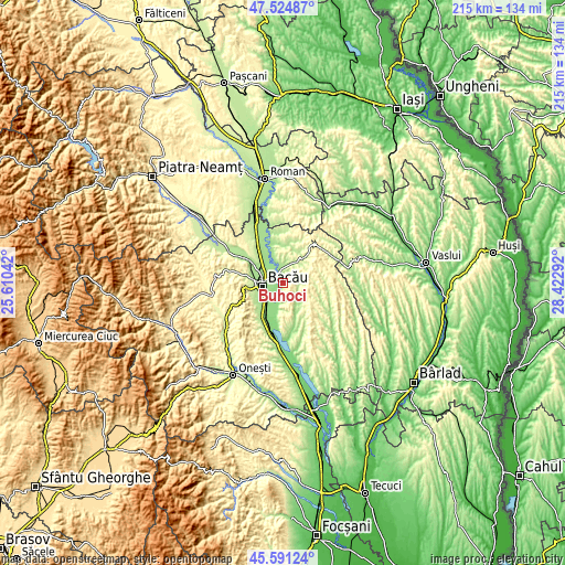
| Width | 6.72 km = 4.2 mi | 13.44 km = 8.4 mi | 215 km = 133.6 mi |
| Height | 6.72 km = 4.2 mi | 13.44 km = 8.4 mi | 215 km = 133.6 mi |
| ↑Max Latitude | 46.596874° | 46.627062° | 47.52487° |
| Latitude at center | 46.56667° | 46.56667° | 46.56667° |
| ↓Min Latitude | 46.536449° | 46.506211° | 45.59124° |
| ← Min Longitude | 26.972725° | 26.928779° | 25.61042° |
| Longitude center | 27.01667° | 27.01667° | 27.01667° |
| →Max Longitude | 27.060615° | 27.104561° | 28.42292° |
Nearby cities:
Cities around Buhoci sort by population:
• Bacău elevation 165 m
7.9 km,  270°
270°
• Mărgineni-Munteni 164 m
9.7 km,  292°
292°
• Tamaşi 141 m
9.6 km,  195°
195°
• Letea Veche 153 m
5.4 km,  250°
250°
• Traian 205 m
7.5 km,  9°
9°
• Secuieni 297 m
11.2 km,  34°
34°
• Ungureni 141 m
7.5 km,  222°
222°
• Prăjești 181 m
10.3 km,  342°
342°
• Bijghir 180 m
3.9 km,  2°
2°
• Săucești 159 m
8.1 km,  315°
315°
• Holt 155 m
3.4 km, 292°
• Ungureni 225 m
8.8 km,  123°
123°
Multilingual:
 En español:
Buhoci elevación 160 m.
 En France:
Buhoci élévation 160 m.


Sources and notes:
- [note 1] Map square and city borders are not equal. Map elevation data is calculated only from area inside that square.
- [src 1] Elevation data from geonames database provided with same terms of usage.
- [src 2] The elevation map of Buhoci is generated using elevation data from NASA's 3 arcsec (90m) resolution SRTM data.
- [src 3] Base (background) map © OpenStreetMap contributors tiles are generated by Geofabrik and OpenTopoMap.
Copyright & License:
This Buhoci Elevation Map is licensed under CC BY-SA. You may reuse any part from this page, if you give a proper credit by linking to this URL:
 More info on terms of use page.