Mărgineni-Munteni elevation
Mărgineni-Munteni (Bacău, Comuna Mărgineni), Romania elevation is 164 meters and Mărgineni-Munteni elevation in feet is 538 ft above sea level [src 1]. Mărgineni-Munteni is a populated place (feature code) with elevation that is 88 meters (289 ft) smaller than average city elevation in Romania.
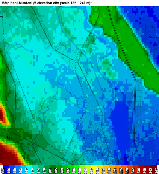
Below is the Elevation map of Mărgineni-Munteni, which displays elevation range with different colors. Scale of the first map is from 152 to 247 m (499 to 810 ft) with average elevation of 171.3 meters (=562 ft) [note 1]
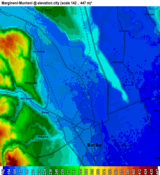
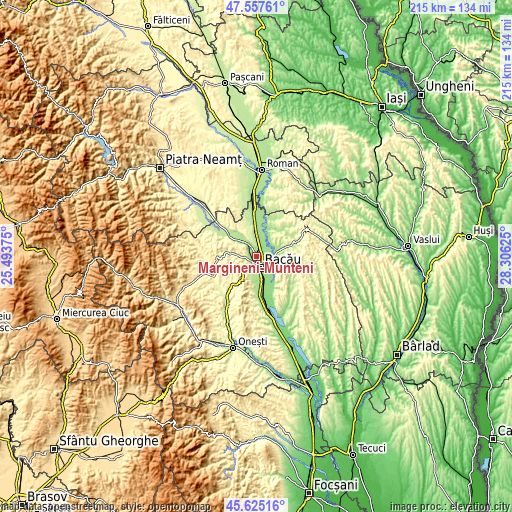
These maps also provides idea of topography and contour of this city, they are displayed at different zoom levels. More info about maps, scale and edge coordinates you can find below images.
| \ | Map #1 | Map #2 | Topo.Map |
| Scale [m] | 152..247 m | 142..447 m | × |
| Scale [ft] | 499..810 ft | 466..1467 ft | × |
| Average | 171.3 m = 562 ft | 193.7 m = 635 ft | × |
| Width | 6.71 km = 4.2 mi | 13.43 km = 8.3 mi | 214.9 km = 133.5 mi |
| Height | 6.71 km = 4.2 mi | 13.43 km = 8.3 mi | 214.9 km = 133.5 mi |
| ↑Max Latitude | 46.630186° | 46.660355° | 47.55761° |
| Latitude at center | 46.6° | 46.6° | 46.6° |
| ↓Min Latitude | 46.569797° | 46.539578° | 45.62516° |
| ← Min Longitude | 26.856055° | 26.812109° | 25.49375° |
| Longitude center | 26.9° | 26.9° | 26.9° |
| →Max Longitude | 26.943945° | 26.987891° | 28.30625° |
Nearby cities:
Cities around Mărgineni-Munteni sort by population:
• Bacău elevation 165 m
3.8 km,  163°
163°
• Letea Veche 153 m
6.7 km,  145°
145°
• Măgura 248 m
5.3 km,  225°
225°
• Mărgineni 198 m
4 km,  249°
249°
• Prăjești 181 m
8.4 km,  43°
43°
• Osebiți 314 m
8.3 km,  214°
214°
• Lilieci 176 m
3.8 km,  325°
325°
• Barați 181 m
3.5 km,  219°
219°
• Săucești 159 m
3.8 km,  56°
56°
• Hemeiuș 175 m
4.6 km,  310°
310°
• Holt 155 m
6.2 km,  112°
112°
• Iteşti 241 m
6.3 km,  340°
340°
Multilingual:
 En español:
Mărgineni-Munteni elevación 164 m.
 En France:
Mărgineni-Munteni élévation 164 m.
 Auf Deutsch:
Mărgineni-Munteni höhe über dem Meeresspiegel ist 164 m.

Sources and notes:
- [note 1] Map square and city borders are not equal. Map elevation data is calculated only from area inside that square.
- [src 1] Elevation data from geonames database provided with same terms of usage.
- [src 2] The elevation map of Mărgineni-Munteni is generated using elevation data from NASA's 3 arcsec (90m) resolution SRTM data.
- [src 3] Base (background) map © OpenStreetMap contributors tiles are generated by Geofabrik and OpenTopoMap.
Copyright & License:
This Mărgineni-Munteni Elevation Map is licensed under CC BY-SA. You may reuse any part from this page, if you give a proper credit by linking to this URL:
 More info on terms of use page.