Măgura elevation
Măgura (Bacău, Comuna Măgura), Romania elevation is 248 meters and Măgura elevation in feet is 814 ft above sea level [src 1]. Măgura is a populated place (feature code) with elevation that is 4 meters (13 ft) smaller than average city elevation in Romania.
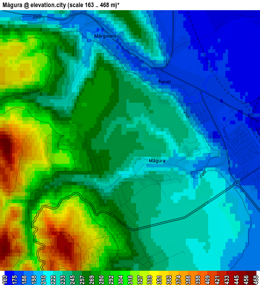
Below is the Elevation map of Măgura, which displays elevation range with different colors. Scale of the first map is from 163 to 468 m (535 to 1535 ft) with average elevation of 250.1 meters (=821 ft) [note 1]
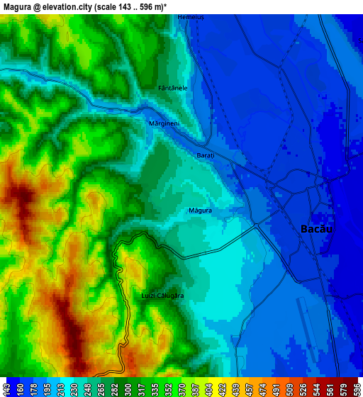
These maps also provides idea of topography and contour of this city, they are displayed at different zoom levels. More info about maps, scale and edge coordinates you can find below images.
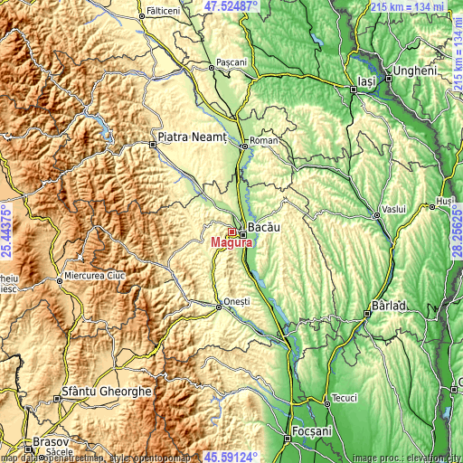
| \ | Map #1 | Map #2 | Topo.Map |
| Scale [m] | 163..468 m | 143..596 m | × |
| Scale [ft] | 535..1535 ft | 469..1955 ft | × |
| Average | 250.1 m = 821 ft | 268 m = 879 ft | × |
| Width | 6.72 km = 4.2 mi | 13.44 km = 8.4 mi | 215 km = 133.6 mi |
| Height | 6.72 km = 4.2 mi | 13.44 km = 8.4 mi | 215 km = 133.6 mi |
| ↑Max Latitude | 46.596874° | 46.627062° | 47.52487° |
| Latitude at center | 46.56667° | 46.56667° | 46.56667° |
| ↓Min Latitude | 46.536449° | 46.506211° | 45.59124° |
| ← Min Longitude | 26.806055° | 26.762109° | 25.44375° |
| Longitude center | 26.85° | 26.85° | 26.85° |
| →Max Longitude | 26.893945° | 26.937891° | 28.25625° |
Nearby cities:
Cities around Măgura sort by population:
• Bacău elevation 165 m
4.9 km,  89°
89°
• Mărgineni-Munteni 164 m
5.3 km,  45°
45°
• Letea Veche 153 m
7.9 km,  103°
103°
• Luizi-Călugăra 322 m
3.9 km,  198°
198°
• Ungureni 141 m
9.5 km,  126°
126°
• Mărgineni 198 m
2.3 km,  1°
1°
• Osebiți 314 m
3.2 km,  194°
194°
• Sărata 242 m
7.3 km,  168°
168°
• Lilieci 176 m
7.1 km,  13°
13°
• Barați 181 m
1.9 km,  58°
58°
• Săucești 159 m
9.1 km, 50°
• Hemeiuș 175 m
6.7 km, 2°
Multilingual:
 En español:
Măgura elevación 248 m.
 En France:
Măgura élévation 248 m.


Sources and notes:
- [note 1] Map square and city borders are not equal. Map elevation data is calculated only from area inside that square.
- [src 1] Elevation data from geonames database provided with same terms of usage.
- [src 2] The elevation map of Măgura is generated using elevation data from NASA's 3 arcsec (90m) resolution SRTM data.
- [src 3] Base (background) map © OpenStreetMap contributors tiles are generated by Geofabrik and OpenTopoMap.
Copyright & License:
This Măgura Elevation Map is licensed under CC BY-SA. You may reuse any part from this page, if you give a proper credit by linking to this URL:
 More info on terms of use page.