Corni-Albești elevation
Corni-Albești (Vaslui, Comuna Albeşti), Romania elevation is 224 meters and Corni-Albești elevation in feet is 735 ft above sea level [src 1]. Corni-Albești is a populated place (feature code) with elevation that is 28 meters (92 ft) smaller than average city elevation in Romania.
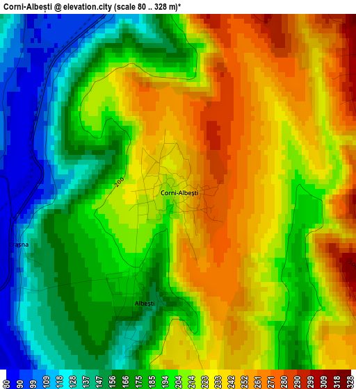
Below is the Elevation map of Corni-Albești, which displays elevation range with different colors. Scale of the first map is from 80 to 328 m (262 to 1076 ft) with average elevation of 202 meters (=663 ft) [note 1]
These maps also provides idea of topography and contour of this city, they are displayed at different zoom levels. More info about maps, scale and edge coordinates you can find below images.
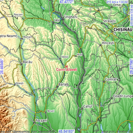
| \ | Map #1 | Topo.Map |
| Scale [m] | 80..328 m | × |
| Scale [ft] | 262..1076 ft | × |
| Average | 202 m = 663 ft | × |
| Width | 6.72 km = 4.2 mi | 215.2 km = 133.7 mi |
| Height | 6.72 km = 4.2 mi | 215.2 km = 133.7 mi |
| ↑Max Latitude | 46.548361° | 47.4772° |
| Latitude at center | 46.51813° | 46.51813° |
| ↓Min Latitude | 46.487882° | 45.54183° |
| ← Min Longitude | 27.827765° | 26.46546° |
| Longitude center | 27.87171° | 27.87171° |
| →Max Longitude | 27.915655° | 29.27796° |
Nearby cities:
Cities around Corni-Albești sort by population:
• Lipovăţ elevation 194 m
14.2 km,  292°
292°
• Muntenii de Jos 161 m
13.6 km,  323°
323°
• Roşieşti 185 m
9.5 km,  174°
174°
• Albeşti 163 m
2.1 km,  190°
190°
• Hoceni 142 m
10.6 km,  77°
77°
• Costeşti 184 m
9.5 km,  257°
257°
• Olteneşti 142 m
7.6 km,  16°
16°
• Deleni 241 m
10 km, 290°
• Vutcani 148 m
9.3 km,  128°
128°
• Bogdănești 187 m
13.5 km,  235°
235°
• Hurdugi 114 m
14.1 km,  94°
94°
• Crețești 163 m
14.1 km,  25°
25°
Multilingual:
 En español:
Corni-Albești elevación 224 m.
 En France:
Corni-Albești élévation 224 m.
 Auf Deutsch:
Corni-Albești höhe über dem Meeresspiegel ist 224 m.

Sources and notes:
- [note 1] Map square and city borders are not equal. Map elevation data is calculated only from area inside that square.
- [src 1] Elevation data from geonames database provided with same terms of usage.
- [src 2] The elevation map of Corni-Albești is generated using elevation data from NASA's 3 arcsec (90m) resolution SRTM data.
- [src 3] Base (background) map © OpenStreetMap contributors tiles are generated by Geofabrik and OpenTopoMap.
Copyright & License:
This Corni-Albești Elevation Map is licensed under CC BY-SA. You may reuse any part from this page, if you give a proper credit by linking to this URL:
 More info on terms of use page.