Hurdugi elevation
Hurdugi (Vaslui, Comuna Dimitrie Cantemir), Romania elevation is 114 meters and Hurdugi elevation in feet is 374 ft above sea level [src 1]. Hurdugi is a seat of a second-order administrative division (feature code) with elevation that is 138 meters (453 ft) smaller than average city elevation in Romania.
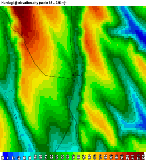
Below is the Elevation map of Hurdugi, which displays elevation range with different colors. Scale of the first map is from 65 to 225 m (213 to 738 ft) with average elevation of 137.4 meters (=451 ft) [note 1]
These maps also provides idea of topography and contour of this city, they are displayed at different zoom levels. More info about maps, scale and edge coordinates you can find below images.
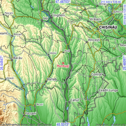
| \ | Map #1 | Topo.Map |
| Scale [m] | 65..225 m | × |
| Scale [ft] | 213..738 ft | × |
| Average | 137.4 m = 451 ft | × |
| Width | 6.73 km = 4.2 mi | 215.2 km = 133.7 mi |
| Height | 6.73 km = 4.2 mi | 215.2 km = 133.7 mi |
| ↑Max Latitude | 46.538017° | 47.46703° |
| Latitude at center | 46.50778° | 46.50778° |
| ↓Min Latitude | 46.477526° | 45.5313° |
| ← Min Longitude | 28.010775° | 26.64847° |
| Longitude center | 28.05472° | 28.05472° |
| →Max Longitude | 28.098665° | 29.46097° |
Nearby cities:
Cities around Hurdugi sort by population:
• Văleni elevation 163 m
9.5 km,  3°
3°
• Stănileşti 47 m
15.2 km,  35°
35°
• Lunca Banului 39 m
13 km, 41°
• Roşieşti 185 m
15.5 km,  237°
237°
• Vetrişoaia 25 m
14.6 km,  126°
126°
• Albeşti 163 m
14.4 km,  266°
266°
• Hoceni 142 m
5.1 km,  313°
313°
• Olteneşti 142 m
14.5 km, 305°
• Vutcani 148 m
8.1 km, 235°
• Corni-Albești 224 m
14.1 km, 274°
• Pădureni 122 m
12.9 km,  9°
9°
• Crețești 163 m
16.1 km,  330°
330°
Multilingual:
 En español:
Hurdugi elevación 114 m.
 En France:
Hurdugi élévation 114 m.


Sources and notes:
- [note 1] Map square and city borders are not equal. Map elevation data is calculated only from area inside that square.
- [src 1] Elevation data from geonames database provided with same terms of usage.
- [src 2] The elevation map of Hurdugi is generated using elevation data from NASA's 3 arcsec (90m) resolution SRTM data.
- [src 3] Base (background) map © OpenStreetMap contributors tiles are generated by Geofabrik and OpenTopoMap.
Copyright & License:
This Hurdugi Elevation Map is licensed under CC BY-SA. You may reuse any part from this page, if you give a proper credit by linking to this URL:
 More info on terms of use page.