Roşieşti elevation
Roşieşti (Vaslui, Comuna Roşieşti), Romania elevation is 185 meters and Roşieşti elevation in feet is 607 ft above sea level [src 1]. Roşieşti is a seat of a second-order administrative division (feature code) with elevation that is 67 meters (220 ft) smaller than average city elevation in Romania.
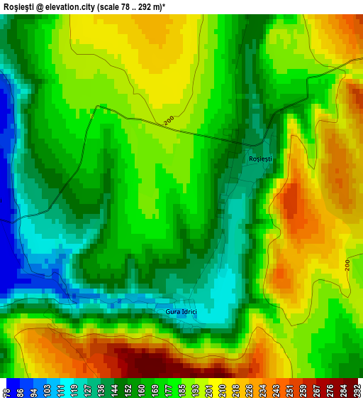
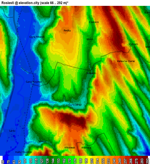
Below is the Elevation map of Roşieşti, which displays elevation range with different colors. Scale of the first map is from 78 to 292 m (256 to 958 ft) with average elevation of 177.3 meters (=582 ft) [note 1]
These maps also provides idea of topography and contour of this city, they are displayed at different zoom levels. More info about maps, scale and edge coordinates you can find below images.
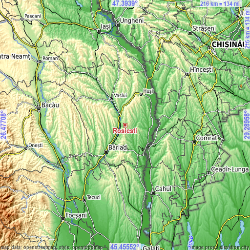
| \ | Map #1 | Map #2 | Topo.Map |
| Scale [m] | 78..292 m | 66..292 m | × |
| Scale [ft] | 256..958 ft | 217..958 ft | × |
| Average | 177.3 m = 582 ft | 163.5 m = 536 ft | × |
| Width | 6.74 km = 4.2 mi | 13.47 km = 8.4 mi | 215.5 km = 133.9 mi |
| Height | 6.74 km = 4.2 mi | 13.47 km = 8.4 mi | 215.5 km = 133.9 mi |
| ↑Max Latitude | 46.463609° | 46.49387° | 47.3939° |
| Latitude at center | 46.43333° | 46.43333° | 46.43333° |
| ↓Min Latitude | 46.403035° | 46.372722° | 45.45552° |
| ← Min Longitude | 27.839385° | 27.795439° | 26.47708° |
| Longitude center | 27.88333° | 27.88333° | 27.88333° |
| →Max Longitude | 27.927275° | 27.971221° | 29.28958° |
Nearby cities:
Cities around Roşieşti sort by population:
• Banca elevation 182 m
16.1 km,  203°
203°
• Viişoara 253 m
5.6 km,  180°
180°
• Albeşti 163 m
7.5 km,  350°
350°
• Hoceni 142 m
15.1 km,  38°
38°
• Costeşti 184 m
12.6 km,  305°
305°
• Vutcani 148 m
7.4 km,  59°
59°
• Găgeşti 95 m
12.8 km,  150°
150°
• Bogdăniţa 188 m
15.4 km,  276°
276°
• Dodești 150 m
8.8 km, 175°
• Corni-Albești 224 m
9.5 km, 354°
• Bogdănești 187 m
12.1 km, 278°
• Hurdugi 114 m
15.5 km, 57°
Multilingual:
 En español:
Roşieşti elevación 185 m.
 En France:
Roşieşti élévation 185 m.
 Auf Deutsch:
Roşieşti höhe über dem Meeresspiegel ist 185 m.

Sources and notes:
- [note 1] Map square and city borders are not equal. Map elevation data is calculated only from area inside that square.
- [src 1] Elevation data from geonames database provided with same terms of usage.
- [src 2] The elevation map of Roşieşti is generated using elevation data from NASA's 3 arcsec (90m) resolution SRTM data.
- [src 3] Base (background) map © OpenStreetMap contributors tiles are generated by Geofabrik and OpenTopoMap.
Copyright & License:
This Roşieşti Elevation Map is licensed under CC BY-SA. You may reuse any part from this page, if you give a proper credit by linking to this URL:
 More info on terms of use page.