Slatina elevation
Slatina (Olt, Municipiul Slatina), Romania elevation is 165 meters and Slatina elevation in feet is 541 ft above sea level [src 1]. Slatina is a seat of a first-order administrative division (feature code) with elevation that is 87 meters (285 ft) smaller than average city elevation in Romania.
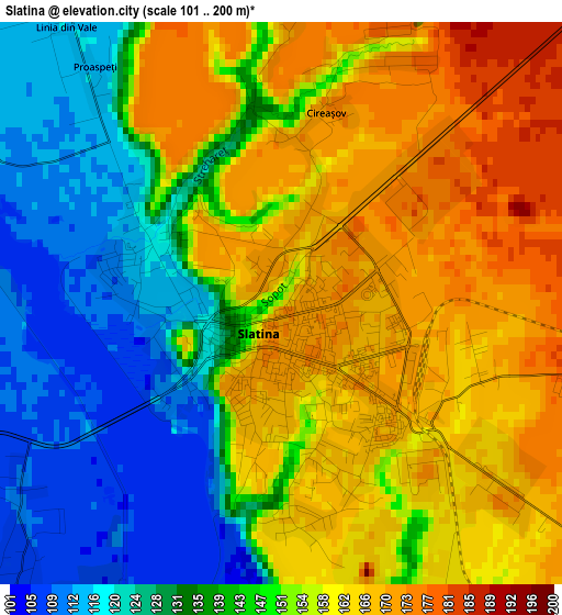
Below is the Elevation map of Slatina, which displays elevation range with different colors. Scale of the first map is from 101 to 200 m (331 to 656 ft) with average elevation of 148.7 meters (=488 ft) [note 1]
These maps also provides idea of topography and contour of this city, they are displayed at different zoom levels. More info about maps, scale and edge coordinates you can find below images.
| \ | Map #1 | Map #2 | Topo.Map |
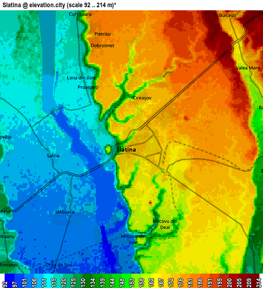
| Scale [m] | 101..200 m | 92..214 m | × |
| Scale [ft] | 331..656 ft | 302..702 ft | × |
| Average | 148.7 m = 488 ft | 146.3 m = 480 ft | × |
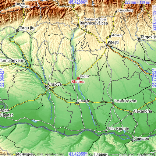
| Width | 6.98 km = 4.3 mi | 13.96 km = 8.7 mi | 223.3 km = 138.8 mi |
| Height | 6.98 km = 4.3 mi | 13.96 km = 8.7 mi | 223.3 km = 138.8 mi |
| ↑Max Latitude | 44.464701° | 44.496056° | 45.42886° |
| Latitude at center | 44.43333° | 44.43333° | 44.43333° |
| ↓Min Latitude | 44.401942° | 44.370537° | 43.42055° |
| ← Min Longitude | 24.322725° | 24.278779° | 22.96042° |
| Longitude center | 24.36667° | 24.36667° | 24.36667° |
| →Max Longitude | 24.410615° | 24.454561° | 25.77292° |
Nearby cities:
Cities around Slatina sort by population:
• Piatra Olt elevation 132 m
10.9 km,  226°
226°
• Curtişoara 122 m
7.9 km,  340°
340°
• Găneasa 107 m
6.9 km,  254°
254°
• Valea Mare 198 m
6.5 km,  54°
54°
• Pleşoiu 127 m
8.8 km,  295°
295°
• Brebeni 129 m
9.9 km,  138°
138°
• Teslui 160 m
9.3 km,  0°
0°
• Slătioara 107 m
5.4 km, 226°
• Piatra 123 m
9.9 km,  214°
214°
• Priseaca 218 m
11.4 km,  35°
35°
• Dobrotinet 181 m
5.4 km, 343°
• Dranovățu 115 m
7 km,  272°
272°
Multilingual:
 En español:
Slatina elevación 165 m.
 En France:
Slatina élévation 165 m.


Sources and notes:
- [note 1] Map square and city borders are not equal. Map elevation data is calculated only from area inside that square.
- [src 1] Elevation data from geonames database provided with same terms of usage.
- [src 2] The elevation map of Slatina is generated using elevation data from NASA's 3 arcsec (90m) resolution SRTM data.
- [src 3] Base (background) map © OpenStreetMap contributors tiles are generated by Geofabrik and OpenTopoMap.
Copyright & License:
This Slatina Elevation Map is licensed under CC BY-SA. You may reuse any part from this page, if you give a proper credit by linking to this URL:
 More info on terms of use page.