Tăşnad elevation
Tăşnad (Satu Mare, Oraș Tăşnad), Romania elevation is 177 meters and Tăşnad elevation in feet is 581 ft above sea level [src 1]. Tăşnad is a seat of a second-order administrative division (feature code) with elevation that is 75 meters (246 ft) smaller than average city elevation in Romania.
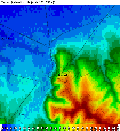
Below is the Elevation map of Tăşnad, which displays elevation range with different colors. Scale of the first map is from 123 to 226 m (404 to 741 ft) with average elevation of 151.1 meters (=496 ft) [note 1]
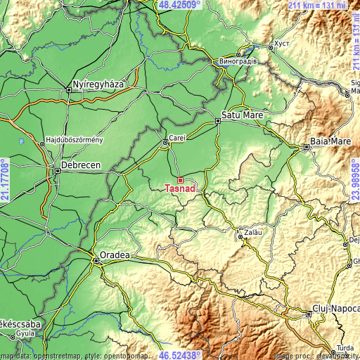
These maps also provides idea of topography and contour of this city, they are displayed at different zoom levels. More info about maps, scale and edge coordinates you can find below images.
| \ | Map #1 | Map #2 | Topo.Map |
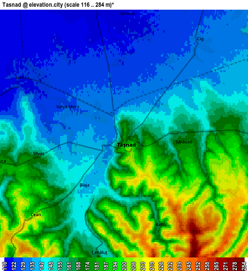
| Scale [m] | 123..226 m | 116..284 m | × |
| Scale [ft] | 404..741 ft | 381..932 ft | × |
| Average | 151.1 m = 496 ft | 159.1 m = 522 ft | × |
| Width | 6.6 km = 4.1 mi | 13.21 km = 8.2 mi | 211.3 km = 131.3 mi |
| Height | 6.6 km = 4.1 mi | 13.21 km = 8.2 mi | 211.3 km = 131.3 mi |
| ↑Max Latitude | 47.51302° | 47.542693° | 48.42509° |
| Latitude at center | 47.48333° | 47.48333° | 47.48333° |
| ↓Min Latitude | 47.453623° | 47.4239° | 46.52438° |
| ← Min Longitude | 22.539385° | 22.495439° | 21.17708° |
| Longitude center | 22.58333° | 22.58333° | 22.58333° |
| →Max Longitude | 22.627275° | 22.671221° | 23.98958° |
Nearby cities:
Cities around Tăşnad sort by population:
• Supuru de Jos elevation 145 m
16.4 km,  96°
96°
• Santău 123 m
6.2 km,  306°
306°
• Căuaş 116 m
9.6 km,  344°
344°
• Craidorolţ 124 m
17.2 km,  30°
30°
• Cehal 228 m
11.2 km,  173°
173°
• Pir 123 m
16.4 km,  263°
263°
• Săuca 159 m
7.7 km, 256°
• Boianu Mare 185 m
11.7 km,  198°
198°
• Viişoara 207 m
15 km,  222°
222°
• Săcăşeni 152 m
7.5 km,  90°
90°
• Sărăuad 171 m
3.2 km, 97°
• Acâş 139 m
16 km,  69°
69°
Multilingual:
 En español:
Tăşnad elevación 177 m.
 En France:
Tăşnad élévation 177 m.


Sources and notes:
- [note 1] Map square and city borders are not equal. Map elevation data is calculated only from area inside that square.
- [src 1] Elevation data from geonames database provided with same terms of usage.
- [src 2] The elevation map of Tăşnad is generated using elevation data from NASA's 3 arcsec (90m) resolution SRTM data.
- [src 3] Base (background) map © OpenStreetMap contributors tiles are generated by Geofabrik and OpenTopoMap.
Copyright & License:
This Tăşnad Elevation Map is licensed under CC BY-SA. You may reuse any part from this page, if you give a proper credit by linking to this URL:
 More info on terms of use page.